Extraterrestrial Highway

Yamaha FJR Motorcycle Forum

Help Support Yamaha FJR Motorcycle Forum:

This site may earn a commission from merchant affiliate links, including eBay, Amazon, and others.

FJRocket

Doctor Throckenstein !!!
Joined
Jun 25, 2005
Messages
2,229
Reaction score
7
Location
Indiana
Planning on riding the ET highway after WFO ends. On the way back to Utah. Thinking about doing it at night. One rider may not have an LD bike like the FJR, so wondering how logistically to ride from Reno to Cedar City (or thereabouts) and be able to find gas.

Anyone ever ride this area at night? Without a fuel cell? Thought it might be more interesting at night, and a whole lot cooler (in more ways than one). Seems the small towns along the way may or may not have gas stations and probably not open 24 hours.

Recommendations for this ride through Nevada would be greatly appreciated. Doesn't look like there's a whole lot of choices after Tonopah. May just have to ride really early, then take a big siesta and then ride late? I'm open for suggestions, please.

 
Which one is the ET highway? :blink:
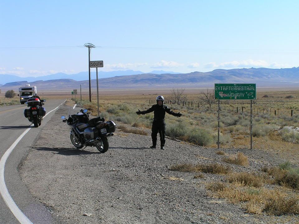
NV375

RickMayerSaddleTrip010.jpg


FJRocket-

Absolutely no gas stations between Tonopah and Rachel. We (vectervp1 - ugly mofo in the photo) gassed in Tonopah. We almost didn't, and that would have been a mistake. My map showed a town of Warm Springs at the northern end of NV375, but there was absolutely nothing there except for a couple of run-down, abandoned buildings. We didn't gas in Rachel, but there was a station there. Should have 24hr gas in Tonopah with auto pumps even if the station is closed, but I don't know about Rachel. Right after NV375 ends is Ash Springs, and they will have 24 hr gas also (auto pumps). From Tonopah, I show 108 miles to Rachel, and 152 miles to Ash Springs, so should be no problem making that.

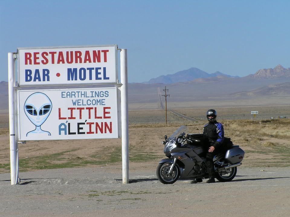
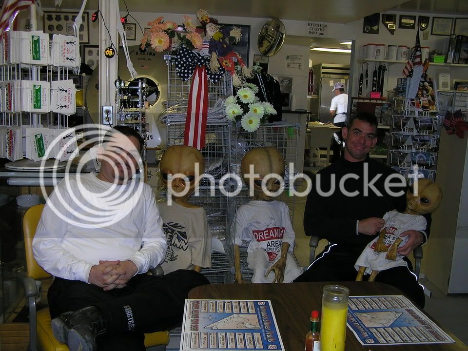
I suggest doing it in the daylight. It's kind of boring wide open scenery, but that is the allure to me. Just can't see too many places like this in the U.S. anymore. For me, daylight means excellent visibility, and therefore warp factor 10. Also, I highly recommend stopping at the Little A'LE'INN in Rachel for some grub and a photo op:

RickMayerSaddleTrip027.jpg


RickMayerSaddleTrip026.jpg


Enjoy the trip. The two-lane back roads in Nevada are some of my favorite places to ride.

 
Thanks Skooter! Any other roads out there in that area that are "don't miss" roads?

The night idea was just to stay cool and see if there was any night action over Nellis. Just a thought, and don't know if it will happen or not. Depends on how hung over we are at the end of WFO. I can see checking out, loading up and napping by the pool until it cools off later in the afternoon.

I don't think the moon is going to be in our favor, so in the event of cloud cover, all bets are off. My night vision ain't that good, and no one in our group has the "eyes of god".

Wasn't thinking about going WFO on the throttle, but I'll bet there's lots of easy places to do that out there.

 
FJRocket, I would not ride it during the evening. Most of the route is marked with warning signs that it is a free-range cattle area. Cows frequently cross the road - I saw several in the road.

51 Road is interesting and takes you gates of Area 51, but it is 15 miles of gravel road until you get there. Here is a picture of the ominous signs outside the military facility that doesn't exist. Also a picture of the "cammo dudes" on a hill overlooking the signs to make sure they are not crossed.

Don

Area51signs.JPG


cammodudes.JPG


"I would not ride it during the evening. Most of the route is marked with warning signs that it is a free-range cattle area. Cows frequently cross the road - I saw several in the road."

I strongly second this. Much of the wide open areas in Nevada have wild horse herds. If you think hitting a deer is bad news, try a wild horse. They will even put a semi down.

 
Ok, I'm convinced. Daylight hours only.

Any other interesting alternates along the way?

 
There are 2 major gas stns in Tonopah - don't know about 24 hours though.

There is gas at Rachel if the pumps are open, which they usually are if the store is open. If the store is closed, go to the trailer behind the store and knock on the door. The person inside will oblige and unlock the pumps, day or night.

This per the store clerk - but a couple of years ago.

After that your next gas is Caliente IIRC

FJRocket, I would not ride it during the evening. Most of the route is marked with warning signs that it is a free-range cattle area. Cows frequently cross the road - I saw several in the road.

+ 1
 
Diane and I rode this last year in March, at 1am, headed to Mammoth from Torrey Utah. I can tell ya there's plenty of open range cattle! The *******s are standing in the road in droves, as the road is warmer than the desert floor at night. Pack and packs of them! The Magnum blasters did not phase them! Thank god the Hellas picked them up eary and the Widders were turned on full blast! Not only do you have to deal with the cattle at night but there are thousands and thousands of suicidal rabbits that infest the place at night. Gotta love bumps in the dark!!

 
Hey hey, finally somebody asks about my backyard.

1. Are you taking Hwy 50 to WFO or coming across some other route (I-80, etc)? Hwy 50 is a great road that does allow you to stretch your legs when traversing the valley floors while taking some high speed sweepers across the mountain passes.

2. I'm at a loss as to why Warm Springs is even on the map. I'd be surprised to hear that the handful of buildings there have phones.

3. Even though it is Nevada, not everything is legal. Watch yourself on Hwy 95 from Reno to Tonopah. If you keep it no greater than ten over and wave at the LEO, you'll usually get a wave back and not a light show. Tonopah is where the Nye Co. Police Dept. is based and they regularly set up speed traps in Tonopah on Hwy 95 and on Hwy 6 as it exits town to the east.

4. Hwy 6/375 from Tonopah to Ash Springs in late July will be a toasty ride. Be sure to drink a ton of water. Even mild hyponatremia with dehydration can affect your level of alertness causing altered judgement and sudden unwanted changes in velocity. I will second the cow issue. There are many, many, many cows out there. No farms until you get closer to Rachel, but many cows. I think they monitor the area for the government. These cattle are used to the Hwy, don't move even if you get off your motorcycle and smack them in the ass (do this from the side, not from behind the cow), and there are no fences (hence, open range).

Stop in Rachel. If not for food, at least for a beverage and to cool off. Hwy 93 from Ash Springs through Caliente and on up to Great Basin National Park offers some scenery that is pleasing. It's not your classic motorcycle joyride though. Fuel is available in Ash Springs, Caliente, and in Baker UT (outside of Great Basin National Park). The fuel stop in Baker has no attendant or other conveniences. It's basically just a couple of pumps and a large gravel parking lot on the south side of town. There is also a nice mom and pop resturaunt at the intersection of Hwy 93 and Hwy 6/50 that makes a nice greasy spoon stop. Baker has a small supply store with hot food, but the hours are limited. Take the time to visit Lehman Caves at Great Basin if you can. It'll cool you off. You can also drive up above 9,000ft at Great Basin to cool off as well. There is no park entrance fee at Great Basin (but there is a nominal tour fee for the caves).

Nevada's paved roads are usually in pretty good shape. Almost every paved road is on the map. The "backroads" are usually gravel/rock. Great if you own a R1200GS. Not so great for your FJR.

5. You will leave cell phone service areas. Unless you have a satellite phone, you could be S.O.L. if you breakdown in rural NV. Be prepared for a breakdown and it won't happen. Forget to inspect your bike when you leave Reno and when you leave Tonopah and you'll certainly have problems. You're tires will get hot. Not warm, but HOT. Watch for adverse issues related to this.

6. If you need it, there is a Yamaha dealer in Tonopah. It's called Nevada West Cycles 325 Main St, Tonopah, NV 89049 (775) 482-6943. They're not really experienced on FJR repair, but can help you out if you're in a pinch. Most of their service dept demand is on ATV's and dirt bikes.

I hope that this helps.

 
Last edited by a moderator:
Yeah, we're planning on US50 coming in, and down to Tonopah and ET back out after Reno. Looking for any and all suggestions.

Thanks WorldBound!

 
If you don't ride CA120 between Lee Vining CA and Benton CA during WFO, you may want to consider taking 395 south out of Carson City, hopping on 120 in Lee Vining at Mono Lake, and then taking Hwy 6 from Benton to Tonopah. It's a fun ride that takes you past Boundary Peak (NV's highest peak). Then if you cut up north again to Great Basin you could travel around Wheeler Peak (NV's second highest peak).

It sounds like you have quite a distance to cover. On your return trip are you wanting to get home, or tour some more? How far do you want to get on the first day? Planning on staying in Cedar City or pushing things further east to say.... Grand Junction CO? I know sometimes after a long journey the one thing you really want is to be at home in your own bed.

If you take Hwy 93 out of Ash Springs and want to bypass Great Basin Nt'l park, NV319/UT56 is a nice run into Cedar City, UT. You could then hit Cedar Breaks Nt'l monument (a great site to see) and make your way to Bryce Canyon, Capitol Reef, Canyonlands, and Arches National parks. Now that would be a fantastic trip. People have spent days (including me) traveling between Cedar City and Moab UT.

So, If you want to kill two days time, make Reno to Cedar City day one, and Cedar City to Grand Junction day two. Want more scenery and better motorcycle roads? Spend the second night in Blanding, UT then make one long day to get from Blanding to Denver on two lane roads only (through Montrose, Gunnison, and Salida). Now that would be a killer ride!

 
Last edited by a moderator:
Ok, Reno to Benton, CA (188 miles and a gas station bonus!)

Benton to Tonopah = 81 miles and no fuel services in between these two.

If your friend's bike has a shorter range that 188 miles, there are fuel stops in Lee Vining, CA to even out the distance a bit.

Travel time from Reno to Tonopah via Benton, CA is about 3.5 hours and 269 miles (much better scenery than trudging down Hwy95 and Hwy 120 is a must!). If you leave Reno pre-dawn you could see the sunrise over Mono Lake and beat a lot of heat.

Fuel up in Tonopah. Tonopah to Ash Springs (next decent fuel stop) 151 miles. You can fuel up in Rachel if you'd like, but Ash Springs gets a lot of business and has more services. So, photo op in Rachel and fuel in Ash Springs. Reasonable travel time is two hours but can be done in an hour and a half if you are stupid enough.

Ash Springs to Cedar City is 142 miles. Again very reasonable for most any bike. Travel time would be about 2.25 hours.

Reno to Cedar City via this route.... 562 miles and a reasonable travel time of 7.75-8 hours on the bike plus break times. It will make for a nice 10-12 hour day with appropriate safety stops.

 
That sounds great. Thanks for taking the time to detail the routes.

Yeah, I'm in no hurry to get home, sorta. Was hoping to spend about 3 days to play between Cedar City and Mount Evans... then slap it home from Denver. The ride back to the flat lands may end up being a 1kday, or 2 fivsies. Just depends. Personally, I wish I could click my heels and bypass Kansas altogether.

And yes, I was planning to make it to Cedar City in one big day, but was planning on a beeline to Tonopah, then make like a bandit out in the open. Hoping to see some of those routes closer to Reno as part of the WFO rides. Just depends on what happens.

So many choices, so little time....

THANKS!!!!!

 
Yeah, we're planning on US50 coming in, and down to Tonopah and ET back out after Reno. Looking for any and all suggestions.
Thanks WorldBound!
Rocket, are you planning on coming through St. Louis at all? I got a wild hair yesterday to suddenly come to WFO and turn it into the start of a 3 week tour up to Vancouver, BC, across the canadian rockies to Jasper/Banff, then down to Glacier, over to Sheridan and the Black Hills, then home. If we do this, we'll leave on the 25th or so; if you're heading through this way, maybe we can hook up as we'll likely be taking the same routes.... :D

 
I got a wild hair yesterday to suddenly come to WFO and turn it into the start of a 3 week tour up to Vancouver, BC, across the canadian rockies to Jasper/Banff, then down to Glacier, over to Sheridan and the Black Hills, then home. If we do this, we'll leave on the 25th or so; if you're heading through this way, maybe we can hook up as we'll likely be taking the same routes.... :D
I am planning to come to the WFO from Oliver, BC via Highway 3 to Pincher Creek then South through Glacier NP into Missoula. I have done the Jasper Bannff Ice Fields Highway several times and it is one not to miss. Your plans should be a fantastic trip.

 
Last edited by a moderator:
Top