Garmin 2610

Yamaha FJR Motorcycle Forum

Help Support Yamaha FJR Motorcycle Forum:

This site may earn a commission from merchant affiliate links, including eBay, Amazon, and others.

NMdcporter

Well-known member
Joined
Jul 8, 2008
Messages
97
Reaction score
0
Location
Rio Rancho, NM
Gang,

Not sure if this the right place but here goes.

I have a Garmin 2610 and I have downloaded a big route to my Garmin. After completing download I'm getting a route truncated message. It stopped plotting about 1000 miles from the end of the ride. My question is since all the way-points are stored can I just delete at some point and recaluated and get the last part of the route or wil the system automatically continue once you past a waypoint? I really don't want to break the route into 2 seperate routes and load only sections if I can prevent.

I do have a 2g flash card in my Garmin.

Thanks for any help.

Dave

 
Sounds to me like you have to many waypoints wich is making the route to large for the 2610's memory. I'm no guru, but that would be my guess. It's not that big a deal to split a route in half and load 2 routes into the unit. Just means changing routes somewhere in the middle of the trip.

 
Do you need a single multi-thousand mile route? Or can you break it up into 1,000 mile days?

I've noticed that I have the best luck formatting the flash card before loading it with maps and routes for any trip I'm planning. The garmin software doesn't remove the old waypoints and routes, so you could have too many, maybe.

What is the exact error message? Have you searched Google with it?

 
Where did the route come from? Mapsoursce, or another app?

I've encountered this with the DeLorme Street Atlas that I use. After building a route in Street Atlas I have the choice of sending it straight to the 2610, or exporting a .gpx file which I then load into Mapsource to download.

The first method sounds great, but it builds what I'd call a reference point every few yards, apparently, resulting in entirely too much data. By "reference point" I mean it locks the route with data points that are entirely too close together. For example, US98 from Panama City to Pensacola, there's no need to mark the route every few feet, or even every few hundred feet. It's a continuous highway.

The second method, exporting a .gpx file, only exports the "important" points. Intersections, changes of highway, and marked vias you used in the route. Problem is, it has to be recalculated in Mapsource, which may result in a slightly different route. For example, routing from here to Arlington, VA via New Orleans then Lexington, KY (to make an SS1000 route), Street Atlas brough me across West Virgina into Virgina on I64. Mapsource took me up into Maryland via I79, I68, then back down through Baltimore and Washington, adding over 100 miles!

I don't know if that truncated route is a limit on the amount of data a single route can contain, or if the 2610 is actually out of memory, so I may not be answering your question at all. If it's the former, breaking up the route will help. If the latter, you're just out of memory. You may have to get multiple memory cards and load part of your route (and needed maps) onto each one. CF cards are cheap as dirt any more, so that may be your option.

Edit: After thinking about my answer and doing an experiment on my own 2610, I have to change the last part. Routes aren't stored on the memory card, so using multiple cards won't help. I have a couple routes in my unit, and they were still there when I pulled the card out. I saw an error about the roads not being matched, should I recalculate. I don't know how much memory is available for route storage.

 
Last edited by a moderator:
The route came from Map Source. The error states Route Truncated. I have only 24 way points but the route is over 7000 miles.

 
Try reducing the amount of distance on both sides of route to 25 mile that way it uses less memory it has been a long time since i used a 2610.

 
The route came from Map Source. The error states Route Truncated. I have only 24 way points but the route is over 7000 miles.
The short answer to your question is Yes.

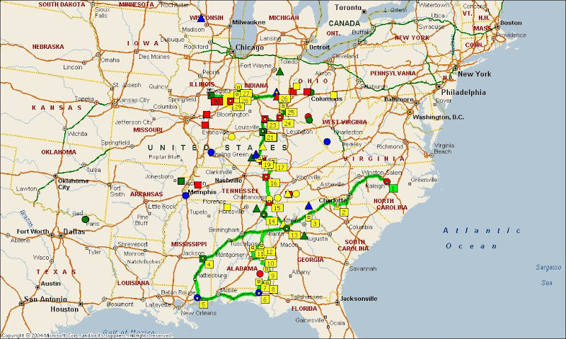
I had this same thing happen on the last leg of the ButtLite. I created this route with 30 waypoints totaling about 2,600 miles. Got the route truncated message when uploading via Mapsource. I thought it may be a case of Mapsource uploading to many via points in the route so I tried recalculating on the 2610 but still got the route truncated message.

image_map.gif


Reviewed the route and discovered it truncated the last 6 or so waypoints. I ran the route for the first day and then deleted the waypoints I'd already hit, added the remaining waypoints, and recalculated the route. No problems. Just be aware if you use the 2610 to recalculate the route you may end up with a different route than your Mapsource route.

 
Top