North Central Washington Post Fire Ride

Yamaha FJR Motorcycle Forum

Help Support Yamaha FJR Motorcycle Forum:

This site may earn a commission from merchant affiliate links, including eBay, Amazon, and others.

Fontanaman

Robin Trower
Joined
Oct 29, 2009
Messages
2,007
Reaction score
1,060
Location
Spokane, Wa
I have not been riding the FJR much this summer. I was on a dual sport ride in Mexico in March and used up my available vacation time. Couple that with 60,000 plus miles on the FJR mostly on roads in Washington State and it adds up many repetitions of riding the same roads all too often. So this summer I went hiking, did some home maintenance, built a fence and enjoyed a vacation to the Oregon Coast with Linda my lovely bride. It was wonderful.

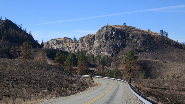
After a two month hiatus the FJR was calling. The goal was to see some of the burned areas from the fires in North Central Washington where thousand of acres burned, hundreds of homes were lost and three firefighters lost their lives. I wanted to see something different and ride roads never rode before.

Out of the house at 7:30 I am heading to Arlington where I can get off I-5 and the real ride begins. Here is my route for day one.

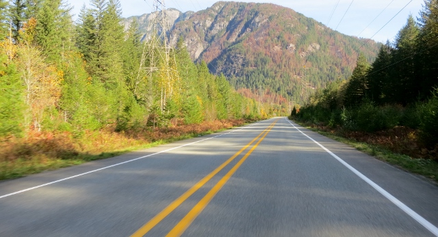
Ah the North Cascades Hwy. I ought to wire a mike to and talk about my thoughts as I ride this road again for the NNNth time since 1975 or so. I feel for you if you can’t ride this grand road on a whim.

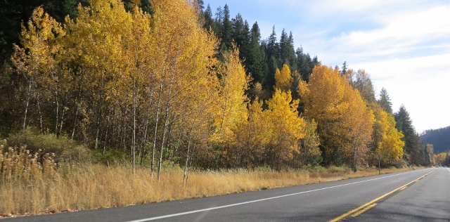
Some falls colors with a power line. I have taken this photo before - it is a great fall shot less the darn powerline. This photo is a bit overexposed. Oh well.
IMG_2737%252520%252528640x346%252529.jpg


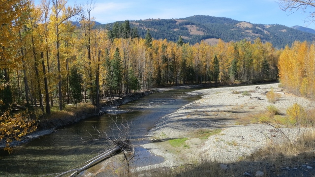
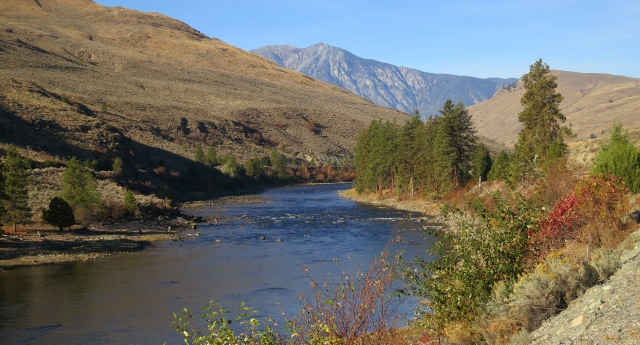
The Methow River near Twisp
IMG_2739%252520%252528640x360%252529.jpg


IMG_2740%252520%252528640x360%252529.jpg


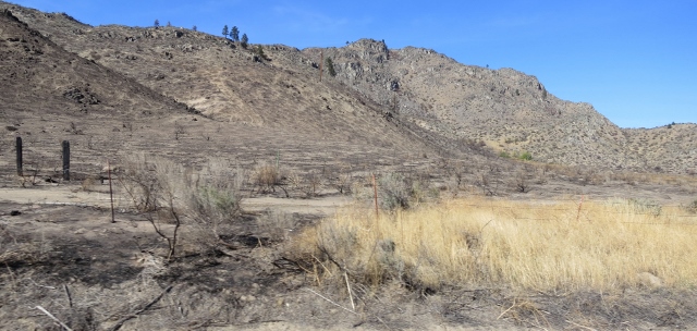
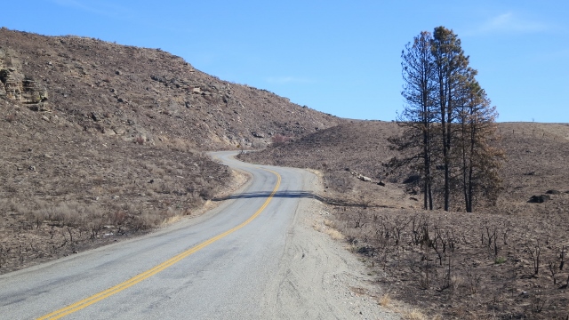
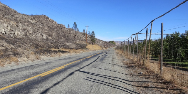
My route takes me on a few roads never rode before such as the B & O North Road and the Spring Coulee road. It was along here the fire damage was coming into view. In this photo the fire was stopped by apple orchards, with the fence posts on the right scorched by fire. Crazy.
IMG_2743%252520%252528640x319%252529.jpg


IMG_2745%252520%252528640x353%252529.jpg


IMG_2746%252520%252528640x304%252529.jpg


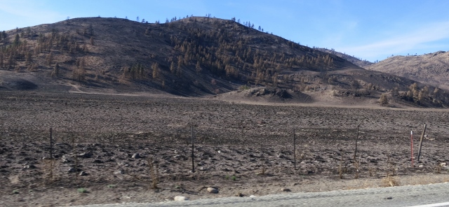
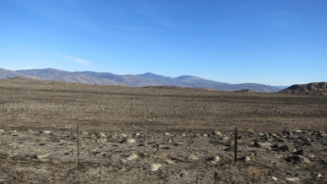
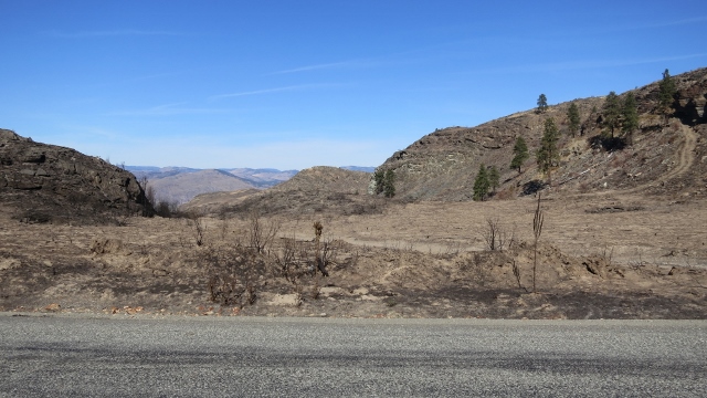
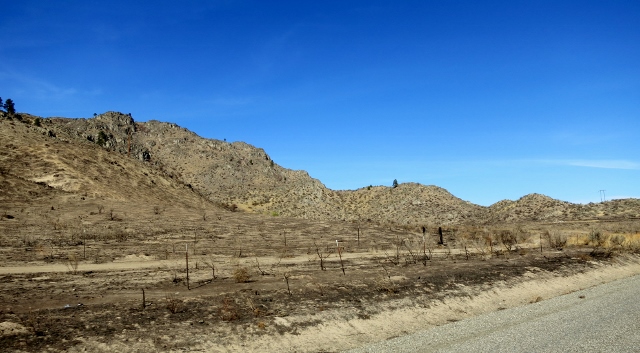
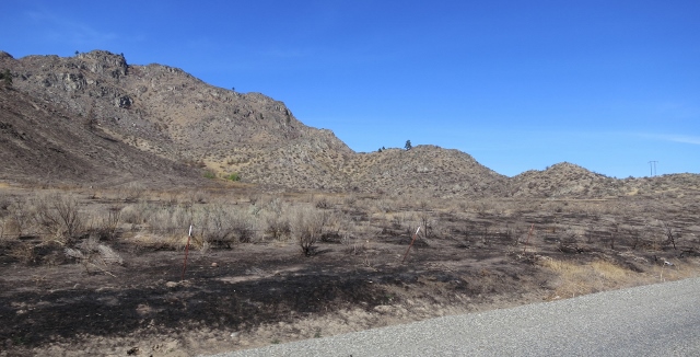
The area east of the city of Okanagan looks like the moon. Cattlemen who depend on the land are ruined. If their herd didn’t burn, they can’t feed what cattle they have left. The dilemma is cattle feed is too expensive and their land is burnt and will not produce grass for at least two seasons. Most are lucky to have their homes. Replacing a fence will cost $5000 per mile. Telephone poles have white X’s on them, meaning they need replacing. It looks like the moon.
IMG_2747%252520%252528640x326%252529.jpg


What a tragedy.

IMG_2753%252520%252528640x296%252529.jpg


IMG_2756%252520%252528640x360%252529.jpg


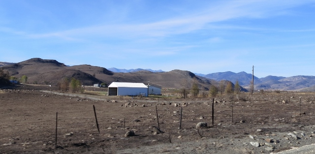
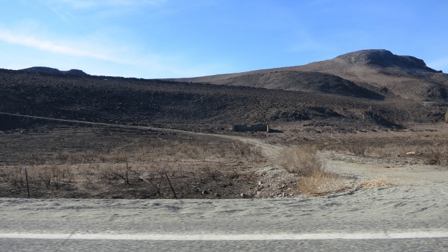
A structure saved. There was many structures saved. Even from the motorcycle at highway speed I could see homes still standing but with damage from the extreme heat, such as buckled siding.
IMG_2759%252520%252528640x314%252529.jpg


IMG_2761%252520%252528640x360%252529.jpg


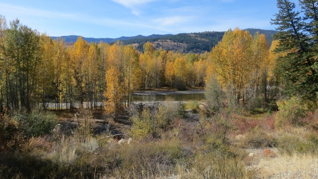
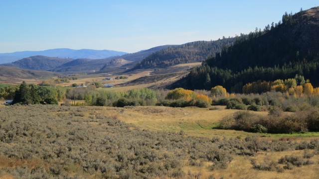
I am near Conconully when I took this picture. This is what the valley usually looks like.
IMG_2763%252520%252528640x360%252529.jpg


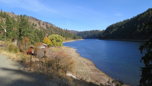
At Conconully Lake.

IMG_2764%252520%252528640x360%252529.jpg


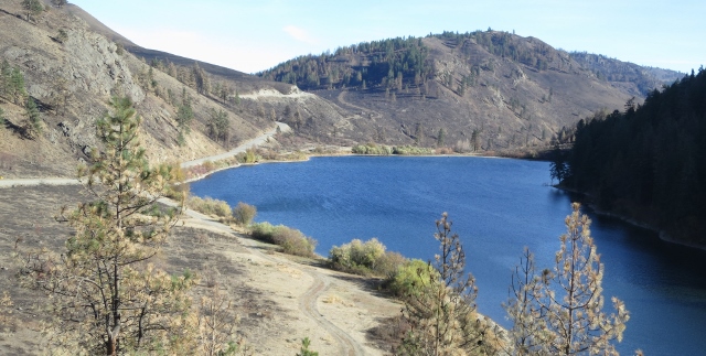
This is where the road goes from pavement to gravel for 7 miles and area affected by fires resumes. The gravel road is named Sinlahekin Rd on Google maps, but it is a Forest Service road. The seven miles of gravel cuts a significant amount of time to get to Fish Lake Road. Instead of two down and outs I can ride a loop. I had no problem with the FJR on the gravel road.
IMG_2765%252520%252528640x323%252529.jpg


End of Day One.

 
Last edited by a moderator:
We were up there weekend after labor day. Going over loup loup it was hard to tell which fire the damage was from. Great pics, more please.

 
Did the day loop last Tues. over N cascades, took 20 from twisp over loup loup down to old 97 and S. to Brewster, back roads over the plateau to Waterville and home Stevens. Visited Mazama, not much there. 446 miles and the days are shorter for sure. Your pics are great, as always, I enjoy looking at them and relating to "I was there". Burnt areas were eerie, wonder how much of a tree has to burn to kill it? Took the trip on the new toy Suzuki dl1000 V-strom, thing moves right along, it was my first extensive ride on it. Lost a couple of months due to some surgery. Might take the FJR east this next Tues. If the pics were day 1 where did you bunk in for the nite?

 
Did the day loop last Tues. over N cascades, took 20 from twisp over loup loup down to old 97 and S. to Brewster, back roads over the plateau to Waterville and home Stevens. Visited Mazama, not much there. 446 miles and the days are shorter for sure. Your pics are great, as always, I enjoy looking at them and relating to "I was there". Burnt areas were eerie, wonder how much of a tree has to burn to kill it? Took the trip on the new toy Suzuki dl1000 V-strom, thing moves right along, it was my first extensive ride on it. Lost a couple of months due to some surgery. Might take the FJR east this next Tues. If the pics were day 1 where did you bunk in for the nite?
I spent the night in Oroville for it lined me up for riding the Toats Coulee road near Nighthawk a road I have never been on and won't be on in the future. Toats Coulee road is a pot holed mess with no center line and no white lines on the road. The Loomis Oroville road is great, except the loose chip seal rock an a few places.

If I did this trip again I would have looked at a fire map (silly me) and checked out the burn areas. This would have led me to Aeneas Valley road and Aeneas Washington a down and out road, but with the Vstrom you have a bit more flexibility.

I suggest riding the Tunk Creek Road out of Riverside to the east. Great road - a down and out, but fun. Lot of fire damage. I will have photos when I finish up this report.

With the Vstrom you could ride from Aeneas WA to Synarep, Wa via gravel roads and connect the Aeneas Valley and Tunk Creek Road. Check with the local Forest Service or Okanogan County to find out if the area is open yet.

Have fun.

 
Last edited by a moderator:
Thanks for the pictures. I have been thinking about a weekend to visit some of the burn areas and haven't had the time. Sad to see the damage. I hope the winter rains are gentle enough to soak in instead of running of and causing landslides and more problems. A good snowfall would help but the long range forecasts don't hold much hope for that. Hard to imagine the impact on the ranchers and their families.

 
Thanks for taking us along Jim.

Sad to see so much fire damage on the east side...hope this winter brings more normal amounts of snow and spring run-off.

--G

 
Did the day loop last Tues. over N cascades, took 20 from twisp over loup loup down to old 97 and S. to Brewster, back roads over the plateau to Waterville and home Stevens. Visited Mazama, not much there. 446 miles and the days are shorter for sure. Your pics are great, as always, I enjoy looking at them and relating to "I was there". Burnt areas were eerie, wonder how much of a tree has to burn to kill it? Took the trip on the new toy Suzuki dl1000 V-strom, thing moves right along, it was my first extensive ride on it. Lost a couple of months due to some surgery. Might take the FJR east this next Tues. If the pics were day 1 where did you bunk in for the nite?
I spent the night in Oroville for it lined me up for riding the Toats Coulee road near Nighthawk a road I have never been on and won't be on in the future. Toats Coulee road is a pot holed mess with no center line and no white lines on the road. The Loomis Oroville road is great, except the loose chip seal rock an a few places.

If I did this trip again I would have looked at a fire map (silly me) and checked out the burn areas. This would have led me to Aeneas Valley road and Aeneas Washington a down and out road, but with the Vstrom you have a bit more flexibility.

I suggest riding the Tunk Creek Road out of Riverside to the east. Great road - a down and out, but fun. Lot of fire damage. I will have photos when I finish up this report.

With the Vstrom you could ride from Aeneas WA to Synarep, Wa via gravel roads and connect the Aeneas Valley and Tunk Creek Road. Check with the local Forest Service or Okanogan County to find out if the area is open yet.

Have fun.
Been all over around Loomis Oroville roads, Nighthawk, Chopaka, Similkameen rd. Palmer lake, Spectacle lake never heard of or saw a Toats coulee rd? Some other name maybe? Nothing I could find in my Wash Gazetteer. Aha, found it and does not look like anyplace I would go.

 
Last edited by a moderator:
Day Two

I was planning on a three day ride but it did not work out that way. Oh well and that was fine. After seeing burned land mile after mile, a few more miles is sad but repetitive.

Here is my route for day two.

A photo of the Similkameen River near Nighthawk Washington where it was 39 degrees when I rolled through.

IMG_2767%252520%252528640x345%252529.jpg


I thawed out on my way to Riverside Washington where I take the Tunk Creek Road. Good choice - this is a nice little down and back road one I have not been on before. Tunk Creek also was one of the five named major fires in North Central Washington in late September and the damage was along the road was dramatic.

IMG_2768%252520%252528640x360%252529.jpg


IMG_2769%252520%252528640x360%252529.jpg


A few burned cars. I saw a burned garage with a burned car.

IMG_2770%252520%252528640x213%252529.jpg


IMG_2776%252520%252528640x360%252529.jpg


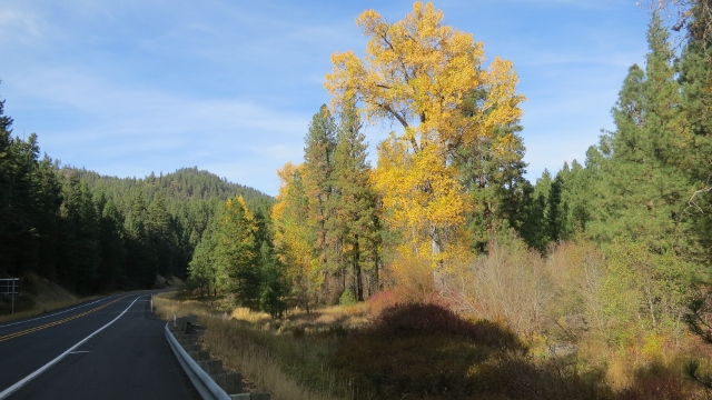
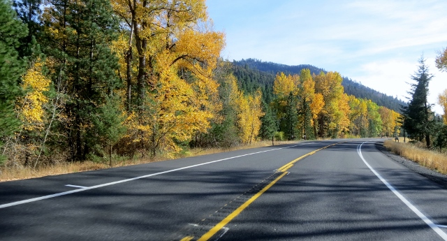
I returned home via Blewett Pass where I shot a few fall photos.
IMG_2777%252520%252528640x360%252529.jpg


IMG_2779%252520%252528640x345%252529.jpg


IMG_2783%252520%252528640x316%252529.jpg


End of Trip.

 
Last edited by a moderator:
Really look forward to your travel postings in state, blessed are we. Started serious PNW traveling in 1975 on the latest wonder bike, a 1975 Honda 750 K5 and look at us now. Throw up some of your old ride stuff in Dec., Jan., to break the tedium.

 
Really look forward to your travel postings in state, blessed are we. Started serious PNW traveling in 1975 on the latest wonder bike, a 1975 Honda 750 K5 and look at us now. Throw up some of your old ride stuff in Dec., Jan., to break the tedium.

Well why wait!? Before Comcast takes down my personal web page check out my ride report to Copper Canyon in 2007.

 
Last edited by a moderator:
I was in that general area about 3 weeks ago, heading to Kelowna BC on HWY 33 in Canada, north of Washington.

I rode through a large burned out section, at first I thought, "wow, there's a lot of forest gone" then I came up on quite a few homes that were just gone---nothing but foundations and some fireplaces still standing.

Came up a ridge, a big hand-painted sign on plywood said "THANK YOU EVERYONE!", come over the ridge and a large business was just totally gone--nothing but a concrete pad. Boy, my eyes still well up thinking about that--what a sad sight.

It was a brutal year for sure.

 
Panman, Jimiejimie and I did that loop and up through Canada. Aside from a little sand and gravel, it was awesome.

But that was before the fires this year ...

Thanks for taking us along Jim.

 
Excellent ride report Jim.....thank you for sharing your ride....it was very enjoyable to see and read :)

 
Top