Trans-Canada Highway

Yamaha FJR Motorcycle Forum

Help Support Yamaha FJR Motorcycle Forum:

This site may earn a commission from merchant affiliate links, including eBay, Amazon, and others.

Trip

Active member
Joined
Apr 9, 2006
Messages
26
Reaction score
0
Location
Lake Forest, CA
I am planning a ride next summer that will take me from So. Cal east to Key West, north to Maine and then across the southern Trans-Canada Highway to Vancouver Island. South from there. Just starting to research the trip. Any thoughts/suggestions on the Canadian leg would be appreciated. Saw that the availability of getting gas may be an issue. BTW, I will be camping along the way. Thanks.

 
Sounds like a fantastic trip.

The only area along the TC where gas stations become scarce is across the top of Superior (Wawa to Thunder Bay). If you're travelling here during peak tourist season, it shouldn't be much of an issue, but if you're travelling off-season, it can get a little tougher. I've done this trip twice (moving to and from Winnipeg) and only once did I start to pucker up waiting for the engine to start sputtering. Of course that was Monday night on the Thanksgiving long weekend. Not a whole lot open after 6:00 p.m. :eek:

Others here on the forum may have done this trip more often and may have better information.

 
I am planning a ride next summer that will take me from So. Cal east to Key West, north to Maine and then across the southern Trans-Canada Highway to Vancouver Island. South from there. Just starting to research the trip. Any thoughts/suggestions on the Canadian leg would be appreciated. Saw that the availability of getting gas may be an issue. BTW, I will be camping along the way. Thanks.

Sounds like a nice long trip. However, you're hitting a lot of straight and/or congested roads on your trip. Unless you've already done all the country's curvy, more scenic roads...I would plan a trip with more of that...if that is the sort of thing that appeals to you.

You could still hit those four corner milestones if you jigged and jogged a little bit. Then again, maybe you already are, and I have made a horrible assumption.

 
North of Superior can be a little iffy based on the distances between gas stations. But generally, not a problem.

Their is one gas station between Sault Ste. Marie and Wawa, it's a tourist trap and gas is expensive there. Fill up either in Wawa or SSM.

Between Wawa and Thunder Bay, you can get gas in just about any town during 'normal hours'. White River (home of Winnie the Pooh!), Marathon, Terrace Bay, Schrieber & Nipigon.

Do NOT run over Superior after dark!

It can get a bit chilly/wet on that route. Make sure you geared for it.

Camping in provincial parks can get spendy in Canada. ($25-45/night). However, if you don't need a shower/electricity, you can legally camp on Crown land free gratis. Over top of Superior, see a lake you like? Find some access to it (nearly all do), set up your tent and done.

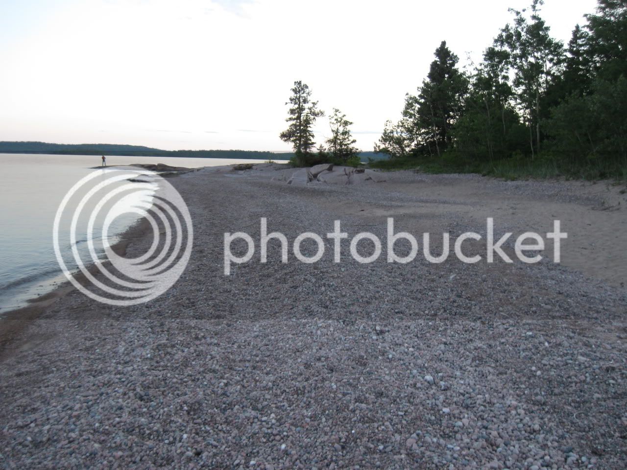
Otherwise, it's spectacular scenery. Recommend the Rainbow Falls campground, great sandy beach and great views.

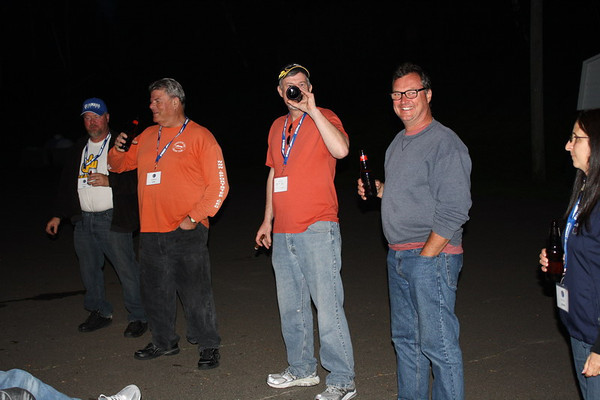
As you can see from the pic, it's gets a little haywire on a Canada Day long weekend :D

IMG_1503.jpg


You will need to stop at every Tim Horton's you see along the way through Manitoba, Saskatchewan, and most of Alberta. This to keep your caffeine levels up and prevent passing out and slumping over the bars. On the other hand, you probably won't need to wake up for 100 miles if your bike tracks good and straight.

 
You will need to stop at every Tim Horton's you see along the way through Manitoba, Saskatchewan, and most of Alberta. This to keep your caffeine levels up and prevent passing out and slumping over the bars. On the other hand, you probably won't need to wake up for 100 miles if your bike tracks good and straight.
So yer sayin John that it's as flat, straight, and boring as SE Ohio...

 
I am planning a ride next summer that will take me from So. Cal east to Key West, north to Maine and then across the southern Trans-Canada Highway to Vancouver Island. South from there. Just starting to research the trip. Any thoughts/suggestions on the Canadian leg would be appreciated. Saw that the availability of getting gas may be an issue. BTW, I will be camping along the way. Thanks.
https://billpratt.com/4corner/ A great source of information on all of your legs is found at the Four Corners Tour website ran by the Southern California Motorcycling Association, I have been a member of SCMA since the sixties. Dozens of ride reports here such as Bill Pratt's.

https://www.usa4corners.org Pictures, maps and tons of info here. https://www.usa4corners.org/dave_allen.html Dave Allen's Report.

 
Last edited by a moderator:
Winnipeg to Calgary is BRUTAL FLAT and Boring....drove it many times in a past career. I'd turn south after Duluth and head over to Rapid City, then work your way up thru Wyoming and Montana to Calgary to reconnect with the Trans Canada Highway there. Just my opinion, for what it's worth.

 
If you have a little more time, swing northwest from Winnepeg and go up to Edmonton through Saskatoon. A bit west of Edmonton, you will hit Jasper NP. The trip down through Jasper, Banff and Kootenay areas are well worth it. The trip west to Vancouver from south-central BC is also pretty good.

 
Str8, Wheaton, Ice, I am going to have to pull out a map and then read all of these replies. Wawa, Superior, Thunder Bay???? Time is not much of an issue. Leaving in early May and will be in Canada sometime in early July. Boring and congested is not what I am looking for. Beemerdons, spent some time in Europe last summer but took a spill right before I left and so did not rent a bike, etc., while there.

 
You didn't say if you were trying to make the best possible time, ride the best possible roads, or see the best possible sights. Also are you going to push on into the nights or be settled in at the campground or motel by dark? Advice will vary depending on all that. But the one thing I will say is, unless you've already got an aux gas tank, I recommend carrying a small can along. After stretching the range almost all the way to bone dry (not by choice), I bought a little red plastic jug in Utah last year--it's just over a gallon I think--and I carry it now on all my long-distance trips. It just sits on the left bag and bungees to the rack on one side and the passenger footpeg strut on the other. One gallon won't take you all that far, but I'd rather ride that last forty miles than walk it.

 
Last edited by a moderator:
Winnipeg to Calgary is BRUTAL FLAT and Boring....drove it many times in a past career. I'd turn south after Duluth and head over to Rapid City, then work your way up thru Wyoming and Montana to Calgary to reconnect with the Trans Canada Highway there. Just my opinion, for what it's worth.
It doesn't have to be if you get off the Trans Canada Highway. The Trans Canada follows the rail line which when it was built followed the straightess and flatess sections of the country.

 
Trip, if time is not an issue as you say, then as long as you are that far east, you should consider going a bit further east. Catch the ferry out of Bangor, Maine to Nova Scotia. There's a nice piece of real estate up that way called Cape Breton Island. Very tranquil IMHO. Then continue your ride through New Brunswick.

Either way, you're gonna have an amazing trip. Someday I'd like to.....

 
Last edited by a moderator:
Trip, if time is not an issue as you say, then as long as you are that far east, you should consider going a bit further east. Catch the ferry out of Bangor*, Maine to Nova Scotia. There's a nice piece of real estate up that way called Cape Breton Island**. Very tranquil IMHO. Then continue your ride through New Brunswick.

Either way, you're gonna have an amazing trip. Someday I'd like to.....
There is no ferry from Maine to Nova Scotia.

One used to run from Portland to Digby, NS, but was discontinued several years ago.

Cape Breton Island: "In Nova Scotia, Cape Breton's celebrated Cabot Trail, 190 miles of spectacular ocean and highland vistas, has long been a major draw for serious motorcyclists. The winding road cuts through forested mountainsides, hugs seaside cliffs and overlooks deep river gorges, offering riders one breathtaking view after another. There are plenty of scenic pullover spots along the way." from clicky

*Bangor is ~ 50 miles inland

 
You also may want to keep in mind that CFR is in Huntsville, Ontario on June 20 - 23 this summer.

 
Last edited by a moderator:
Top