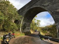
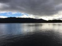
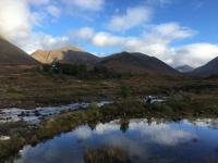
A few Scottish miles

Yamaha FJR Motorcycle Forum

Help Support Yamaha FJR Motorcycle Forum:

This site may earn a commission from merchant affiliate links, including eBay, Amazon, and others.

mcatrophy

Privileged to ride a 2018 FJR1300AS
Joined
Aug 25, 2006
Messages
4,363
Reaction score
1,866
Location
Derby, UK
Anyone who has followed this other thread will realise that this ride has been very difficult for me to do, it's only a little over four months since my wife passed away. Had it not been for the title of that thread I wouldn't have gone. It has possibly been the least enjoyable of any of my rides. However ...

This little ride was organised by my Guernsey riding friend R (for those whose geography is as bad as mine, Guernsey is one of the Channel Islands in the English channel, much closer to France than England). Those taking part were (obviously) R on his Multistrada, M, another Channel Islander from the island of Jersey on a F800ST, my son on his Monster 821, and me on my FJR1300AS. All of them are good riders. M normally rides a Triumph Trident, but apparently it had a hissy fit, so he had to rapidly sort a new front tyre for his BMW.

Day 1, Sunday 1st October, Derby to Killin.

We met up in Killin. Son and I from our homes in Derby, R after a ferry from Guernsey and an overnight stop on the mainland, M similarly took a ferry from Jersey and an overnight stop.

Son's and my trip started in light rain, which petered out by the time we reached the M6 motorway. The M6 was not as busy as it often is, but we did do a couple of miles of filtering where traffic was near-stationary because of an accident. We came off the M6 near Carlisle onto the A7. The road had obviously had a lot of rain, the surface very wet, several rivers running across it, and occasional deep puddles. No problems riding through any of it. Apparently R got caught up in some of this rain (he'd gone along a bit earlier), said some of it was torrential.

We decided to go over the new Queensferry Crossing bridge over the Firth of Forth, only recently opened. This was a mistake, the traffic was horrendous (I think every man and his dog had decided to do the same). Once in the traffic we had no option but to sit in with the cars, the lanes were too narrow to filter. Also the views from the bridge were disappointing, there were wind-breaks along both sides so you couldn't see down at all. The speed limit was 40mph, we were mostly doing between 0 and 4. Anyway, no harm done, just a little frustrating, though son's wrist was hurting him with all the clutch work (he suffers from RSI in his wrists, prolonged clutch use exacerbates it). I was very thankful for Yamaha's YCC-S.

The last few miles were in fairly heavy rain, just to prove we were in Scotland. R was already at the bar when we arrived, so a quick shower and we joined him for a welcome drink. M turned up a little later into the evening.

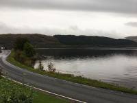
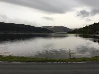
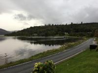
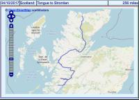
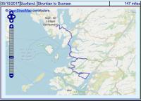
The day's route (route photos link to interactive route map):
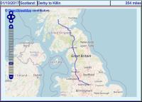

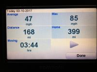
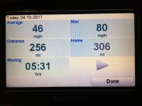
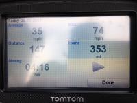
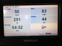
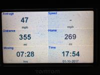
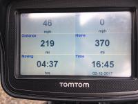
The day's stats (Tomtom's screen still wet!)
(Click on image for larger view)

To be continued ...

[edited to change the interactive route map link]

 
Last edited by a moderator:
Good for you Mac
smile.png


Spousal Unit and I spent about ten days in Scotland back in the good ole Cold War days. No itinerary, just bounced around in her Fiat X-19 seeing the sights and staying in B&Bs. It is perhaps our fondest memory of traveling and we have talked of doing it again on bikes. Maybe, just maybe.........

 
Day 2, Monday, Killin to Gairloch.

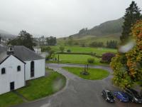
Overnight there had been torrential rain and high winds.

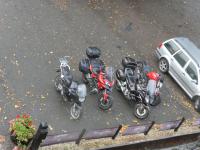
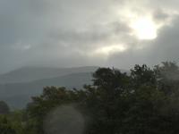
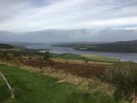
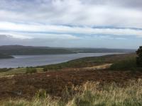
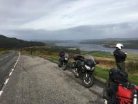
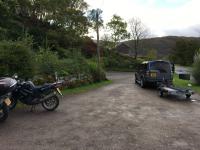
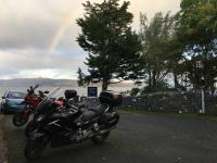
The grass was very green             the bikes hadn't blown over           the skies look threatening.


But by the time we set off the rain had stopped, the winds were relatively calm, just a little drizzle. Into the Cairngorms National Park, more renowned for skiers in winter and walkers in summer than motorcyclists, but as with much of Scotland, the roads suit our rides well, narrow, winding, always interesting, sometimes challenging, and with good views of the surrounding countryside.

We stopped in Balmoral where the Queen stays when in Scotland, visited the church (Crathie Kirk) where she attends Sunday services. We'd arrived a few minutes before they closed it for lunch-time (I suppose they need to have an attendant to prevent inevitable souvenir hunters), so we only had a couple of minutes there. It's small, no grandure about it, just another country church. It does have a somewhat stern-looking bust of Queen Victoria.

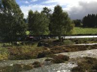
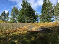
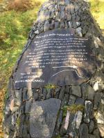
We stopped at the site of old rocks, smoothed off by glaciers in the last ice age (roche moutonnees). By this time the sun was out, we could clamber over the rocks (with care, they were slippery with wet lichen and other undergrowth, nature desperately trying to cover them).

Bikes parked nearby                      Rocks covered in undergrowth     Cairn with descriptive plaque


It's unusual to see glacially smoothed rocks like this, normally they are totally buried after the thousands of years since they were shaped.

The weather continued to be bright and sunny, the roads were all wet with some gravel on them. Talking of gravel, one aspect of Scottish roads is that, as there are numerous rivers and streams, there are a lot of bridges. Often these have tight bends at each end, and are single track. Any gravel gets brushed into the centre, so you inevitably have to cross the gravel as you change from leaning one way on entry to leaning the other on exit. Can make it interesting.

A very pleasant ride onwards towards our destination hotel. One more stop at a waterfall, the Victoria Falls, we thought it would be more exciting after all the rain, but we were mildly disappointed, seemed its normal self (I've been here several times before). One aspect of this area, it used to be surrounded by a wood made up of trees that were very mature, probably several hundred years old. A few years ago, the whole area was flattened by a freak wind, changed the look and feel of the place totally.

Vctoria Falls


Then on to the Myrtle Bank Hotel in Gairloch, probably my favourite hotel in Scotland. We are now on the west coast, the weather can be anything from bright sunshine to howling gales and torrential rain. Rarely warm, though!

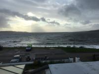
This is in a relatively sheltered bay, as we arrived the sea was rougher than I'd ever seen it. We normally park the bikes opposite the hotel facing the sea, but because of the potential salt spray (or even waves breaking right over), we parked close to the hotel. However, within a couple of hours it had calmed considerably.

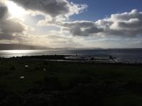
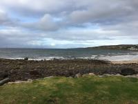
View from our hotel room window


Bikes are just visible in the foreground. You can sometimes see the Isle of Skye on that central bit of the horizon, this time it wasn't visible. The local saying is "If you can't see Skye, it's raining; if you can see Skye, it's going to rain".

One reason for liking this hotel is the food, it provides exceptionally good meals. I ordered some venison in a sort of stew. I'm afraid the first taste made me think of my late wife's cooking, and I more-or-less broke down at the table. It's difficult to tell your fellow diners that you will be ok whilst you can't speak coherently. Took me a few minutes to compose myself. Thankfully that was the only time on the trip when my grief affected me significantly in public.

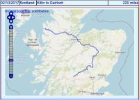
The day's route and stats


Day 3, Tuesday, Gairloch to Tongue

In the morning, the weather was much improved.
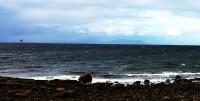
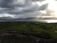
View out to sea


Skye is just (only just) visible within the dark clouds on the horizon, about a quarter in from the left. You'll need to see the larger picture (or even the original) to make it out! However, with a bit of enhancement (actually a lot of enhancement) it is visible in the picture below, cropped to the left half of the original:
Cropped and (brutally) enhanced

The black spec just above the sea to the left is a bird, between that and the sea you can see Skye. Follow this to the right, it ends in a mound just to the right of centre of the cropped picture. Make the most of it; it's not often the weather here allows you to see Skye!

From Gairloch we wind up the western side of Scotland, our destination is Tongue on the north coast.

Our route is along some of my favourite roads in Scotland (or in any country I've been in). Lots of hills to climb and descend, corners ranging from fast sweepers to tight hairpins, much of it single track - when travelling quickly it can be quite a challenge to keep on the road, with cliff faces, ditches or drops immediately off the tarmac. Absolutely no room for error.

On almost all of its single track roads, Scotland provides passing places, clearly signed, and very necessary. In the main tourists months, you would spend a significant amount of time sitting in a passing place or waiting at a parking place for a vehicle coming the other way. The most frustrating part is coming up behind another vehicle, hoping they will pull over into a passing place so that you can overtake - there are police notices asking drivers to do this, but many can't read, don't look in their mirrors, don't see why anyone should get in front of them, or hate motorcyclists (that last probably just a rant on my part). We, however, are at a time when the crowds have disappeared, there are very few tourists around and the locals have much better road manners than visitors, we were seldom held up significantly.

What is noticeable is that the exhaust note of the Ducatis makes these bikes much more noticeable to drivers, they can obviously hear them much more than my FJR. This was also noticeable when filtering on the motorway, cars would give more space when Son pulled his clutch and blipped his throttle!

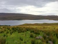
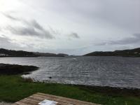
We stopped a few times to admire the scenery. The pictures can't do justice, but ...

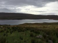
Loch Bad a' Ghaill                          With a little enhancement


Loch Inver


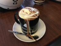
We stop at the Balnakeil Craft Village, and visit the Cocoa Mountain.
A nice warming, filling, cup of hot chocolate


And on to the Tongue Hotel. This used to be a shooting lodge, and gives a very relaxing end to the day.

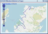
The day's route and stats (I think Tomtom must be lying about the maximum speed)


To be continued ...

[Edited to change the interactive route map links]

 
Last edited by a moderator:
Day 4, Wednesday, Tongue to Strontian

Weather was being kind, no rain, though mostly overcast. The first part of the route was almost due south, which takes us from the midwest of the north coast to very nearly the east coast (sounds Irish
fool.gif
, but then Scotland is a funny shape ).

We go past Loch Craggie, Loch Loyal, through the village of Altnaharra, past the Crask Inn (which claims to be the most isolated inn in Scotland, I can believe that), Dalchork, Loch Shin, Lairg (a useful petrol stop in an otherwise very under-serviced route), along a bit of the River Shin, through Invershin, over the Bonar Bridge, along part of Dornoch Firth.

Don't you love some of these Scottish names?

We stop at Struie Hill.
View over Dornoch Firth                                                                           Convenient parking


This part of the route has all been on the A836. In England, an 'A' road is considered a major route, roads are often dual carriageways, or if single carriageways, suitable for a lot of traffic. In Scotland, things are not quite the same. This is almost all single track, the surface has seen better days in places, but for us this was a good ride, little traffic (but sheep wandering around in places, care needed for these mobile hazards), hills, corners, views. Definitely worth revisiting.

Anyway, we turn off the A836 onto the B9176. In England, a 'B' road is considered of a lower standard than an 'A' road, less traffic expected, generally narrower (though usually two lane). However, this is Scotland. The B9176 is two-lane, obviously built for a higher traffic density than the A836. Strange, but that's the way it is.

We join the A9. The more southern part of the A9 is a major trunk road, carries a lot of traffic, has many speed cameras, but it's rare to be able to test them owing to the traffic volume. We are still north enough that this is single carriageway, though quite busy, so overtaking is difficult.

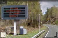
We go along part of Cromarty Firth ("Firth" means "estuary" for those whose Gaelic is not up to scratch), then turn off the A9 to go east along the A835. We pass a road sign that I didn't see, I found this on Google Maps whilst investigating the route:
"Allow motorbikes to pass safely"


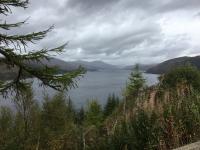
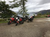
We are now travelling east, the description of the run is "more of the same". We stop to look over Loch Carron. You have to be careful on many of these lay-bys, the surface leaves a lot to be desired.
View of Loch Carron                      Not an ideal surface for bikes


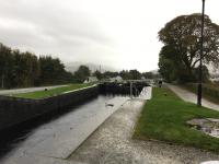
Then on to Neptune's Staircase, a series of eight locks that raise the water level by some 64 feet, built around 1810 as part of the canal system to allow boats to go between the Atlantic Ocean on the east of Scotland to the North Sea on the west of Scotland without going all the way round the north of Scotland (a potentially very dangerous sea-way). My photos can't show much of the locks ...
Neptune's Staircase


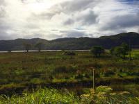
Now we go south-west past Loch Duitch [fighting my spell-checker], Loch Cluanie, Invergarry Castle, Loch Oich, Loch Lochy, past Ben Nevis (the highest mountain in Britain) and Loch Eil. We go as far as Glenfinnan railway station, this is a small station, and while still in service, is something of a museum. It has a railway carriage there that's converted into a café, where we stop for a welcome cup of tea.

Back along the other side of Loch Eil to go to our hotel in Strontian. Now for the sad part of the ride.

We've kept the order of R, son, me and M the whole way, this works well for us. M likes to go at his own pace, sometimes dropping back and catching up (we've all played this game when riding sweep). So when he disappeared from my mirrors, I wasn't at all concerned, he couldn't get lost, and he'd done this many times before. This time, however, he didn't catch up. I slowed to a crawl, wondering if he'd had a problem, and after an age, I saw him in my mirrors. Ok, thought I, he's ok, and I continued at pace to the hotel, parked up beside R and son. However, it was again a long time and M hadn't appeared. Eventually R decided to go back to see what had happened, after a while they both reappeared, travelling quite slowly.

M's F100ST has a belt drive. What had happened was that its teeth had started to give way, so he was getting a lot of slipping. As far as riding the bike anywhere was concerned, this was terminal. We were very fortunate it happened within a few miles of the hotel.

M had arranged to leave us to head south the next day, he had a gig on at home (he plays an accordion in a group!) on the Saturday. He still hoped to make this. He started organising transport to Glasgow for the bike in the morning, also to get the only spare belt in the UK to the BMW dealer there.

Views from this hotel can be stunning in sunny weather. Even in the overcast conditions I find the view mesmerising (as usual, photos fail to do justice).

View of Loch Sunart from the Strontian Hotel car park


So, we settled in for the night, the conversation mostly about why teeth might fall off belts.

The route and Tomtom's stats
 

To be continued ...

 
Last edited by a moderator:
I'm enjoying this ride report very much. The pictures are wonderful, as is the prose. Any motorcyclists (especially one from the US) would envy your ride, and aspire to join you on such a fine adventure. One day I shall hope to see Scotland's Loch's. And drink scotish whiskey.

But what is equally moving for me is that fact that this reads like you are actually doing it. You are venturing out and by association, if I may be so bold to declare with the utmost respect, you are actually moving on, Mac. To be sure, not forgetting. Just moving forward. Maybe I'm way off base here, and if that is true, then just fake it until you make it. It's OK, and it's dam fine, if you ask me.

Ride on, my friend. I am with you in spirit...

 
Last edited by a moderator:
Day 5, Thursday, Strontian to Sconser

We spent some time in the morning waiting for M's transport to arrive.

About to push the BMW onto the trailer


So, after M leaves in the van with bike in tow, we set off to go north again. This might seem an illogical route choice, but it was done specifically for M to ride south today, unfortunately, because of his belt, this was not to be. This also meant that the distance we were to travel was short, under 150 miles. Just as well since we were late starting after awaiting M's transport.

First we did a loop westerly and southerly to Loch Linnhe (you have got your maps out, haven't you?).

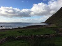
Loch Linnhe


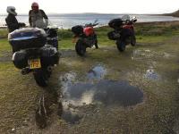
Waterlogged parking


We complete the loop and travel further north, to come across ...

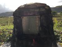
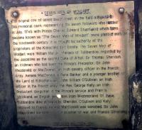
There's a local legend about the seven men of Moidart, a cairn and its plaque


Where the trees were, these here now are replanted


We carry on west along a tiny road/track to the coast. Little to see, so we turn back, and head to the Glenfinnan railway station again for a lunchtime break.

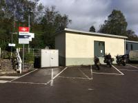
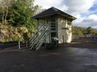
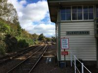
Parked up, the (now unused) signal box, looking down the line


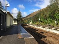
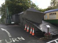
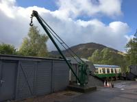
Looking past the signal box, a (now unused) snowplough, and a crane near the carriage-café


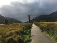
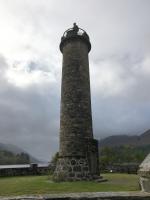
And on the the Glenfinnan Monument, which honours those who died in the Jacobite campaign back around 1745.

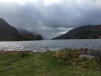
The monument, overlooking Loch Shiel


Also just visible is the Glenfinnan railway viaduct (familiar to Harry Potter fans).

Glenfinnan Viaduct


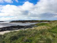
We retrace our route north for a bit, then head west along the A830, which winds its way round hills and gullies, all bends, mostly blind, so care is needed. We stop near Portnaluchaig on the coast to take in the scenery.

View to the sea


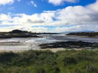
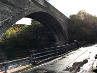
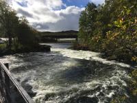
A bit further on, we cross the River Morar

On the road bridge, above the railway, and under us the river


Just wide enough off road for the bikes, and Loch Morar


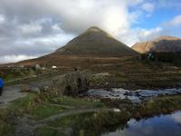
Then on to the Mallaig ferry that takes us to Armadale in the Isle of Skye. A ride past our hotel and on to Sligachan Bridge, where we stop for a while.

View from Sligachan Bridge


Finally, we head back to our hotel, the Sconser Lodge. This also vies for being my favourite hotel, again, excellent food, and we are well known by the owners (as we are by all of them on this trip). Its only downside is a deep gravel driveway from one of its entrances, making steering a little tricky. This is the last night they are open this year, they are closed for the winter from tomorrow.

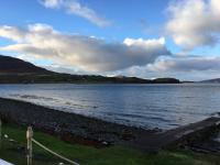
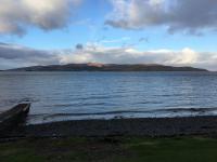
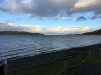
View from the hotel front


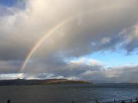
15 minutes later a rain shower goes by ...

A rainbow!


Route and Tomtom's stats


To be continued ...

 
Last edited by a moderator:
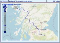
Day 6, Friday, Sconser to Innerleithen

Because of some of the roads, a fair distance to travel, and uncertainty about traffic, today was a fairly quick run with few stops.

We retrace some of our earlier route, passing Loch Duich [still fighting my spell-checker], past the peak Sgurr Fhuaran, the tallest of the five sisters of Kintail, Loch Cluanie, Loch Loyne, Loch Garry, Loch Lochy, Spean Bridge, Ben Nevis, Loch Eil, the bridge at Ballachulish, Loch Leven, into Glen Coe.

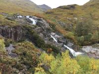
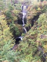
Here we made the only proper "tourist" stop. During the "high season" in the last few years, this road is a solid crawl of traffic, the bikes can only overtake sporadically, and we'd decided on a meeting point in case we got split up. However, being this late in the year, the traffic was minimal, we could easily keep together. So, with more time to spare than we'd thought we might have, we stopped near a waterfall.

Again, we thought it might be flowing really impressively, but it seemed its normal self. I strongly suspect these highland waterfalls don't vary much because the surrounding land is covered in vegetation which acts as a reservoir, releasing the water to the myriad of streams relatively slowly, unlike the areas that are farmed or have been built over, where water runs off as the rain falls.

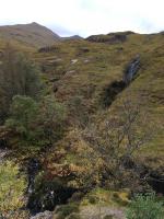
The waterfall, and looking over a bit of a bleak Glen Coe.


We were also very fortunate with the weather. I've been through here many times, it's usually misty, raining (anything from a light drizzle to heavy downpour) and/or blowing a hoolie. Can make for an eerie experience when you are told about the inter-clan massacres that occurred here - apparently walkers still find bones and other remains. However, it was relatively dry, bright and calm. In a way, disappointing, I'm unable to regale stories of seeing apparitions in the mists and hearing the clashes of arms and the moans of the wounded.

On we go, Loch Ba, Lochan na h-Achlaise, Loch Tulla, into the Trossachs National Park. I can't find words for the variety and wild impressiveness of the scenery, it has to be experienced.

One little incident. I'm well used to sheep wandering across the road (much worse in the lambing season). But it's not often I've had a kamikaze pheasant dash out from the undergrowth on the side of the road to collide with my footrest - I wasn't immediately sure he'd hit me, but in my mirror I caught a glimpse of him running back, feathers flying, so he'd got at least a bit of a headache.

We come out of the National Park, past Doune Dastle, and hit the A9, down here it's a major dual carriageway, and it leads onto the M9. We come off the M9 as soon as sensibly possible, and head across country south then west to our destination in Innerleithan, the Caddon View Hotel - more of a guest house than a real hotel. We arrived early enough to be greeted with tea and homemade cakes, delicious and very relaxing after our ride. It's a set course evening meal, but very tasty.

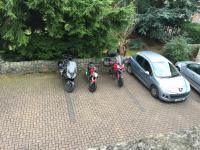
Bikes parked for the night


The route


Today's mileage: 257.

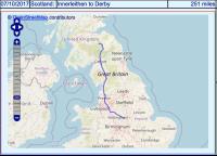
Day 7, Friday, Innerleithen to Derby

The final day, back to home.

Not too much to say. Back down to one of my favourite FJR roads, the A7. Been along it many times, full of flowing corners, rises and dips, but always a good road surface, and plenty of overtaking opportunities (and quite a few blind bends where overtaking would be extremely unwise!). Then on to the M6. R accompanied son and me for this part of the trip. He was hot-footing it further south than we were, and left us after we turned off for petrol (son's range was our limiting factor).

We made good time; again, traffic was reasonable, only held up in queues where there were roadworks. These are usually accompanied by average speed cameras, so cars usually travel a little below the set limit. It can be a little frustrating when you can work off the GPS speed and go a little faster than them, however no real hold-ups.

We turn off the motorway as soon as sensibly possible, after about 140 miles of boredom, then into more familiar territory as we head for home.

Today's route and stats (maybe I shouldn't rely on the GPS speed reading?)


Final thoughts

My thanks, to my riding companions and in particular to R for organising things, he's very good at doing it and makes every trip a success, also to family and friends, who have all been very supportive (I could foresee some people saying I was being disrespectful in some way, but all were very happy for me to go).

Commiserations to M for his breakdown. I've not heard the root cause of his issue, suffice to say he couldn't get it repaired straight away in Glasgow (something about needing a new wheel or bearing?), and missed his ferry and his gig.

My bike behaved impeccably throughout (I did have a YCC-S issue on my last trip, but my dealer and Yamaha seem to have fixed it with an adjustment).

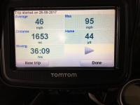
Total trip distance


The bike's odometer suggests 1711 miles, a little over a 3% discrepancy. Near enough.

[edit to add]

Overall petrol consumption just over 53 mpg (UK), that's just over 44 mpg (US). Not as good as I expected, but it does include a fair bit of motorways at motorway speeds, and some moderately enthusiastic riding on some of the more challenging roads.

[/edit]

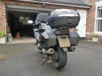
Never known the bike so filthy


As I mentioned in my first post, this wasn't the most enjoyable ride for me. Nothing to do with the ride, the bike, my companions, the weather, the hotels, the food. All of these were as good as I could hope for. I expressed my feelings in my other thread here, they are out of place in this one. I also apologise for my photos being not being as good as some, I have to admit to being less enthusiastic this time.

 
Last edited by a moderator:
^^ Exactly! Always enjoyed your pics.

And "blowing a hoolie" ?
tongue.png
Had to look it up. Learn something everyday.

 
Great ride report! My ancestors were all from Ireland. The first chapel they built was the Glencoe Chapel. (This is in southwest Indiana) I wonder if there were some Scots in the parish now? Fun research for me.

 
Thanks for thie RR. Some pictures remind me of the fabulous moments spent in Scotland last year or at the age of 18 ...

 
Top