Back roads from Sac to Reno

Yamaha FJR Motorcycle Forum

Help Support Yamaha FJR Motorcycle Forum:

This site may earn a commission from merchant affiliate links, including eBay, Amazon, and others.

Lee-N-Reno

Active member
Joined
Jan 2, 2010
Messages
36
Reaction score
0
Location
Reno, NV
Some where I have seen a posting on the back roads ( old Highway 40 ) from Reno to Sac.

I am looking for the way to go over the hill from Reno towards Sac, NOT LOOKING FORWARD to going over 80 with all the pot holes, traffic jams, construction going on.

I have taken the 395 to 50 and over from Tahoe, then to Sac, also taken 89, 49 and 20.

If I recall what I read ( where........ have had a BRAIN FART..... can't recall :dance: ) there was several people voicing a want for the same info.....

any help would be appreciated

 
I remembered that thread--it's here. Unfortunately, it sounds like it isn't something you can just be told about; apparently you'll need to learn it from somebody who can show it to you. Unless perhaps Rich has done that GPS tracking thing up that way and would care to share it????? (hint, hint, if it's not obvious enough) :rolleyes:

 
I remembered that thread--it's here. Unfortunately, it sounds like it isn't something you can just be told about; apparently you'll need to learn it from somebody who can show it to you. Unless perhaps Rich has done that GPS tracking thing up that way and would care to share it????? (hint, hint, if it's not obvious enough) :rolleyes:
He promised to show us this Spring and Spring is here!

 
You can get on/off old 40 (which is labeled and assortment of roads now-a-days, but you still will have to be on I-80 for at least one stretch of maybe 15miles or so. On the east end there are a a couple of ways ...I'll let Rich give you his versions and we can all compare notes.

You mention 49 etc ......

But so far no one has got adventuresome and mentioned Foresthill/Mosquite Ridge:

100417mosquiteRidge.gif


have fun ...John

Oh, and maybe tomorrow's lesson will be using Henness Pass road, which has even better history than 40 (clicky)

 
Last edited by a moderator:
You mention 49 etc ......But so far no one has got adventuresome and mentioned Foresthill/Mosquite Ridge:
Oh, my!

Riding Mosquito Ridge again tomorrow (today) with Sean. Groovy road, John.

From Pashnit-

Mosquito Ridge Road

600 Curves in 36 Miles

...This is a road quite unlike those that surround. And one could probably go even further and say its uniqueness is unparalleled for the Sierra Nevada Mountains. So what's the big deal. For starters, Mosquito Ridge has length, at nearly 40 miles of just curves. Add in the scenery, drop-offs and a fantastic dosage of Sierra Nevada terrain- all the ingredients are there....

Plus, it's fun as hell. ;)

Often patrolled, ...but that's okay.

 
Well, the reason no one has mentioned Foresthill Ridge Road into Norden, per your map, RJ, is that that it's dirt for what -- 15 to 25 miles? -- the kinda challenging dirt that an FJR isn't going to handle without dented tank or F'd up panniers from being dropped AT LEAST once. (Henness Pass is dirt for even longer, for those that don't know.) Last time I rode Foresthill into Norden was on the KLR 650 with OrangevaleFJR on his DRZ 400, mid summer of 2007 (parts of it would be under 10 feet of snow right now). There are substantial stretches in midsummer where it has a foot deep of talcum powder dust, downhill to rocky rivulet crossings, where you gotta go back up. Even on the KLR, it's a challenge to turn at all in that, or to slow enough to make it through the rip rap at the bottom where the road starts uphill again. You pass riders on horseback on that road. O'Vale "biffed it" (his words when he caught up to me going back to find him) in that stuff, and it was all I could do to avoid going down, but was worn out holding those bars steady in nonturnable powdered dirt.

Mosquito Ridge from Foresthill is usually good by around now, but I'm not so certain this year. Looking forward to OM's report. In mid May '08, I encountered snow on Wentworth Springs Rd between where Mosquito Ridge/Eleven Pines Rd tees into Wentworth Springs and where Wentworth Springs tees into Ice House Rd. There was one downhill stretch of 18" deep ruts in a 100 yard snow bank across Wentworth Springs that I slid/rode through, hoping it wasn't impassable ahead. Reason? Because I could make it across going downhill, but I'd never have been able to cross it going uphill if I'd had to turn around. I did get through and all the way to 50 to go over the summit to SLT. That trip, I had taken Wentworth Springs from Georgetown, so I didn't see what Mosquito Ridge was like, but there are stretches of it that might have been obstructed by snow if the snow I encountered on Wentworth was an indication of what existed at similar elevations on Mosquito Ridge.

About 40, though, RJ's right -- there is about a 15 mile stretch between Baxter Grade and Cisco Grove on/off ramps that you have to do on I-80 between Sacramento and Truckee. From Truckee, you can go east either through Glenshire or through Prosser (the latter off 89) to get to the Boca on/off ramp, but then you have to take I-80 east from there again. I'm talking paved roads, that is. There is a way to go from 89 north of Truckee through Dog Valley, but that's gravel and dirt that RJ's probably ridden a bunch of times.

The fun way to stay on pavement in summer all the way to Reno is to take 40 (and its little offshoots and variants) to Truckee, then 267 over the summit to Brockway/Kings Beach (or 89 into Tahoe City), then north and east along North Lake Blvd to Mt. Rose Highway and over it to Reno (or Virginia City).

Funny this thread got posted when it did. A couple hours earlier, I had sent a PM to OM in which I asked if he'd be up for doing this ride in a couple or three weeks. We've been getting accumulations of snow at the Lake (Tahoe) and on Donner Summit as of just a few days ago, and I don't know for sure whether 40 (Donner Pass Rd) is open from Sugar Bowl to Donner Lake yet. By May, we oughta be able to do a ride over it, and I'm still planning on doing that for those that are interested.

 
Last edited by a moderator:
Late start here. :unsure:

In mid May '08, I encountered snow on Wentworth Springs Rd between where Mosquito Ridge/Eleven Pines Rd tees into Wentworth Springs and where Wentworth Springs tees into Ice House Rd. There was one downhill stretch of 18" deep ruts in a 100 yard snow bank across Wentworth Springs that I slid/rode through, hoping it wasn't impassable ahead. Reason?
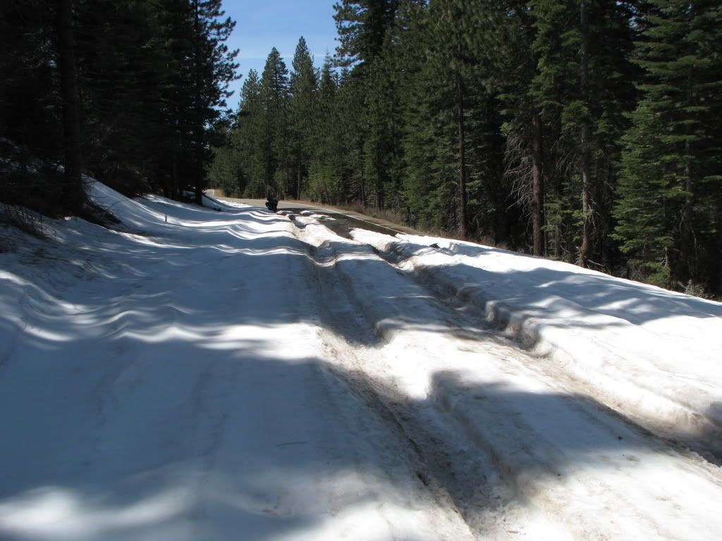
Like this, Rich?

(Last year, mid-April, a few miles before Stumpy Meadows.)

IMG_0697.jpg


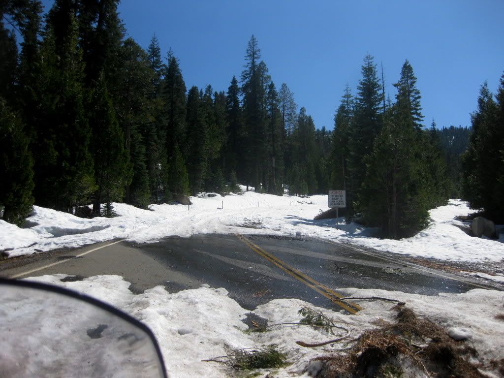
And this is Wentworth (the other end) looking from Ice House Rd.-same weekend.

IMG_1364-1.jpg


Since this winter was much "heavier" than last, I'm guessing it's won't be looking good for motorbikes through there for a couple more weeks.

 
Late start here. :unsure:

In mid May '08, I encountered snow on Wentworth Springs Rd between where Mosquito Ridge/Eleven Pines Rd tees into Wentworth Springs and where Wentworth Springs tees into Ice House Rd. There was one downhill stretch of 18" deep ruts in a 100 yard snow bank across Wentworth Springs that I slid/rode through, hoping it wasn't impassable ahead. Reason?
Like this, Rich?

(Last year, mid-April, a few miles before Stumpy Meadows.)

IMG_0697.jpg
Yep, just like that, only on a steeper downgrade further out, and it was MAY 10, 2008 (just checked my calendar for day I got performance award on 50). I stopped and thought about it before doing it -- pretty sure I could get through but not sure what lay ahead. Good thing it was the only one like that, because it was really tough going through and there was no way, short of shoveling 100 yds of snow drift, that I coulda gone back uphill through it.

And you're right about that area around Stumpy -- there's shaded areas that harbor snow part or all the way across the road for longer than you'd imagine, but at least it's mostly kinda flat there. I've also seen the intersection of Wentworth and Icehouse just like your pic shows. Came in from 50 late enough in the spring when I lived in Gardnerville that I thought for sure I could get to Georgetown without snow on road and had no problem at all until getting to the Wentworth Springs intersection to find that it was impassible.

 
Last edited by a moderator:
Well, the reason no one has mentioned Foresthill Ridge Road into Norden, per your map, RJ, is that that it's dirt for what -- 15 to 25 miles? -- the kinda challenging dirt that an FJR isn't going to handle without dented tank or F'd up panniers from being dropped AT LEAST once.
I should have realized the ***** audience, you know what I'm talking about ...the pony-tail OM type. FJR does just fine, but you will have to wait a couple months for the snow to go down a bit.

Personally, if one wants to talk about sacto to Reno, I'll take all options into consideration and not be skewed into a false premise that pavement is better than dirt. Have you seen I-80 lately?, that POS is a hell of a lot rougher than Foresthill Ridge Road .....and IMO much more dangerous.

You might be able to scare that ***** OM, but I ain't buying a pound of your asphalt -BTW, have you seen what that stuff will do to a bike when it goes down? And how about the rider, they don't call it ***-FAULT for nothing.

Looking at the world without blinders in Reno ...John

 
I knew Sacramento County resembled something familiar

saccountymap-1.gif


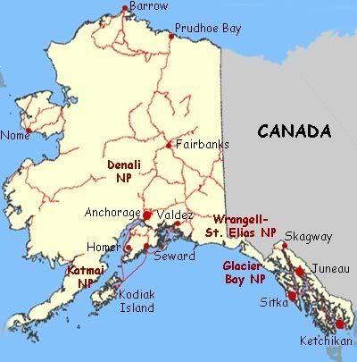
alaska-map-highway.jpg


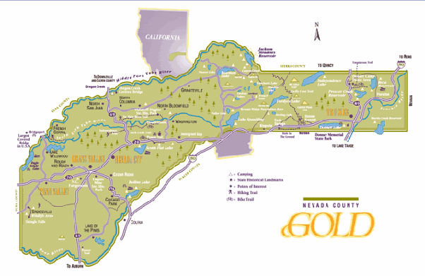
But now Nevada County too?

nevadacounty-1.gif


1confederate_2082_13757901.gif


Who the heck drew up the boundaries in this state?? Hey, and I'd be very glad of the chance to do that Sierras tour when you get it going too, Rich. Looks like fun riding, as well as a darn nice to know alternate road.

 
I should have realized the ***** audience, you know what I'm talking about ...the pony-tail OM type.
Renal John, I'm sorry. I didn't catch all of that,

'cause while you were riding a mouse, I was out riding a motorcycle. :lol:

But I was thinkin' about ya. Made you something.
Ahhhaaahhaha Good for you Mikey. Man, I'm getting the itch to ride something fierce, hope we can log a few miles sometime soon.

Really, you are my favorite hippie, ....and I'm especially fond of ya since discovering you're a grandpa ....now that is cool. Let's go ride, first mescaline hit is on me.

 
You can get on/off old 40 (which is labeled and assortment of roads now-a-days, but you still will have to be on I-80 for at least one stretch of maybe 15miles or so. On the east end there are a a couple of ways ...I'll let Rich give you his versions and we can all compare notes.
You mention 49 etc ......

But so far no one has got adventuresome and mentioned Foresthill/Mosquite Ridge:

100417mosquiteRidge.gif


have fun ...John

Oh, and maybe tomorrow's lesson will be using Henness Pass road, which has even better history than 40 (clicky)
Has this turned into a dualsport forum? The dirt section to Robinson Flat from Soda Springs would kill a FJR... not saying it couldn't be done but I wouldn't do it it with a street bike I like.

Henness pass is no picnic on a street bike either.

 
Top