Cali Big Dog Rides

Yamaha FJR Motorcycle Forum

Help Support Yamaha FJR Motorcycle Forum:

This site may earn a commission from merchant affiliate links, including eBay, Amazon, and others.

FJRocket

Doctor Throckenstein !!!
Joined
Jun 25, 2005
Messages
2,229
Reaction score
7
Location
Indiana
Looking at the WFO site and trying to pick routes to ride. Trying to cover as much ground as reasonable in the short time out there.

It looks like some of the directed routes have some overlap. I'm thinking about modified 3 Passes and Yosemite Big Dog rides.

Perhaps State Road 4 is worth doing twice. That's cool if it's that awesome.

I'm thinking about doing 88 out, then 108 and back. Then do 4 and 120 through Yosemite and back. Not much of a route change, but less overlap.

The routes as is look pretty great. Just trying not to cover too much of the same ground. Might be worth it though?!

Looking for recommendations from folks who BTDT. I think we'll be seeing plenty of Nevada coming in and going out, so leaning toward two big Cali rides during WFO. I know these are going to be big days, but if anyone has recommendations of side jaunts, avoidances, etc, would be greatly appreciated.

TIA!

 
Last edited by a moderator:
Those are all great passes, all with spectacular scenery. You're talking about my stomping grounds. I live a couple miles from 88 just inside the Nevada line, and ride 88, 108 and 4 regularly. 4 is known as Ebbetts Pass (and yes, it is THAT good), 88 is known as Carson Pass, 120 is known as Tioga Pass and 108 is known as Sonora Pass. Another you ought to ride in the area and can hook up in the loops you suggested is Monitor Pass (Hwy 89) between its junction with 395 (just south of Topaz Lake) on the east and its junction with Hwy 4 (just to the south of Markleeville) on the west end -- 22 miles of really fine sweepers and a fine view. For all these passes, either direction is great. Consider riding from Reno one early morning up Mount Rose, then along the east shore of Tahoe to Hwy 89 south over Luther Pass to 88 at Pickets Junction -- then either take your route west over Carson Pass or east to Woodfords where you make a right through Markleeville and over either Monitor (to 395 south to Sonora or Tioga) or over Ebbetts.

The only additional thing I'd mention is that Tioga (120) is best immediately after they open it from its winter closure. (Tioga, Ebbetts and Sonora Passes are all closed during the winter until the snow melts off, usually sometime after May 15, depending on how much snow there was for the year.) The reason I say that is that Yosemite Park gets crowded during the summer, so you're likely to spend a lot of time in traffic -- something you won't see on the other mentioned passes, but Tioga DOES have the most spectacular scenery of the four, and that's really saying something, since all are spectacular.

There's a lot of fine roads in the area around Reno. All 4 ways into and out of Virginia City are excellent as a short jaunt from Reno. The route from Truckee north on 89 to Sierraville and then down 49 through Sierra City, Downieville and to Nevada City, then over to Colfax on 174 and back up to Truckee (mostly on the little known old Hwy 40 route in the Hwy 80 corridor) is also excellent in either direction. Mount Rose Highway from Reno to Incline Village at Lake Tahoe is great. The ride around Tahoe is also really nice, BUT fraught with way too many tourists mid day at that time of year. 49 in the California foothills is good, the ride from Placerville northeast to Georgetown and then east on Wentworth Springs Road to Ice House Road south to Highway 50 is great. (All compass directions I mention are general from one end to the other.)

Hey, it sucks having to live here and ride all these ****** routes. :(

 
Last edited by a moderator:
Having ridden most of these routes, I'll just add that they are worth doing in each direction at least once, some more. I don't take in much scenery when riding, that's Eve's job. I'm usually just searching for the line through the next twisty and watching out for hazards. Group rides can be a bit more relaxed, depending on pace. That Yosemite Big Dog ride is going to make for a long day. We'll probably stay a bit closer to the North. Besides, we get to ride Yosemite on the way home. :D

 
What about some of the interior roads between all those passes mt. aukum rd., fair play, grizzlly flats, north south road, iron mountain all connect to 88 0r 89 some very good roads . Hope this helps ride that area all the time :D :D :D

 
I nominate MadMike and RogDeb to detail the routes for us and Highlander to pick the lodging and resturants... Some how 49 needs to be included. Word. :D

 
Some how 49 needs to be included. Word.
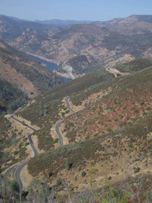
Free preview. :dribble: I can almost see this road from my house. If you look real close, you may even see the remnants of several sets of tires I've left along this highway during the year. :D

IMG_0639.jpg


Last edited by a moderator:
Ah, yup! Hwy 49, South of Sonora. Just beware errant H.D> riders running FJRs over cliffs... :angry:

exskibum nailed the descriptions.

Mt. Rose (8000') and Monitor Pass (8300') for sweepers and grand vistas. Sierras at your back, desert 5,000 ft below. Amazing!

Hwy 4 (Ebbett's, 8730')) and Hwy 108 (Sonora, 9204') are twisty and technical. Great scenery in pine forests.

Hwy 120 (Tioga, 9945') is a great combination of sweepers, Lakes, nice turns (not really twisty) and ends up at the North Gate of Yosemite. If you go to Yosemite--and it really is awe inspiring. No pictures do it justice, it must be experienced--plan on traffic. If you ride down 395 to 120, be sure and stop at the gas station for lunch--Really!--its unbelieveable.

I ride 88 too often, so it really doesn't do much for me. The "high" portion, around Kit Carson and Kirkwood is pretty, as well as the Eastbound downhill into Hope Valley. By all means, get of the bike at the Carson Overlook (8573'), walk about 100 yards east and see the majesty of the Sierra Nevadas.

There are too many side roads to discuss here. I plan on bringing some AAA maps with me. I'm going to highlite some great secondary roads.

Kingsbury Grade up to Daggett Pass (Nev 207 out of Minden/Gardnerville, only 7300') has some great views of the Lake Tahoe Basin. Old Priest Grade on Hwy 120 is awesome, and short enough to ride 2 or 3 times.

Let's not forget Hwy 89 North to Bassett's Grade (sportbike riders come from all over to ride that road. over 1000' feet in about 3 miles) and 49 through Downieville (Pretty along the river, then technical through the forested canyon) and on to Grass Valley, then Hwy 20 back to 80 East, get off at Cisco Grove and go left under I-80 and take the "Old Hwy 40" along the American River and over the Old Donner Summit (7200') to Truckee.

Too many roads and adventures.....thankfully, we live here. Maybe we locals should all bring maps and "pin" them in some central location so the visitors can see our highlited "special" and "favorite" roads, ask us about them, then transfer the info to their own maps or GPSs. ;)

Between Skyway (from Sonora), exskibum (gardnerville/Minden), Bluestreek (Marysville--Northern Hwy 49 area) and the rest of us who ride the Mountains, we should be able to give the out-of-staters plenty of information.

Actually, if you are going to ride the passes, you aren't going to have a lot of extra time to take side roads. Believe us that while the distances don't look that far, the roads are not the type that you will make great time on. Some of these roads are 25-35 mph in the twistier sections. So time is the issue, not distance. But, hey, we're here to help.

Who'd know about Ram's Horn Grade above Volcano except a local....or Fiddletown Road, easily twice as good as the famous Salmon Falls Road...or the high speed run from Hwy 88 on Mormon Immigrant Trail...or....

 
Last edited by a moderator:
You guys are breakin my heart.... ;) It all sounds fabulous so far.

For starters, the rides that WC posted up look great. Sounds like there's many more places to visit in and around the area. <--- understatement.

I know there's only so much time every day, which is why I wanted to hear more from those of you fortunate enough to ride out there regularly.

I'm certainly interested in any modified routes and "short cuts" for sake of time and quality.

Looks like I may have to extend the visit a day or so. So many roads, so little time....

Yes, I move that you guys post rides and then LEAD. I wanna see big maps in the convention hall: MADMIKE2's Monitor Pass RIDE ONE:, Skyway's Sonora Ride:, etc.. Perhpas they end up being the same as WC's rides, perhaps variations on the theme. Sure sounds like no matter what, there should be some fantastic riding.

I also move that you guys get together and ride the routes as many times as possible and get them down pat for us. I know that breaks YOUR hearts! ;)

Thanks for sharing. Keep it coming!

 
Last edited by a moderator:
Uhm, TWN, prolly not. Some-buddy volunteered me to be aworkin' at the Reno site, so there may not be much ridin' for me.

FJRocket, that's exactly what I had in mind! I suppose, if we really hafta , we could be "put upon" to ride all of these rides. :D I have already planned to ride some of them just to check turn-offs, road construction and times....alll important data for those who've not ridden them before.

It looks like March through June will be busy....Oh dang! ;)

 
Will there be any impromptu rides with riders taking several riders and hitting the road that know the area or must all rides be of a desiginated route for safety in case some thing happens? Rders meanning riders from other parts of the country and riders not knowing the area? Just wondering. ;)

 
Will there be any impromptu rides with riders taking several riders and hitting the road  that know the area or must all rides be of a desiginated route for safety in case some thing happens?  Rders meanning riders from other parts of the country and riders not knowing the area? Just wondering.    ;)
That's very likely what I'll do -- pick a route and lead a small contingent that wants to go along. I did exactly that in June with a Blackbird meet (also organized by Warchild) in Reno. While I never atually got up to the Hilton for that meet, I hooked up with riders coming south to ride these passes on Friday and Saturday. On Saturday, part of the group did one loop, and I took a couple riders on another.

For WFO next July, I'll be staying at the Hilton with GF, and assuming that I can get her up and ready, I'll probably take two rides starting early a.m. on Friday and Saturday -- one a southern loop and one a northern loop through Nevada City. I can't imagine anyone setting up a rigid set of routes everyone must follow for safety or any other reason, though several of us would be happy to advise about routes and safety issues the night before. I ride the area so much that I would never feel constrained to follow specified routes, will pick what I think is most fun and fits the time available, and am happy to lead a small group on whatever I do pick.

For the southern loop, I'd envision probably an early start up Mount Rose Highway (431) to Lake Tahoe, along the east shore to South Lake Tahoe (28 to 50), south over Luther Pass (89) to Hwy 88, then east to Markleeville and over Monitor Pass (89) to 395, south to Sonora Pass (108), then north on 49 to Angels Camp and back over Ebbetts Pass (4) to Markleeville, to 88 east to Gardnerville (where I live) and then north on 395 to Reno for dinner and revelling.

For the northern loop, I'd probably head west on 80 to Truckee, north to Sierraville and Sattley into 49 west to Nevada City then south on 174 to Colfax. The short route would loop back east on old Hwy 40 in the Hwy 80 corridor (there's a stretch you have to do on 80 between Baxter and Cisco Grove, but the rest is a beautiful 2 lane ride all the way to Donner Lake and Truckee), then either back on 80 east to Reno or south from Truckee on 267 to Kings Beach and east on 28 through Crystal Bay above the deepest part of Lake Tahoe to Mount Rose Highway (431) back to Reno. The longer way would be to go from Colfax west to Auburn along Placer Hills Road, then south on 49 to Cool, 193 to Georgetown, left there on Wentworth Springs Road to Icehouse Road south to 50, then 50 east over Echo Summit and then either around Lake Tahoe to Mount Rose Highway (431) east, or into Carson City to 395 north into Reno for dinner and more revelling.

Sunday, my GF will probably drive the car home (50 minutes south of Reno), while I may take a ride up Geiger Grade to Virginia City, and I'd be happy to show anyone the 3 routes down to Hwy 50 from there (as in two loops, with the uphill return from 50 to Virginia City along the "Truck Route" for maximum grinnage).

I prefer to ride in smaller groups of 5 or 6, maybe 8 riders at most. The two longer Friday and Saturday routes I sketched here are ALL DAY affairs. The only caveat is that while I can easily do two straight days like this, I can't swear that GF will be up for the long version on the second day if we do a long one the day before. (And my monkey-butted ass will be killing me with the stock seat by Saturday night.) GF is excellent on the back (and an RN), and we can rip on roads I know this well, but that's not what I'm interested in doing -- safe and smart riders are required. These roads all offer spectacular views and plenty of really fun and challenging twisties. More importantly, though, it's NOT a good place to let testosterone turn it into a road race -- there are plenty of steep cliffs off the shoulders, as well as trees, boulders and other obstacles if you go offroading (in remote areas mostly lacking in cell reception) that make smart and safe riding imperative. Having said that, I'm not suggesting a motor-home-like pace in the least.

For those of us who live and ride out here, we'll get a huge kick out of showing you stuff that gives you a **** eating ear to ear grin you won't forget, so don't worry about having fun riding. We'll try to make sure of it. Last June, on Blackbirds, I heard plenty of comments about having to find a way to move here, that it was the best meet ever, and even that these roads were easily as good as some of the very best and most famous in the country, but with far better scenery. (You really have ride in the Trinity Alps area of northwesern California to gauge the accuracy of those statements, though . . . and that's where the Blackbird meet is this coming June.)

 
Last edited by a moderator:
For the southern loop, I'd envision probably an early start up Mount Rose Highway (431) to Lake Tahoe, along the east shore to South Lake Tahoe (28 to 50), south over Luther Pass (89) to Hwy 88, then east to Markleeville and over Monitor Pass (89) to 395, south to Sonora Pass (108), then north on 49 to Angels Camp and back over Ebbetts Pass (4) to Markleeville, to 88 east to Gardnerville (where I live) and then north on 395 to Reno for dinner and revelling.
This is a good route which will involve a full day in the saddle, especially when you consider out of state riders stopping for piccis & jaw dropping vista's etc.

Also consider that Hwy4 & Hwy108 are very demanding, technical roads near the summit. Newbies over the top of both may also require a little extra riding time.

 
+1 on Hwy 4 and Hwy 108. Not to frighten, but to enlighten and make others aware, these 2 passes are not to be taken lightly. Many "ricky-racer" types have learned the expensive way.

Spirited=good, too fast=tragic! There is no better place to make the case for "Ride your own ride" or "Ride the pace".

 
+1 on Hwy 4 and Hwy 108. Not to frighten, but to enlighten and make others aware, these 2 passes are not to be taken lightly. Many "ricky-racer" types have learned the expensive way.
Spirited=good, too fast=tragic! There is no better place to make the case for "Ride your own ride" or "Ride the pace".
And in small pacs of 5 - 8, it's a lot easier to manage. Safer, too. More bikes than that and it can easily become a parade, especially with pilots of varying skills and backgrounds.

I'm sure some folks will just take off on their own and see where they end up. With a good map or GPS, that's pretty easy to do. Just go off on your own, 'til you think you're out half a day, then start back. I like doing that on my home turf when I have extra time. At WFO, though, I'm going to defer to those with experience. Not only will that possibley save my (monkey) butt and bacon, but it sure should enhance the experience.

Thanks again guys!

 
For the southern loop, I'd envision probably an early start up Mount Rose Highway (431) to Lake Tahoe, along the east shore to South Lake Tahoe (28 to 50), south over Luther Pass (89) to Hwy 88, then east to Markleeville and over Monitor Pass (89) to 395, south to Sonora Pass (108), then north on 49 to Angels Camp and back over Ebbetts Pass (4) to Markleeville, to 88 east to Gardnerville (where I live) and then north on 395 to Reno for dinner and revelling.
That sounds like just the ticket for a great ride. Sign us up!

 
Is someone gonna make these routes 'offical rides', assign dates & times and provide route maps? Concur with Toey... that route sounds killer!

 
I think His Dictatorness already has the "official" recommended rides at:

Warchild's WFO5 rides

Isn't that official enough? Yikes! We don't want to dis the guy with the ban button!

Having said that, I know at EOM the early risers just rose together and took off. Some agreed the night before. Some of us corresponded on CHEEZY BOARD and hooked up, then planned in more detail in person. Of course then we rode over Hell's Half Acre with the plan rapidly exiting the proverbial window.

What would be really helpful would be to know how early some of the BIGGEST DOG RIDES should start to get the whole thing in. Nice that sun comes up, what, about 5:30 and then sets about 9:30 that time of year? 'Course what's it like on the shady side of the granite come early evening/dusk out there? See, I don't have to worry about that here because the corn usually doesn't get that high, so it's a whole new consideration. Especially if you throw in some altitude with attitude, dude.

 
Top