Fontanaman
Robin Trower
My buddy Brian calls on Monday and says let's go for a ride and you get to plan it and he will meet me where ever I decide. Brian will be out of town, away from email and unable to contribute to ride planning.
So I pick the destination, the Red Horse Diner, in Ellensburg, Washington a fun '50 theme diner. The rest of it is easy, a 4 Pass Blast in the Park, the Park being the State of Washington. I invite a gaggle of victims but everybody is busy enjoy the summer so it is just Brian and I on this one.
The route is done the meeting place is at a Starbuck in Enumclaw along Hwy 410 with a depart time of 8:00am. Sometimes the ambiance of McDonald's wears on me.
The route.
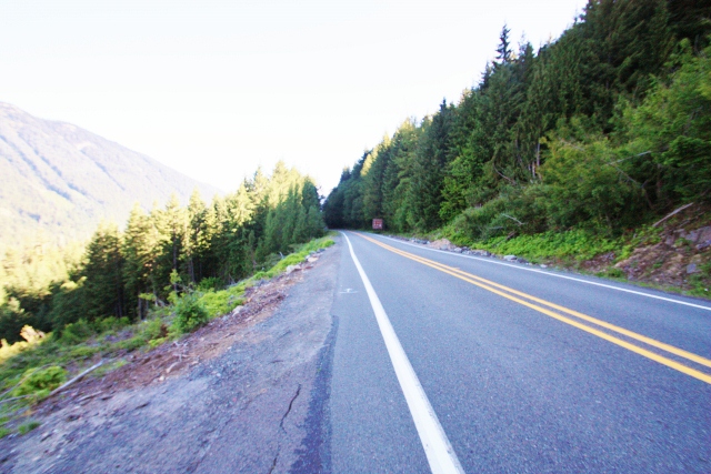
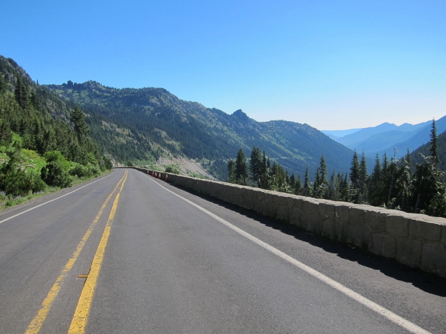
Saturday dawns cloudy and cool with temps in the high 50's. After coffee at Starbucks we head east on Hwy 410 toward Cayuse Pass. The clouds thickened and it start to rain just a bit. I know this rain will be short lived and figure we just have to get above the low valley clouds - you have to get in it to get out of it. Sure enough the rain quickly quit and blue sky started to punch through in places.
The highway follows glacial fed White River flowing from the Emmons Glacier on Mt. Rainier and today the river is murky gray from with silt from the melting glacier.
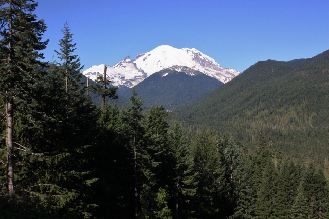
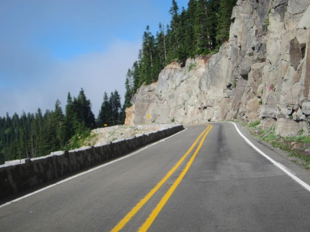
It is not long before we enter Mt. Rainier National Park along the Mather Memorial Parkway named after the first National Park Director, Stephen Mather. The parkway provides access to the east side of Mt. Rainier and features fantastic views of Mt. Rainier. We stop for photos.
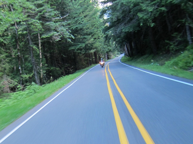
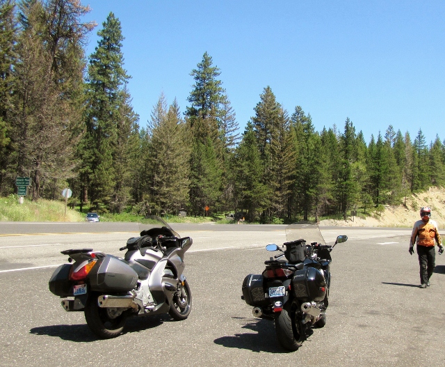
Brian on his ST1300 along Mather Memorial Parkway
The photo of Mt. Rainier below was taken here. Most don't know this but an avalanche roared down this chute 10 to 15 years ago, the lack of trees the tell tail sign.
The Killer View EVERYBODY stops for.
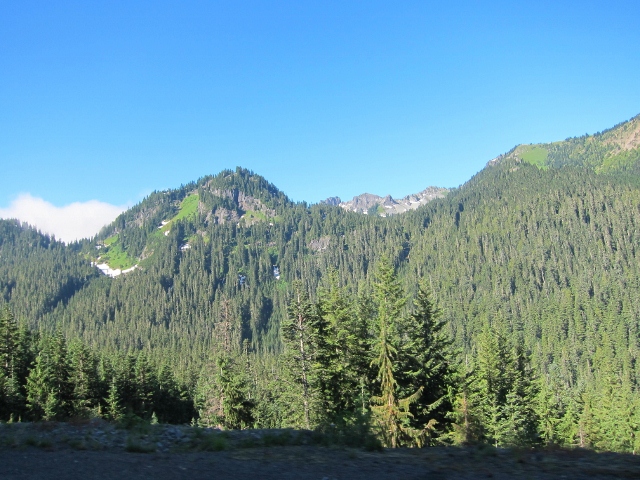
Near the summit of Cayuse Pass. There is still a bit of snow in places.
Next we are off to Chinook Pass about 4 miles or so beyond Cayuse Pass for a photo op of Tipsoo Lake.
On the way to Chinook Pass. You can see the fog in the background.
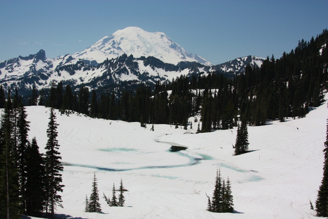
Fog surrounds Tipsoo Lake and blocks the view of Mt. Raineer so we skip the photo op. It was 46 degrees at the summit today. On a good day you will see this.
Tipsoo Lake and Mt. Rainier
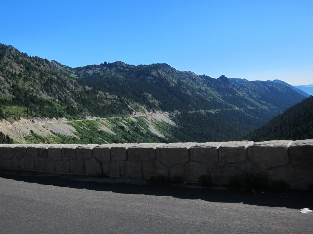
The summit of Chinook Pass at 5450' is closed from mid November and typically opens on by Memorial Day.
Chinook Pass summit looking east. When the pass is opened, usually by Memorial Day, the snowbanks here are 15 feet tall.
Chinook Pass summit looking east with a bit of snow on July 28, 2012.
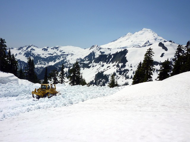
On the east side of Mt. Rainier Chinook Pass is in Mt. Rainier's rain shadow. This year the snow is nearly gone by the end of July. In contrast Artist Point near Mt. Baker just opened last week. Artist Point, is not in a rain shadow, instead it is blasted by storms system fresh from the Pacific Ocean and it is typically a bit cooler too, drawing cool air from the Fraser River Canyon in Canada. The difference is dramatic as can be seen in these photos. Artist Point usually receives twice as much the snow compared to Chinook Pass.
Clearing the road to Artist Point near Mt. Baker, July 13, 2012. Artist Point is at 5,000' elevation. The road to Artist Point was buried under 20 to 30 feet of snow when crews began clearing Mount Baker Highway in early June.
Back to Chinook Pass.
Looking east bound just east of the summit of Chinook Pass.
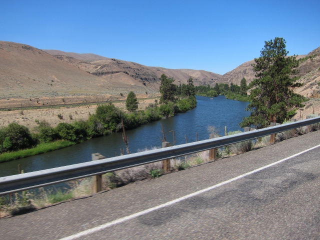
We continue along Hwy 410 toward Naches, following the American and Naches River on their way to the Yakima River or farmers fields to fill our homes with fruits, vegetables. The Yakima Valley is agricultural center of Washington's bread basket to the world. A few weeks ago I road over here the fun of it to buy some farm fresh cherries. They were farm fresh but small and hard.... nuts.
I intended to stop at Applewood Park in Naches but there was a community affair going on there and no place to park. A few years ago we stopped here and my friend John was looking wistfully at the toy horses in the children's play ground. The miniature horses were supported by a large taut coil spring. John has BMW K1300GT with ESA, BMW's fancy electronic suspension. With John looking as if he was reliving a childhood memory I could not help but quip, "No John, you can't ride the horse it doesn't have ESA."
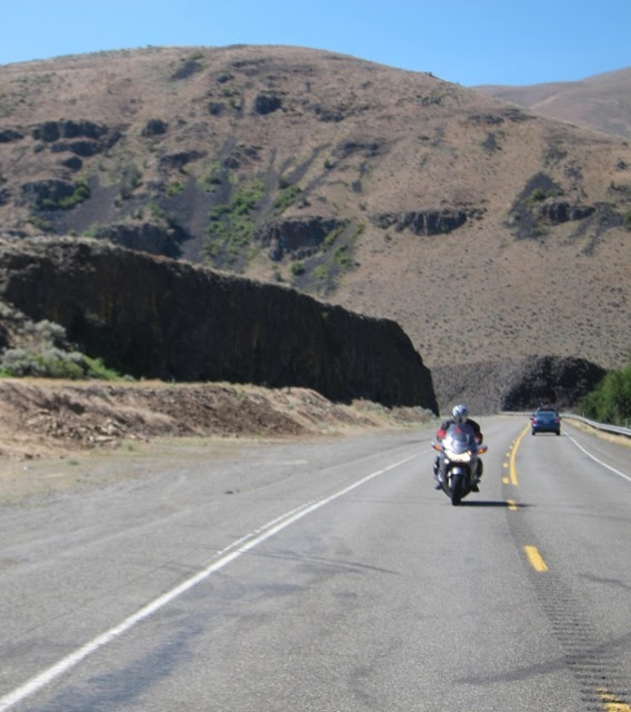
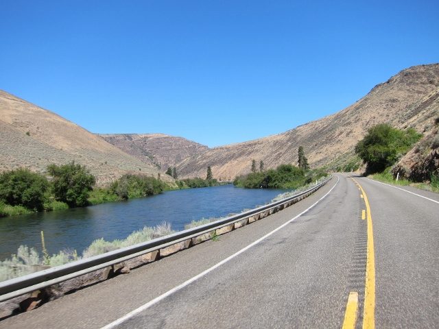
With no stop we continue on and today instead of riding US 12 and I-84 to Ellensburg we take backroads along the Wenes Valley and the Yakima River Road. The Yakima River road runs north and south cuts across the east to west Umtanum and Manastash Ridges in a most un-canyon like manner.
In the summer you will find anglers dreaming of A River Runs Through It in competition with river rafters. Meanwhile motorcyclist must compete with a silly 45 mph speed limit along the Canyon Road. This is difficult especially since a grin means 20 mph over the speed limit along a well patrolled road. Watch out for the county sheriff on the south end.
Yakima River Road
Brian along the Yakima River Road. Notice the desert like hillsides is a stark contrast from the green forest at Chinook Pass.
Another reason riding in Washington is like Riding in the Park. A diverse Park indeed!
Yakima River Road
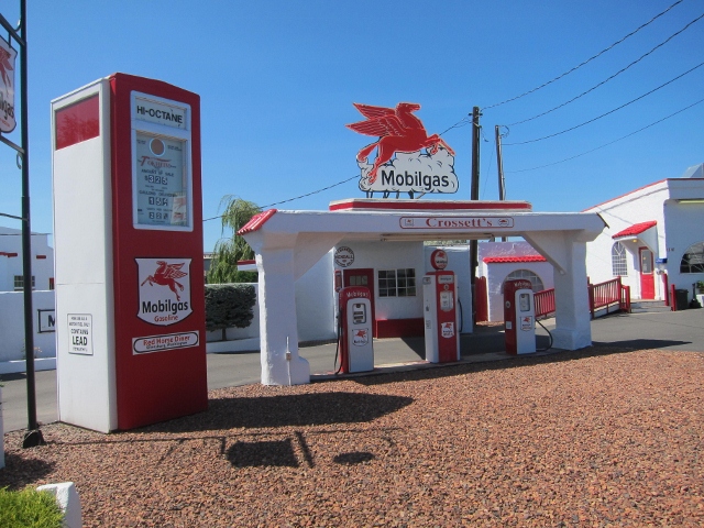
We arrive at the Red Horse Diner in Ellensburg.

Right out of the 1950's - Fairlaner would be in heaven.
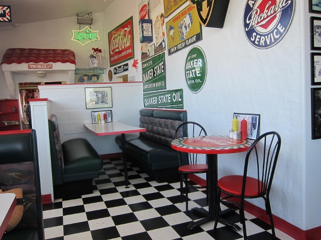
The interior is themed as well.
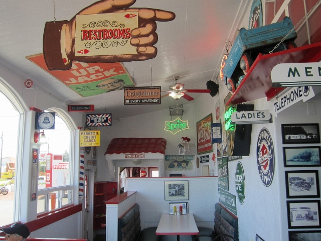
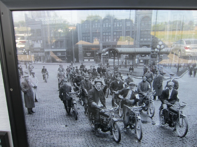
This photo is in the Red Horses Diner. Excelsior V-Twins meeting in downtown Seattle at Pioneer Square in 1911 for an endurance run to Vancouver Washington AND return. Very cool. DO click the link and read the story!
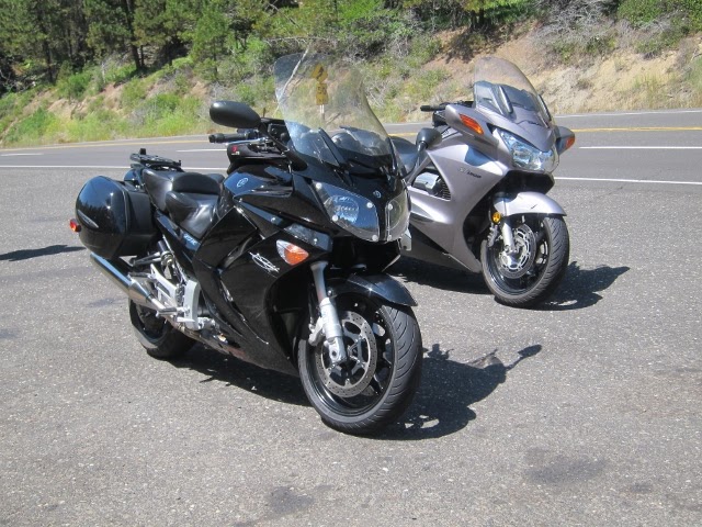
We have a very nice lunch and head for or Blewett Pass our 3rd pass of the day. Here is my FJR and Brian's ST1300.
The bikes and moi at Blewett Pass. I used snowmobile up here in the 1970's with my family. We parked the camper and stayed here for 5 days or more at a time. There is a snow park turnout to the right. The snow is much dryer here than to the west as Snoqualmie Pass - an advantage when riding snowmobiles.
We decide to take the Chumstick Highway to Plain thus avoiding the crush of people in the Bavarian themed town of Leavenworth. Yeah that is right the entire dam town is decked out like a little German Village. It is a huge tourist trap; a commercialized crapper hole. The Autumn Leaf Festival occurs long before any self respecting leaf dares turn color much less falls on the fricking tree. If you want to see people in lederhosen blowning strange horns this is your place!
As it turns out the Chumstick Highway was recently chip sealed and it was a poor job too for there is a high tar content on the road surface. Scratch one nice road for a year or two.
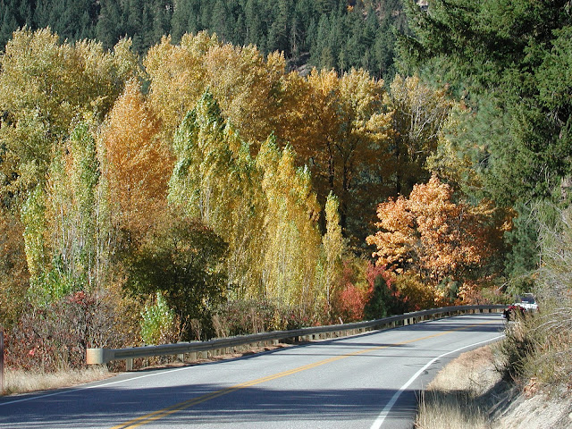
Along the Chumstick Hwy in October 2006.
Brian and I stop take a break in Sultan. Afterwards I take the Ben Howard road which as recently chip sealed and is now packed out. They did a good job here and didn't over oil it. Nice surface. Now if somebody would just please remove the silly 20mph speed limit signs all would be good.
I return home via backroads with less than 20 miles on freeway the entire day.
The End
So I pick the destination, the Red Horse Diner, in Ellensburg, Washington a fun '50 theme diner. The rest of it is easy, a 4 Pass Blast in the Park, the Park being the State of Washington. I invite a gaggle of victims but everybody is busy enjoy the summer so it is just Brian and I on this one.
The route is done the meeting place is at a Starbuck in Enumclaw along Hwy 410 with a depart time of 8:00am. Sometimes the ambiance of McDonald's wears on me.
The route.
Saturday dawns cloudy and cool with temps in the high 50's. After coffee at Starbucks we head east on Hwy 410 toward Cayuse Pass. The clouds thickened and it start to rain just a bit. I know this rain will be short lived and figure we just have to get above the low valley clouds - you have to get in it to get out of it. Sure enough the rain quickly quit and blue sky started to punch through in places.
The highway follows glacial fed White River flowing from the Emmons Glacier on Mt. Rainier and today the river is murky gray from with silt from the melting glacier.
It is not long before we enter Mt. Rainier National Park along the Mather Memorial Parkway named after the first National Park Director, Stephen Mather. The parkway provides access to the east side of Mt. Rainier and features fantastic views of Mt. Rainier. We stop for photos.
Brian on his ST1300 along Mather Memorial Parkway
The photo of Mt. Rainier below was taken here. Most don't know this but an avalanche roared down this chute 10 to 15 years ago, the lack of trees the tell tail sign.
The Killer View EVERYBODY stops for.
Near the summit of Cayuse Pass. There is still a bit of snow in places.
Next we are off to Chinook Pass about 4 miles or so beyond Cayuse Pass for a photo op of Tipsoo Lake.
On the way to Chinook Pass. You can see the fog in the background.
Fog surrounds Tipsoo Lake and blocks the view of Mt. Raineer so we skip the photo op. It was 46 degrees at the summit today. On a good day you will see this.
Tipsoo Lake and Mt. Rainier
The summit of Chinook Pass at 5450' is closed from mid November and typically opens on by Memorial Day.
Chinook Pass summit looking east. When the pass is opened, usually by Memorial Day, the snowbanks here are 15 feet tall.
Chinook Pass summit looking east with a bit of snow on July 28, 2012.
On the east side of Mt. Rainier Chinook Pass is in Mt. Rainier's rain shadow. This year the snow is nearly gone by the end of July. In contrast Artist Point near Mt. Baker just opened last week. Artist Point, is not in a rain shadow, instead it is blasted by storms system fresh from the Pacific Ocean and it is typically a bit cooler too, drawing cool air from the Fraser River Canyon in Canada. The difference is dramatic as can be seen in these photos. Artist Point usually receives twice as much the snow compared to Chinook Pass.
Clearing the road to Artist Point near Mt. Baker, July 13, 2012. Artist Point is at 5,000' elevation. The road to Artist Point was buried under 20 to 30 feet of snow when crews began clearing Mount Baker Highway in early June.
Back to Chinook Pass.
Looking east bound just east of the summit of Chinook Pass.
We continue along Hwy 410 toward Naches, following the American and Naches River on their way to the Yakima River or farmers fields to fill our homes with fruits, vegetables. The Yakima Valley is agricultural center of Washington's bread basket to the world. A few weeks ago I road over here the fun of it to buy some farm fresh cherries. They were farm fresh but small and hard.... nuts.
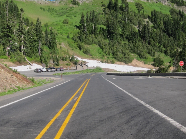
I intended to stop at Applewood Park in Naches but there was a community affair going on there and no place to park. A few years ago we stopped here and my friend John was looking wistfully at the toy horses in the children's play ground. The miniature horses were supported by a large taut coil spring. John has BMW K1300GT with ESA, BMW's fancy electronic suspension. With John looking as if he was reliving a childhood memory I could not help but quip, "No John, you can't ride the horse it doesn't have ESA."
With no stop we continue on and today instead of riding US 12 and I-84 to Ellensburg we take backroads along the Wenes Valley and the Yakima River Road. The Yakima River road runs north and south cuts across the east to west Umtanum and Manastash Ridges in a most un-canyon like manner.
In the summer you will find anglers dreaming of A River Runs Through It in competition with river rafters. Meanwhile motorcyclist must compete with a silly 45 mph speed limit along the Canyon Road. This is difficult especially since a grin means 20 mph over the speed limit along a well patrolled road. Watch out for the county sheriff on the south end.
Yakima River Road
Brian along the Yakima River Road. Notice the desert like hillsides is a stark contrast from the green forest at Chinook Pass.
Another reason riding in Washington is like Riding in the Park. A diverse Park indeed!
Yakima River Road
We arrive at the Red Horse Diner in Ellensburg.
Right out of the 1950's - Fairlaner would be in heaven.
The interior is themed as well.
This photo is in the Red Horses Diner. Excelsior V-Twins meeting in downtown Seattle at Pioneer Square in 1911 for an endurance run to Vancouver Washington AND return. Very cool. DO click the link and read the story!
We have a very nice lunch and head for or Blewett Pass our 3rd pass of the day. Here is my FJR and Brian's ST1300.
The bikes and moi at Blewett Pass. I used snowmobile up here in the 1970's with my family. We parked the camper and stayed here for 5 days or more at a time. There is a snow park turnout to the right. The snow is much dryer here than to the west as Snoqualmie Pass - an advantage when riding snowmobiles.
We decide to take the Chumstick Highway to Plain thus avoiding the crush of people in the Bavarian themed town of Leavenworth. Yeah that is right the entire dam town is decked out like a little German Village. It is a huge tourist trap; a commercialized crapper hole. The Autumn Leaf Festival occurs long before any self respecting leaf dares turn color much less falls on the fricking tree. If you want to see people in lederhosen blowning strange horns this is your place!
As it turns out the Chumstick Highway was recently chip sealed and it was a poor job too for there is a high tar content on the road surface. Scratch one nice road for a year or two.
Along the Chumstick Hwy in October 2006.
Brian and I stop take a break in Sultan. Afterwards I take the Ben Howard road which as recently chip sealed and is now packed out. They did a good job here and didn't over oil it. Nice surface. Now if somebody would just please remove the silly 20mph speed limit signs all would be good.
I return home via backroads with less than 20 miles on freeway the entire day.
The End
Last edited by a moderator:
")