Pictures of Passes

Yamaha FJR Motorcycle Forum

Help Support Yamaha FJR Motorcycle Forum:

This site may earn a commission from merchant affiliate links, including eBay, Amazon, and others.
Joined
Jun 8, 2007
Messages
4,822
Reaction score
974
Location
Shingle Springs, California
Okay.

This isn't really a ride "report", but rather just a bunch of pics from this last Saturday.

Bokerfork, RsvlFeej, and I went up into the mountains east and south of here, and this is what the day looked like.

Breakfast at Brookfields. (Gave us gas.
ohmy.gif
Especially RsvlFeej.)

IMG_3380.jpg


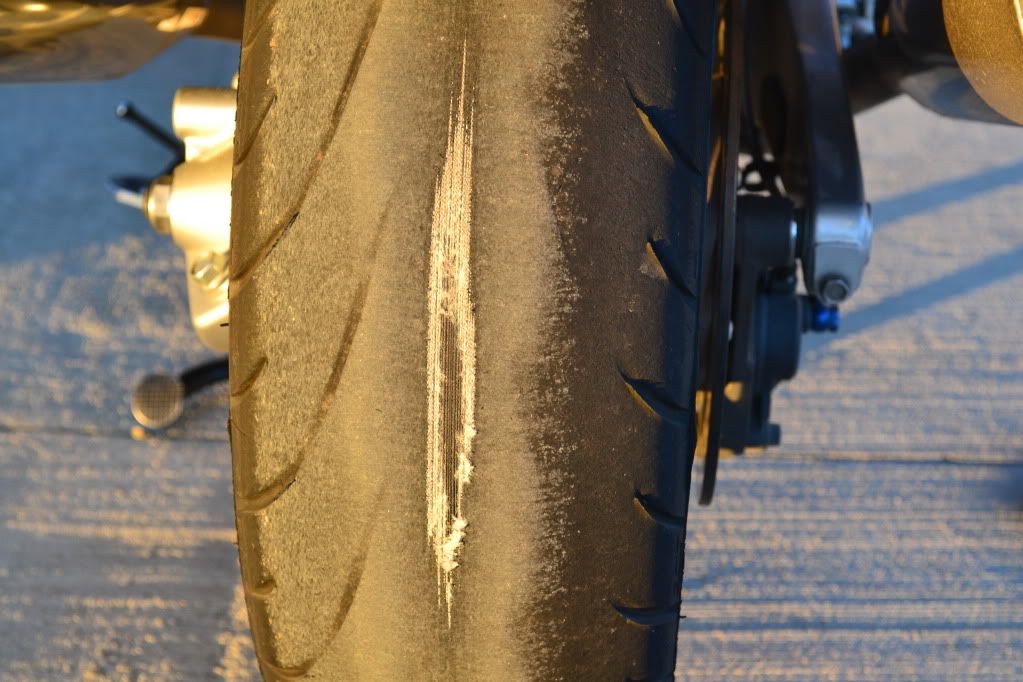
RsvlFeej had a "mishap" a while back, and he thinks it had something to do with the PR2s he'd been running.

I contend he was just going too damn fast (breaking the law) and stuff happens to criminals.

Anyhoo, now he runs nothing but friggin' Avons.

Here's his "supertire" early in the day ...

IMG_3395.jpg


A little later in the day ...

IMG_3431.jpg


And, at day's end ...

IMG_3457.jpg


What a piece of crap!!

Especially the sides.

My Michelin's never wear out on the sides!

biggrin.gif


Moving along...

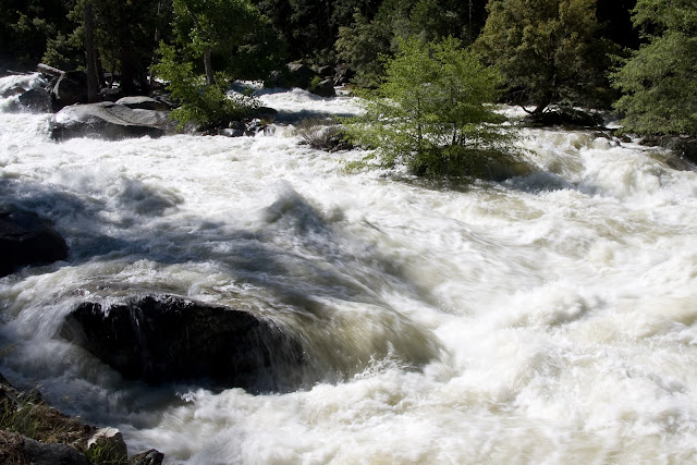
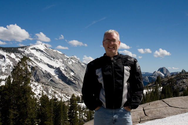
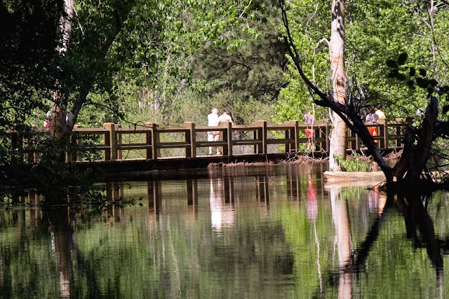
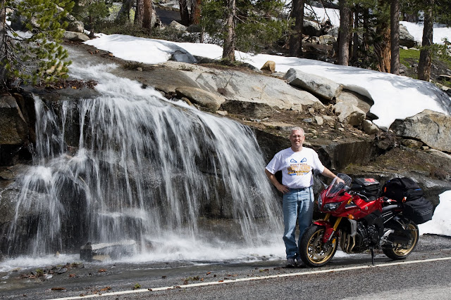
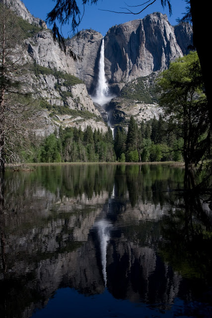
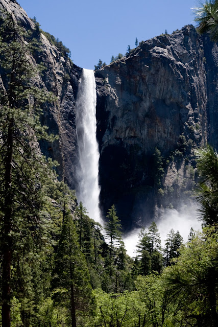
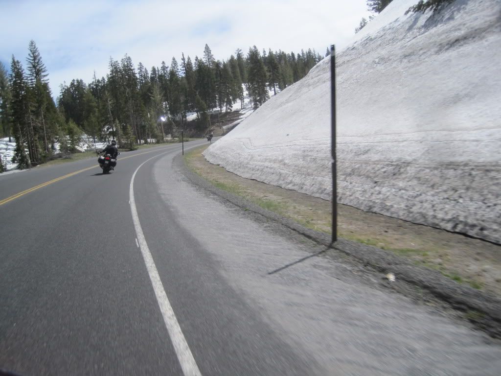
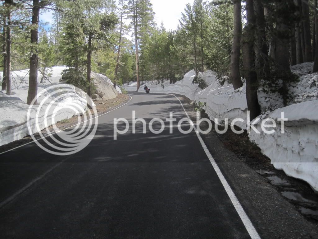
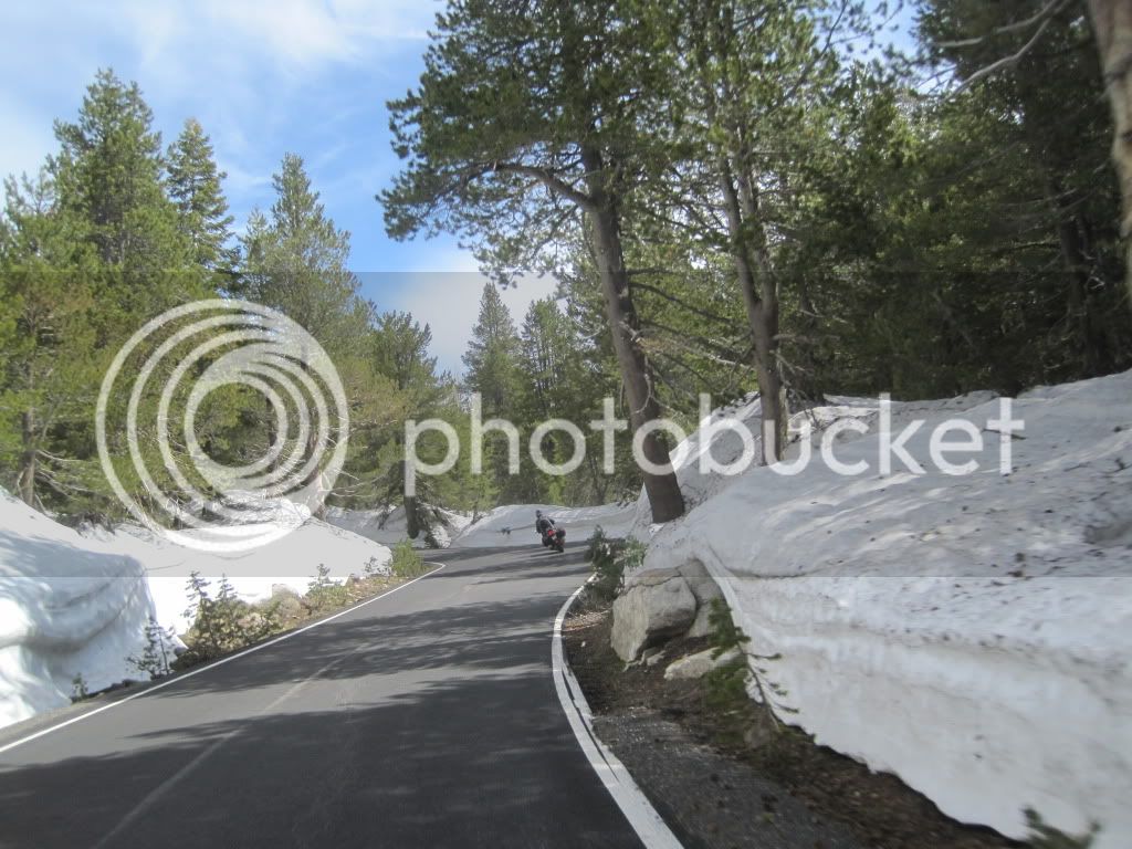
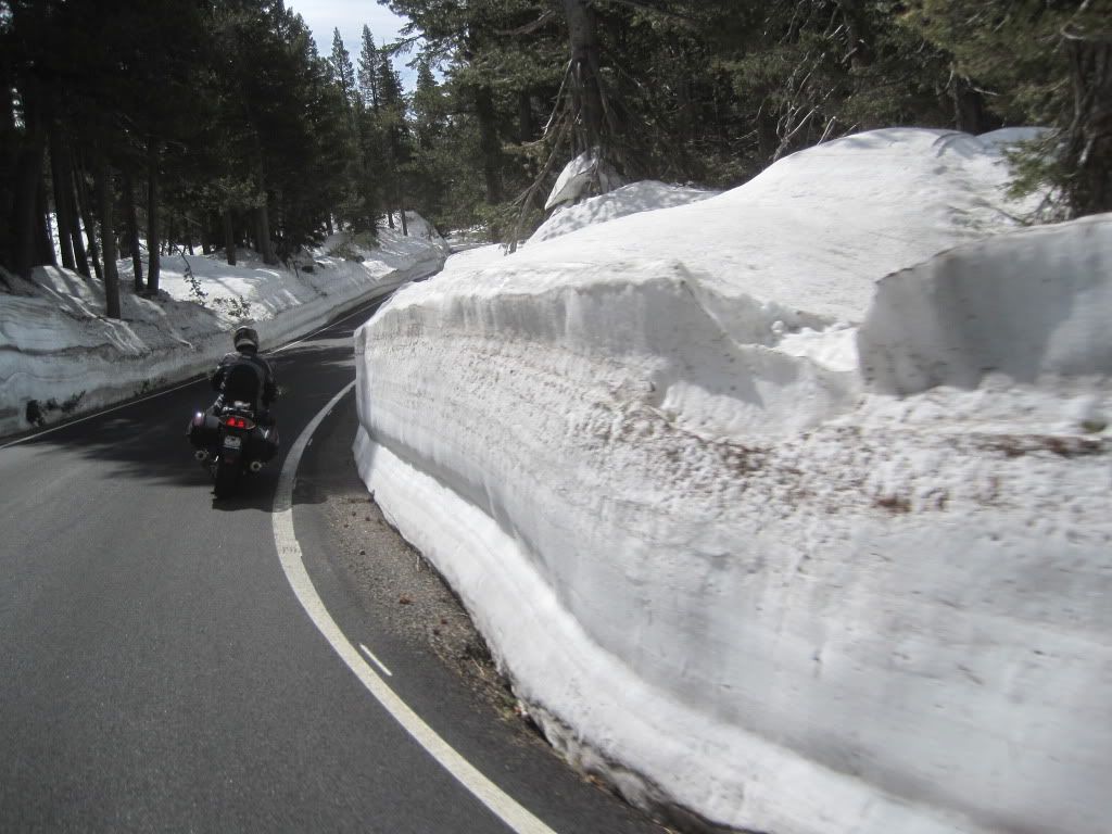
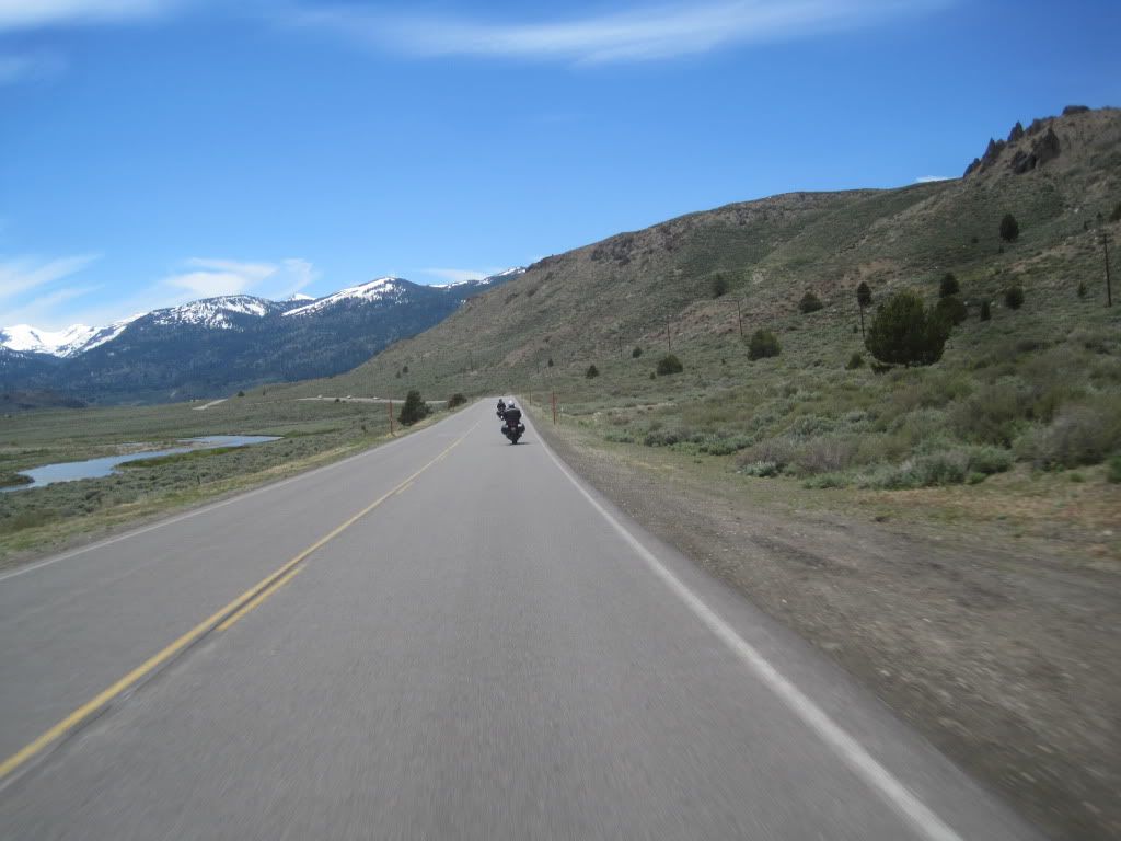
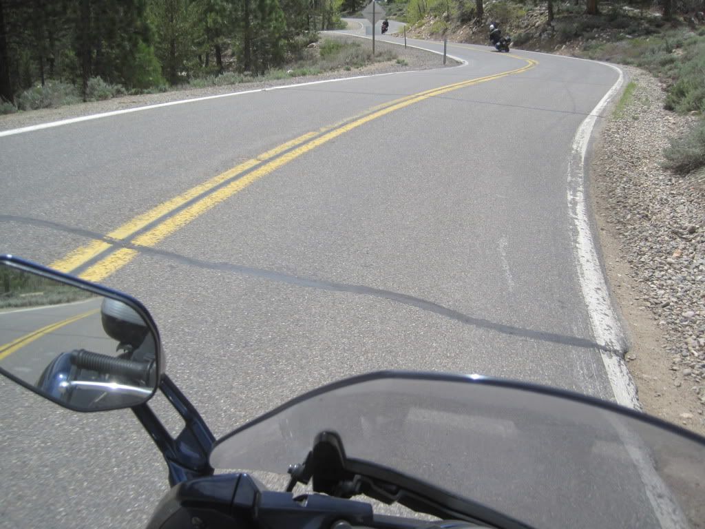
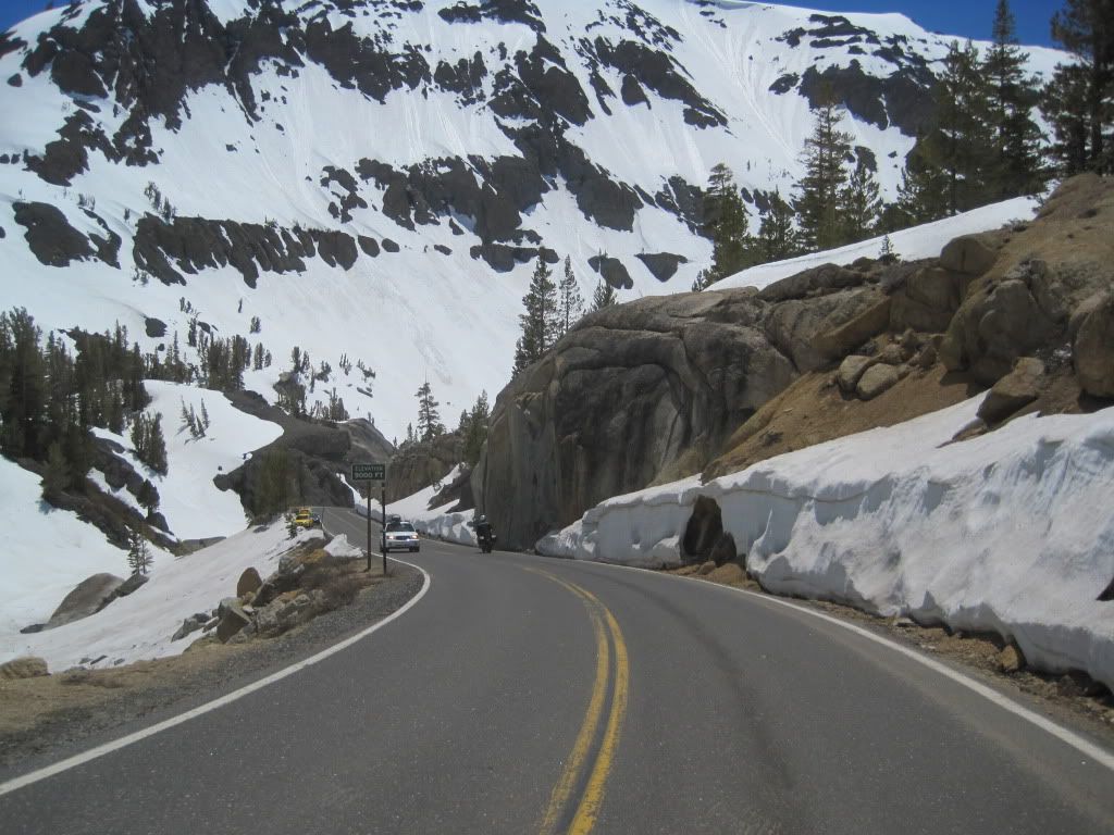
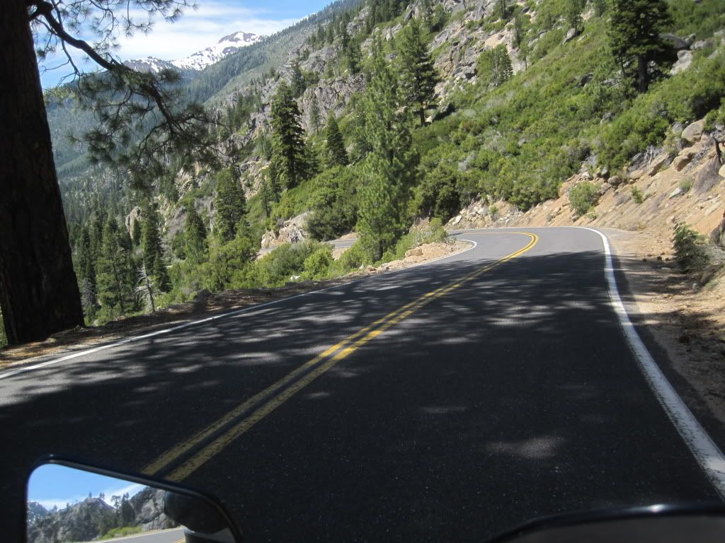
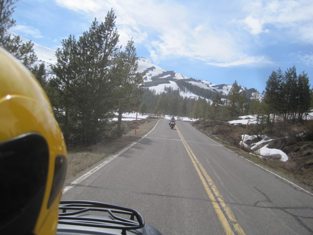
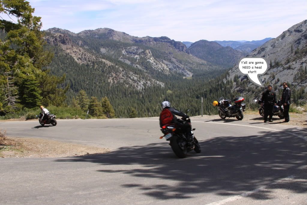
Here are about 50 photos of the same thing -

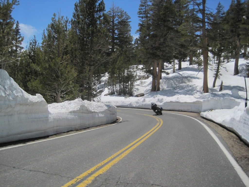
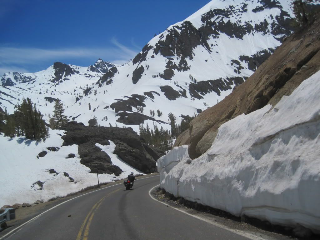
Motorcycles, roads, and mountains.

Look at each one carefully.

(Wheatie/Airboss, y'all were just a little too early. For many, riding these mountains on a motorbike is easily as thrilling as any of the coastal stuff.)

IMG_2004.jpg


IMG_2012.jpg


IMG_2018.jpg


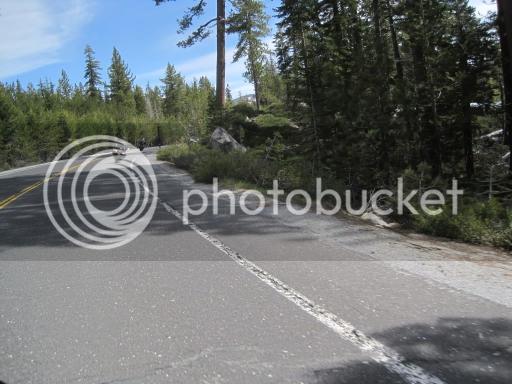
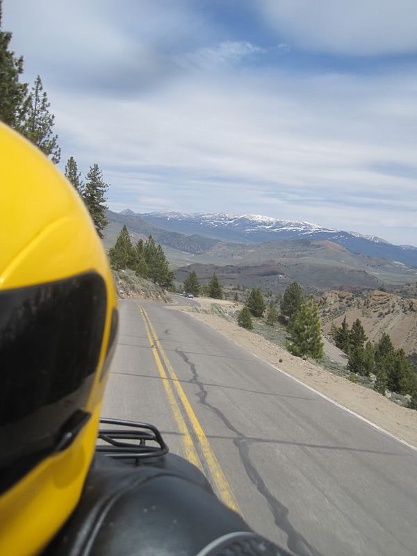
This wasn't a photo-taking ride, so as you can see, most of these had to be gotten on the fly.

IMG_2021.jpg


IMG_2029.jpg


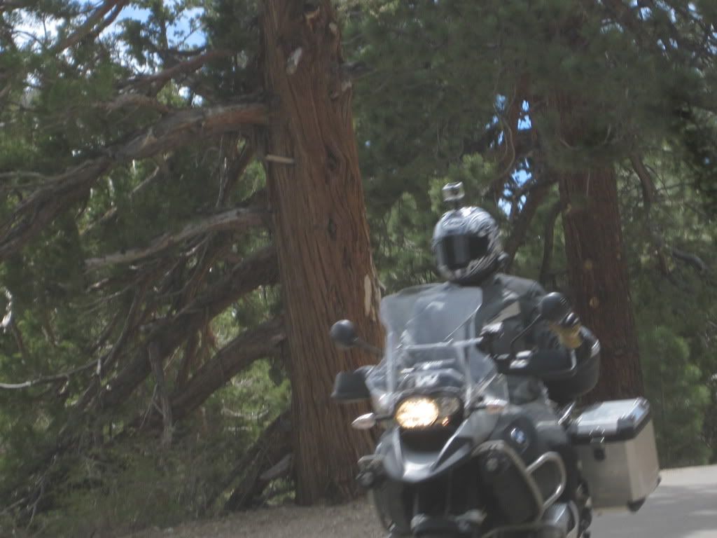
MarkyMark, ....crowding me.

IMG_2043.jpg


IMG_2030.jpg


IMG_3382.jpg


IMG_3386.jpg


IMG_2045.jpg


IMG_2050.jpg


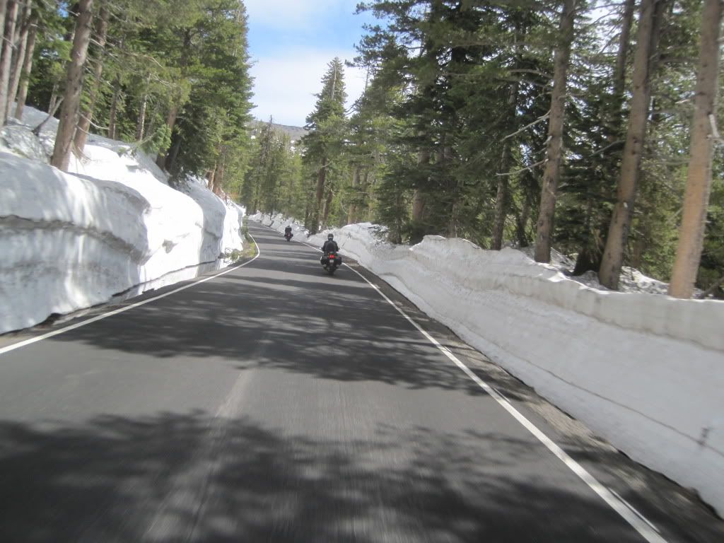
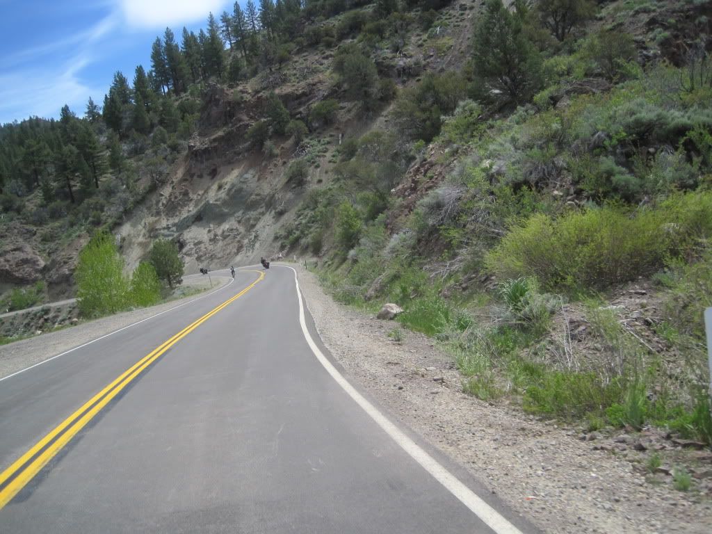
The scenery changes with the altitude elevation and the eastern and western slopes are remarkably different worlds.

IMG_2053.jpg


IMG_2056.jpg


IMG_2067.jpg


IMG_2075.jpg


IMG_2079.jpg


Ain't easy taking pictures and keeping up.

IMG_2091.jpg


IMG_2098.jpg


Some dude making lame-assed videos, probably.
laugh.gif


IMG_2100.jpg


IMG_2111.jpg


Nice country, huh?

IMG_2117.jpg


IMG_2118.jpg


IMG_2120.jpg


IMG_2124.jpg


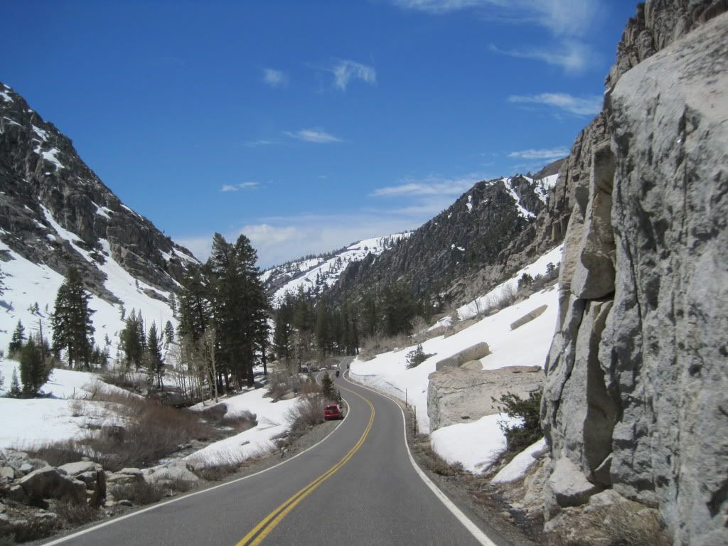
Like this one? I've got dozens more just like it ...
laugh.gif


IMG_2129.jpg


IMG_2131.jpg


IMG_2139.jpg


IMG_2143.jpg


IMG_2146.jpg


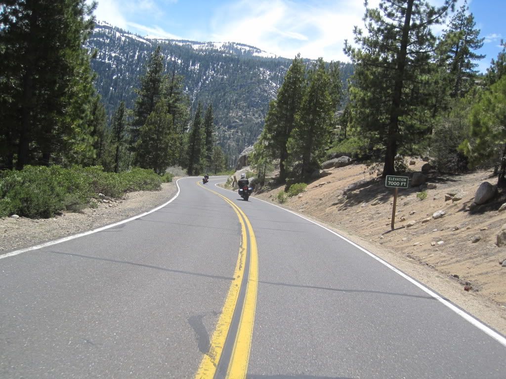
We passed EVERYBODY we encountered. My riding companions were very impatient.
biggrin.gif
It's a wonder they still have licenses.

IMG_2158.jpg


IMG_2162.jpg


IMG_3397.jpg


Did anyone else see these rainbow-colored wispy cloud things up there?

We saw 'em two or three times during the day.

Probably a name for it.

IMG_3437.jpg


IMG_3410.jpg


IMG_3403.jpg


IMG_3414.jpg


IMG_3416.jpg


IMG_3425.jpg


We saw a number of the Cal24 Rally riders doing their thing on the eastern side of Monitor Pass and near Walker.

IMG_3442.jpg


And yes, we had the pleasure of an encounter and chat with RenoJohn. Always good to see him.

IMG_3443.jpg


Last edited by a moderator:
WOW. How do you do that...take great action shots on the fly? Never mind...I can't...but your photos are great! :clapping:

Those roads look great... :(

 
Who was that Cal24 squid with no gloves, jeans and hiking shoes? Say it ain't so OM!

Always good to see that lawbreaker from Reno! Although he looks like he had a hangover from the night before..

 
Last edited by a moderator:
As always OM, nice work and sorry we missed you hoodlums. Your shots sum up our day, cept' that we followed law abiders (for the most part) and tires (PR2) seemed to be an issue near the end of my day too. The day was sent from the heavens as the temps and road conditions were borderline perfect! BTW, we saw the spectrum as well, lots of ice crystals at high altitudes to cause that not too often seen refraction. Next time I'll just copy and paste your stuff so I can get more ride time! Again, nice mobile shots!

 
Last edited by a moderator:
I don't recall that silver Feej from the Cal24.

RJ was a riot as usual. That camera of his probably has some... umm.... interesting pictures on it. I used his netbook to move the rally waypoints over to my GPS. I was afraid it might permanently corrupt my SD card. Luckily, it did not.
blink.gif


Great pics as usual OM!

 
He and Mark and Patrick are very close.
blink.gif


IMG_3444-edit.jpg


IMG_2166.jpg


IMG_2170.jpg


IMG_2172.jpg


IMG_2186.jpg


Lakes won't be clear of ice and snow for a while. (Caples)

IMG_2189.jpg


And back down into the valley.

And back to this crap.
wink.gif


IMG_2194.jpg


But, quickly around it and approaching Sacramento just before sundown.

IMG_2195.jpg


Sorry for the lack of variety in the photos. Just wanted to show some of the non-locals (like Fairlaner) what highways 4 and 108

and 88 and 89 looked like in the springtime.

We had a REALLY great day out riding, and thanks for letting me share it with y'all.

 
How do you do that...take great action shots on the fly?
It's easy, Wheatie. And doing it, I only run completely off the road every couple of years.

I reckon ya suck.

:)
laugh.gif


Who was that Cal24 squid with no gloves, jeans and hiking shoes? Say it ain't so OM!
Sam, I can't say for certain he was part of the rally. We were sitting outside the little store in Walker (with RenoJohn) and

a bunch of 'em were going by us. That was the only guy I managed to get in focus. We saw Melchild and another fellow up the road

at what John told us was probably the Paintball Gun Bonus(?).

nice job Michael, hopefully we will see you next week....

R
Can't do a weekday thing, Richard.

... Your shots sum up our day, cept' that we followed law abiders (for the most part) and tires (PR2) seemed to be an issue near the end of my day too. The day was sent from the heavens as the temps and road conditions were borderline perfect! BTW,...
John, I fully expected and was looking forward to encountering you and your "photographer" and I'm sorry we missed y'all. Yuppers, the weather could NOT have been better.

(RenoJohn ) .... I used his netbook to move the rally waypoints over to my GPS. I was afraid it might permanently corrupt my SD card.
Yeah, I think he carries corruption around in his fannypack.
biggrin.gif


Thanks, all.

 
Man, what would it be like to ride all day without any massive fault lines running through the pavement. :unknw:

Thanks for sharing OM.

 
Excellent photos! Really beautiful country you've got down that way. I'll be heading down to Lake Tahoe again sometime in the next month (this time on the FJR) and would love to go through some of those places.

As for those whispy rainbows in the clouds...I've always called them sun dogs. But appearently they are called circumhorizontal arcs. I guess it depends on their positioning in the sky, along with the angle to the ground.

 
Last edited by a moderator:
Nice stuff, OM, even if the pics were taken on the fly. That's some purty country out there.

Musta been something in the air this weekend, though. Sooze and I were on a weekend jaunt in SE Ohio and the twisties killed my rear tire, too, although not quite to that extreme.

 
Nice stuff, OM, even if the pics were taken on the fly. That's some purty country out there.

Musta been something in the air this weekend, though. Sooze and I were on a weekend jaunt in SE Ohio and the twisties killed my rear tire, too, although not quite to that extreme.
Yep musta been. I think even Skooter G would be proud of this one!
DSC_0647.jpg


Here are some shots from my trip to Yosemite NP last June 6th, the day after Tioga Road opened - hopefully the road is open by next Tuesday when me and Fairlaner hit the park.

Its hard to describe in words or pictures alone how beautiful the park was that day - clear blue skies, probably 65 degrees at 9,000' elevation, snow-capped peaks, and waterfalls where its normally just dirt and rocks. I've got many more but here are a few highlights from both Tioga Road and Yosemite Valley. As reference, the Merced River was running at over 7000 cfs that day, a very high number which is not passed in most years. Also, this is in my pre-FJR days so sorry to advertise his smaller brother.

Merced River just above the West Entrance on Highway 140

Yosemite%252520June%2525202010%252520Merced%252520River%25252004.jpg


At Olmsted Point - Cloud's Rest and Half Dome- the silver panels on my jacket are actually where the mesh is, that's how warm it was (and sorry that it was so hot that I had to get rid of the riding pants)

Yosemite%252520June%2525202010%252520Olmsted%252520Point%25252009.jpg


The Swinging Bridge - normally the river is well below the bridge, you can see here that the bridge is nearly underwater

Yosemite%252520June%2525202010%252520Swinging%252520Bridge.jpg


Somewhere on Tioga Road - some undescribed spot on the road, normally dry as a bone

Yosemite%252520June%2525202010%252520Tioga%252520Road%25252017.jpg


Yosemite Falls - picture was taken from near the Swinging Bridge - you can see the Merced River has nearly flooded the entire valley floor. For most of the summer the river is usually about 50'-75' wide at this point.

Yosemite%252520June%2525202010%252520Yosemite%252520Falls%25252013.jpg


Bridalveil Falls - flow was so high that Bridalveil Creek was nearly running up and over Southside Drive.

Yosemite%252520June%2525202010%252520Bridelveil%252520Falls%25252008.jpg


Michael,

Nice pics, as is customary.

One thing occurred to me in looking at those higher elevation shots: Around here, when the sun is out and there is still snow pack on the sides of the road, the roads are always wet with melt or covered with salt and sand crapola.

I didn't see anything less than completely confidence inspiring on those road surfaces, even with 3-4 foot snow banks.

How dey do dat out dere? :huh:

 
Top