Ride up Superior and points beyond

Yamaha FJR Motorcycle Forum

Help Support Yamaha FJR Motorcycle Forum:

This site may earn a commission from merchant affiliate links, including eBay, Amazon, and others.

Bungie

FrostBack #2 - IBA # 44620
Joined
Nov 9, 2007
Messages
4,384
Reaction score
536
Location
Sudbury, ON
As most major events start innocently enough, so do some that start not so innocently. This story falls in the former. My girlfriend, Betty, and I, were sitting around one night talking about places we’ve been, and, where we’d like to go. I mentioned a really nice overnight trip would be to ride up to Lake Superior Provincial Park. “Ooo! I’d like to see that myself, I’ve never been passed Batchawana Bay!” she said.

So it began - a little germ of a snippet, in a much larger discussion.

Months passed over the winter, we talked occasionally over that time about the ride, and even went so far as to surf the net for interesting stops along the way. The Agawa Indian Picto-graphs, Old Woman Bay, and so many waterfalls to numerous to mention. There are no shortage of stops to make and sights to see.

The ride was to end in Wawa, at the very end of the Park, but every time I looked at a map, I kept eyeballing Hwy 129 from Chapleau to Thessalon. I’ve read a number of comments in passing that it’s a very twisty ride with great scenery. Well, theirs Hwy 101 that runs from Wawa to Chapleau. We could take an extra day, and do the ‘big loop’.

A month or so passed and spring had sprung and it came time to book vacation time. Betty’s schedule is difficult to plan for owing to family obligations, but we decided we’d do the ride from July 31 to Aug 2. Arriving at home at the start of the August long weekend.

Over the winter I’d picked up some gear for Betty to make sure she was happy, comfortable and safe. A new helmet, a rain suit etc. Along the way, I picked up some 2nd generation Bluetooth headsets from Collet Communications. I have obligations at home that require me to be available a phone call away. The MicroFone 2’s fill that need. They also provide wireless intercom service with a passenger or, line of sight with another bike.

Betty had some pressing personal things to take care of and I hadn’t even spoken to her for a few days when she asked if we were ‘still on for the trip?’ Last Wed the 30th. I had COMPLETELY forgot about it! We were to leave the next morning. Needless to say, I spent the evening getting packed and prepping the bike.

Day 1, Thursday July 31

I was absolutely floored how lightly she packed. The stereotype for women is the everything including the kitchen sink. One saddlebag contained bike essentials and my rain gear, the other, her rain gear and odds and ends. We designated the right bag as hers. The top box swallowed up (just) a duffle bag containing our clothes and toiletries. The tank bag held the stuff we’d need handy along the way. Hats, shades, ear plugs, water, camera etc.

Pict0727.jpg


We pulled out at approx 11am on Thurs morning. Batteries charged on the headsets and 3 days to take it all in. Our first major stop was for lunch in Elliot Lake. One of my all time favourite rides is The Deer Trail up over top of Elliot Lake. It seems I can’t just drive by and not do the 120 km tour of Hwy’s 108, 639 and 546. I hadn’t ridden it in over 3 years as we kept hearing reports that it was mostly all gravel owing to road repairs. Well earlier this year, 2 friends rode it and said it was fine shape!

Pict0728.jpg


After lunch, we headed North on Hwy 639. Huge vista’s and a road in very good condition made for an enjoyable ride.

Pict0729.jpg


At the tip of Hwy 639, you hang a left and come back south on Hwy 546.
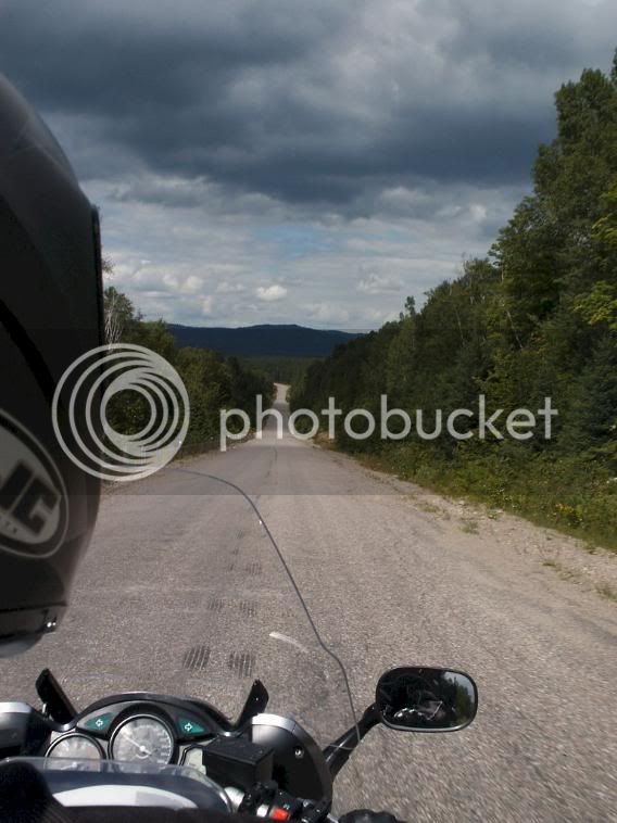
Pict0730.jpg


Immediately, the road degraded somewhat. But still, probably better than 80% of the roads in the City of Sudbury. The road gets more and more scenic and much twistier the at this point. You must remember this is the DEER TRAIL. The urge to honk on it and pretend your Rossi and start punching the bars left and right must be stifled. You just never know when a forest rat may jump out at you, that, and I’m responsible for my passengers safety meant we could only just a have spirited ride.

Pict0733.jpg


Eventually, we came upon the Little White River which the road parallels for about 30 km or so.

Pict0737.jpg


The intercom worked great and I knew Betty was really enjoying the ride judging the interjections in my ear. Very beautiful. I think we only saw 3 or 4 cars the entire trip over the Trail, and two bikes. Remember, this is a Thursday. After stopping a few times for pictures off the one lane bridge that crosses the river, we were on are way to Iron Bridge on Hwy 17.

Pict0739.jpg


Pict0741.jpg


Pict0742.jpg


Along the way, we passed signs for Hwy 129 which has a shortcut to get to it. “I’ll be seeing YOU in a 2 days!”.

The Deer Trail opens up into a farming area for a few kilometers before it meets the highway. It really is amazing how you can go for Cambrian era rock to flat farmland so quickly. We rolled into Iron Bridge, topped up the tank with 12L of regular, stretched out legs and headed out for Sault Ste. Marie. The bike got amazing mileage considering it was two up and all our gear.

The ride to the Sault was pretty much uneventful and frankly, rather mundane. Hwy 17 opens up into a 4 lane about 40 or 50 km before the Sault and their just isn’t much to look at along this stretch. I remember passing the signs for St. Josephs Island which I’m told is really beautiful. Maybe some other time. I wanted to get into all our destinations before dusk to avoid the animals (both forest and human) on the road. We rolled into the Water Tower Inn right around 5:30pm after getting detoured and turned around coming into town. After checking into our Suite (only requirement for this stop was that it had to have a whirlpool ) we headed down to the Casey’s for dinner.

Now normally, I lose my apetite when I travel, but I also know I need to keep my energy levels up so I force myself to eat. We walked downstairs to the attached Casey’s to unwind and eat. The food their was fantastic! I had this baked chicken breast with this Pesto sauce and I damn near inhaled it it was so good. Betty got adventurous and had a Ceaser with dinner. Not your typical Tomato/Vodka Ceaser though, this had Steak Sauce and ground chili peppers in it. Oh, and no Vodka - It was supercharged with some Jack Daniels. I’ll let her comment sum it up “Whoo.. that’s a nose clearer!” Oh yes, the Ceaser didn’t have Celery in it, not even a Pickle. It had a long green bean that had apparently been soaking in the bottom of a barrel of Jack Daniels for some 40 years.

She had two of them along with Shrimp Primavera.

After dinner, we made use of the facilities in the hotel room and turned in for the night after checking out the forecast for the following day. They day dawned foggy but carried the promise of sunny and 23C (about 76F) which is to say, perfect riding weather. We woke up rested after sleeping comfortably. If your stopping in the Sault and need great accomodations, I’d recommend the Water Tower Inn without hesitation.

 
Day 2, August 1

With the bike repacked we rode across the road to a Tim Hortons for breakfast and then topped the bike up with 6L of Shell’s finest blend and pointed the bike North on Hwy 17. I had debated whether to put in my liner in my jacket as the sun was out and it had the feeling of warming quickly. A few minutes North of Sault Ste. Marie, it became apparent that we were going to be riding through some ‘lake affect’ fog for a while. The temperature was still in the mid morning teens (around 65F), combined with the fog, it was chilly! So we pulled over about 20 minutes into the ride so I could zip my liner in. I was still wearing my mesh gloves so my hands were cool, but nothing intolerable.

Pict0747.jpg


Back on the bike and the fog was getting significantly denser. I started to worry that it wouldn’t burn off quick enough and that the scenery that we’d traveled to see would be obscured.

Pict0751.jpg


Pict0757.jpg


Pict0758.jpg


After riding a short while we rounded a corner and arrived at our first stop, Batchawana Bay. The fog was so thick, their was nothing to see but a little shoreline. Disappointing to say the least. We rolled through the scenic lookout and kept going. We kept passing signs for Agawa Indian Crafts a few miles ahead so I decided we’d stop their for a little stretch and give the fog more time to burn off.

Typical roadside tourist trap. We wandered around looking for a gift for my mom, whose a real Indian art junky. While I looked around for something small enough to fit on the bike that she would like, Betty busied herself trying on every piece of jewelry in the store. Finally we decided on this 5” tall Inukshuk. With it safely stowed away in the top box (which was now spring loaded owing to the gear inside) we hopped back on the bike and continued our travel North up Hwy 17.

I guess because it was a Friday morning, their wasn’t much traffic at all, mostly trucks on their never ending journeys. A few miles north of Batchawana Bay, the terrain changed quickly as we entered Agawa country. It was there I noticed that anytime you see a sign that says “Watch for Fallen Rock’ or ‘Steep Grade, trucks use low gear’, your about to have a real treat from the scenery! The road winds and falls, twists and turns through huge rock cuts and over top of ‘mountains’ revealing why they call this part of Canada God’s Country. Truly stellar scenery. Just when you think it can’t get any better, it does. Breathtaking.

Pict0762.jpg


Did I mention that Superior is a huge body of water? Well, I think I just did. Think about it, we drove non-stop for 3 hours right beside it and only saw perhaps a 500th of its shoreline.

Pict0765.jpg


We continued north, marveling at the scenery with every turn in the road. The fog had started to lift, shrouding the tops of the mountains and forest in a heavy mist, leaving it to your imagination to lay beyond and hidden, while still providing enough of a view to be in awe.

We finally passed a sign that said we were entering Superior Provincial Park. Theirs no gas or facilities here for the next 100 or so kilometers. Depending on the mileage your bike gets, make sure you fill up whenever you see a gas station on this route. Good sound advice, and something I needed to remember later in the trip.

Pict0771.jpg


For many kilometers our heads were swiveling left and right non-stop, Betty on the back, snapping pictures and hitting the video record button, the whole while I was talking to her on the Intercom telling her to look behind us, or over there. Stunning.

Pict0798.jpg


Pict0786.jpg


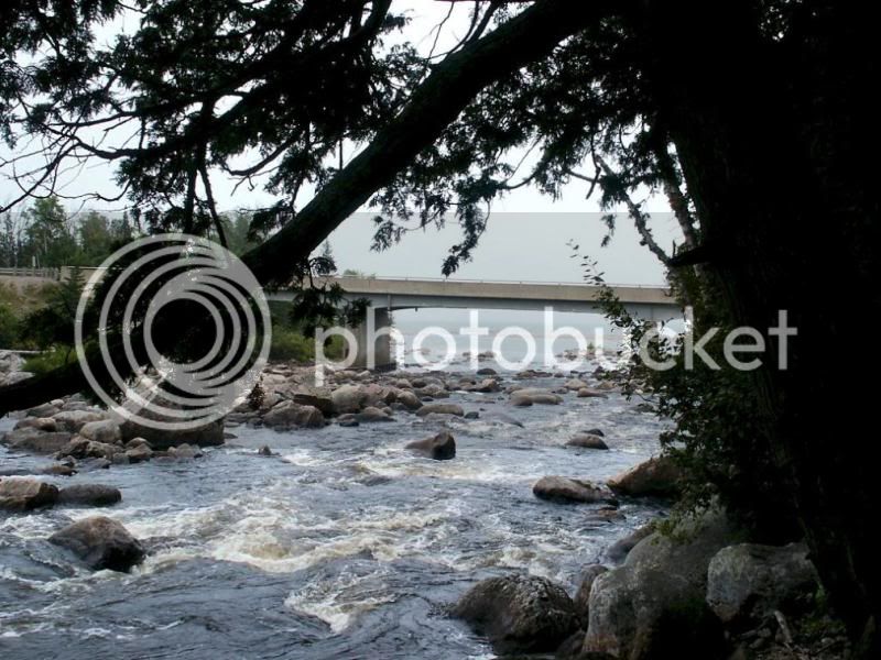
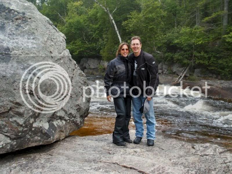
We crossed the bridge at Sand River Falls and I just had to lay on the brakes to pull off the road. Off the bike and a short walk down a trail to the falls to take pictures. Its there we met a couple of Fort Worth Texas. “Ya’ll have some truly amazing country here!”, ya think!

Pict0787.jpg


We spoke for a bit, and swapped cameras to get some couples pictures while standing out on the rocks. We grabbed some munchies (the tank bag was filled with nuts, cookies and licorice from Betty’s stop at the Bulk Barn).

Pict0789.jpg


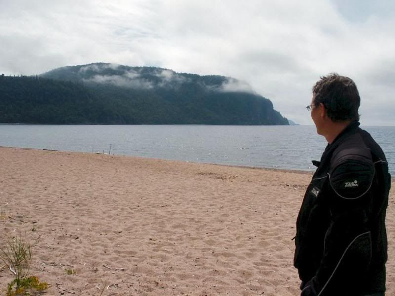
Back on the bike, we headed North again. We rounded a corner and both of us said, in unison “wholly ****!”. Their before us was Old Woman Bay.

Pict0807.jpg


The place in any direction is postcard. We hit the brakes and hopped off the bike. We walked across the 75 feet of natural sand beach down the Lake and stood and marveled at the view. To the left are immense cliffs with the very tops shrouded in fog, to the right, the hwy snaking between the mountain rock cuts. To the front, as far as you can see, Lake Superior.

Pict0811.jpg


We lingered here for about an hour, walking on the beach, taking pictures, and too take a eroded pebble as a keep sake of this magical place.

Shortly thereafter we pulled off onto Hwy 101 toward Wawa. We needed to eat and get gas before the next leg of our journey to west to Chapleau. It started to rain lightly and all the cars heading south were showing signs of driving the in the rain for a while. While looking for a Subway for lunch just off the Hwy, Betty yelled ‘GOOSE!’

Pict0825.jpg


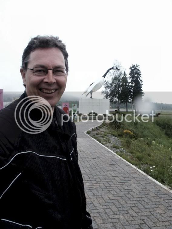
I had driven right by it, the infamous Wawa Goose. So I had turn around pull into the visitors center were it lives overlooking Hwy 17 and Lake Superior for the obligatory Goose pics. Ya, it’s a big assed goose that when in Wawa, you have to take a picture of yourself with it. But after you do that, look the way the goose is facing. Another fantastic view!

We stopped in Wawa for lunch, and to debate about putting on our rain gear. It had stopped raining by the time we finished lunch and sun was breaking through. It was then a nice guy from Kenora asked where we were headed and mentioned that its been raining pretty much constantly since he left this morning. That clinched it, on with the rain gear.

I still wanted to get some gas when our turn off for Hwy 101 came up. I could see a gas station another 500 feet up the road. Betty says “their’ll be a gas station around the corner”.

Well, their wasn’t. Their were however 3 cruisers with the cherry’s going doing a mid day spot check for drinking drivers. I guess things get slow mid day in Wawa. So we kept going thinking a gas station will pop up around the next bend.

Well, 20km down the road, we had exactly NO cars pass by us, no driveways, no lodges no nothing but pine trees in every direction. I don’t recall how far the sign said it was to Chapleau, but I know I did some quick math and figured we’d get to Chapleau with about 375km since the last fill up. Now, I’ve done 400+ on a tank a few times without hitting reserve. But, we were two up, and loaded. Gas mileage would surely be something less.

Onward we went, it got cloudy, and we got spit on. Then the clouds dropped and got very dark. It started to teem rain. The whole while, we had perhaps seen 3 cars pass by us in the last 50 or 60 km. This is a deserted northern road. Now it was raining heavily and Betty was quite quiet behind me. I could see lightening flashing behind us in the rear view mirrors. It came down in buckets, I slowed way down and perhaps tooled along in 5th gear at about 60 to 70 km/h. First, because their was lots of standing water on the road, and to conserve gas.

We passed the sign that indicated from this point North, all waters flow north to the Arctic ocean.

The anxiety level was pretty high for a while when their was a huge crack of thunder that actually made our Intercoms’ sqwuak at us. ”Holy ****” Betty exclaimed. Ya, holy **** is right. It was then I thought that were like a rolling lightening rod with the Intercoms supplying a path directly to our heads. I was tempted to tell Betty to unplug, but, well, I didn’t want her anxiety level any higher than mine was.

A few weeks earlier, I had purchased some Teknic Violator Waterproof boots from NewEnough.com. Believe me when I tell you they got torture tested on this part of the ride. My feet were dry as a bone, in fact, I was dry all over. It was just miserable conditions though.

Onward we rolled. Finally, we got to Hwy 129 and made a left turn toward Chapleau. I had been on my last ‘bar’ on the fuel guage for a while now. I had made reservations that morning in Sault Ste. Marie for the Riverside Inn on Cherry Street. Chapleau is a really odd town. Basically, a forestry/rail town on the banks of a river. I didn’t notice what the population was, but if I was to hazard a guess, I’d say about 1000 or so. The odd thing is, there are like highway overpasses in the center of town to get over the river and the rail lines. It was just odd, especially after traveling through 140km of absolutely nothing. We eventually found the inn and got ourselves checked in.

Nice little place given that there isn’t a whole lot of choices, in fact, kind of quaint. We got a room on the 2nd floor overlooking the river, with the bike parked directly under our door. After unpacking, and our late lunch in Wawa, neither of us were hungry, so we just got ourselves settled and relaxed for a bit. Knowing about small Northern towns and that I’d get my apetite back sometime around 10, we called the Pizza Hut/KFC express and found the express meant you came and picked it up. So after the rain stopped we walked about kilometer to the convenience store to see what we could scavenge for food.

It was then I noticed, their wasn’t a person to be seen. Here it was, 8:30 on a Friday night before a long weekend and the place seemed deserted. We got to the convenience store and ended up getting a couple microwave dinners and some munchies. Betty asked the clerk if their was anybody that delivered food in town. The look on the clerks face was priceless. I just know it was all she could do to not blurt out “your not from around here are you!”

Instead, she just smiled politely and said “not in this town“. So on the way back to the hotel, I noticed some drapes move in a house, then the same thing in another house. I could just imagine the town folk calling each other, “Mable! Theirs strangers walking the streets!” At the time, it was hilarious. So Betty and I put on a show, walking hand in hand and being all affectionate.

Seriously though, it was like a scene out of some kind of Steven King story. You know, where the beast roams the streets at night devouring the unwary.

Pict0830.jpg


We settled in for the night and watched the sunset over the river with the wind turbine spinning lazily in the distance. Around 10 I popped my ‘over a pound!‘ Beer Breaded Chicken and Cheese Fries from Swanson in the microwave. You know, the chicken wasn’t bad! The fries with cheese (up here, those are called poutine) I wouldn’t feed to rabid seagull. Mostly because it would attack me for try to feed him crap.

The problem remained what to have for breakfast in the morning. Given that my frozen dinner was “Over a pound of food!”, I figured I’d save some of it for morning. Oh ya, it was listed as being 455 grams, that’s exactly 1 gram over a pound. Tsk tsk.. I hate marketing guys.

We turned in for the night after watching a bit of Leno and promptly zonked out in a big way.

 
Day 3 - Friday, August 2nd.

After waking up and getting the bike packed up we set off in search of sustenance. We left our unopened munchies as a gift for the ‘Continental Breakfast Table’ patrons - Simply because we didn’t have any spare room to pack them on the bike. Oh, their idea of a Continental Breakfast was a loaf of bread and a toaster. No jam. Still, the accomodations were comfortable given the location.

Pict0846.jpg


It was then I notice the bike was on reserve. We had ‘just’ made it into Chapleau. That was calling it close for sure. We stopped for gas at Syds Esso and pumped in 19L. Some 375km from the last fill up in the Sault. The gas jockey there recommended the Blue Heron for breakfast. He even called them for us. No answer though. So instead of risking a no breakfast start, we grabbed some water and Honey Buns and ate at the gas station. Before we left Chapleau, I had to stop and take some pics of the old rail engine. Kind of juxtapose the old and the new with the bike.

Pict0849.jpg


After a few miles we were southbound on Hwy 129. As I mentioned, I’ve always been curious about his hwy well I was finally get to try it first hand. The first 100 km or so is just the same as Hwy 101 coming into Chapleau from the West, pine trees in every direction flat and straight. Their was one stretch that had to be 5km long that didn’t have a curve in it, just arrow straight with not even an elevation change in it.

I usually make a point of stopping ever hour or so just to stretch your legs and keep the blood flowing to your butt. I didn’t really need to stop as the Genuine Alaskan Sheepskin Butt Pads ™ were doing their job on the trip famously. So we had a passed a nice looking lake and thought this is as good as place as any. Pulled off to the side of the road and bike promptly sank into the soft shoulder about 2”. Stupid mistake, I didn’t drop the bike, but I easily could have.

Pict0852.jpg


Their was significantly more traffic on this stretch of road, mostly people heading north towing boats or in motor homes. Not what you’d call busy mind you, but after the Hwy 101 stretch, it was like rush hour. After a 15 minute break we were back on the road.

Pict0855.jpg


One of the stops we wanted to make was at Aubrey Falls. A sign on the Hwy just before we stopped said it was 10 miles away. It gives you an idea on how slowly things change in the bush as the signs were mostly all still in miles. Canada went metric years and years ago. Well, we maybe went 2 km and their it was. Down a narrow winding gravel ‘road’ to a parking area. Got the puck out and put it under the kickstand this time though. Then we were besieged by black flies. Up your nose, in your ears and stuck in your hair.. No big deal, were from Nothern Ontario, but I sure wasn’t going to take off my jacket!

We walked about a kilometer down a hiking trail, that was oddly enough uphill both ways. The black flies disappeared, but were replaced by 3x as many mosquitoes. Breaking down on the road up here wouldn’t be a test of a survival, it would be slow exsanguination. No matter, we got to the falls and they were stunning. The trail led across a bridge over the gorge. I’m afraid of heights, and frankly, I wasn’t up for the challenge of this one. So thank Betty for being fearless and taking a bunch of pics.

Pict0857.jpg


The terrain had gone from flat to something similar to what we saw on Superior. Back on the bike after making use of the facilities (and the only spot that provided refuge from the hordes of black flies and mosquitoes).

Pict0860.jpg


A short distance further we crossed the Mississagi River Bridge to a spectacular view of the river. For the bottom part of this road, the hwy parallels the river closely. I would personally like to thank the engineer who designed this road for doing that. We then passed a sign that said winding road for the next 40 km.

Pict0866.jpg


And it was good.

Pict0867.jpg


Sheer rock walls on one side, the river on the other and the whole way the road twisting and turning, diving and rising, often in ridiculous combinations. FANTASTIC. The road surface itself deteriorated badly during this stretch. Its still ridable, but after the pristine smoothness of the previous 100 km, this stretch would keep you on your toes. Betty was loving the road as well, I think she took a 100 pictures with the bike cranked over mid corner. At one point I caught a glimpse of her in the rear view mirror, arms splayed out, legs in wind, head back. She later told me her eyes were shut and she swore she was flying.

Pict0893.jpg


Ontario 129 has a lot in common with US 129 (the dragon) Not anywhere as tight or as technical, but hellaciously fun! I’m coming back here for our fall colour ride. The Deer Trail, hang a right and up 129, stop for lunch beside the river at a small campground, then back home will be a fantastic beautiful fun ride.

All good things must come to end though and the terrain changed to flatter farm land toward the end and close to Hwy 17. We were both getting hungry by this point so we stopped in Iron Bridge for some food. We ended up going to a grocery store and buying a bunch of fruit; peaches, pears, banana’s, watermelon and some chips instead of going to the road food route. We walked around the corner and had ourselves a little roadside picnic in the grass in the front yard of the school. Hilarious, because everybody who drove by did a double take at us.

It was good though, bright warm sun, a great ride then real food.

Pict0914.jpg


Fired up the bike and we headed east through Blind River. It was then I realized we’ve seen two Great Lakes, Superior and now Huron, in less than 24 hours. We continued on and stopped for a break at the visitors center for the Deer Trail that I had blown passed on two days earlier. By this time Betty was squirming a bit back there so we took an extra few minutes.

Within 30 minutes or so we were coming passed the turn off for Espanola (another fantastic ride on the way to Manitoulin Island) and my butt had some burn setting in. So we once again stopped for a few minutes.

I could ‘smell the barn’ now as were about 45 minutes from home and familiar highways I ride nearly every week. Hwy 17 splits into 4 lanes for the last 30 kilometers or so an the speed limits bump up to a 100km/h. I adjusted the throttle to about 120km (pushing it on this stretch of road) and just let the bike roll the last miles home.

Epilogue

After traveling some 1300km in the last 3 days, the bike performed flawlessly. I actually felt sorry for it after getting us into Chapleau, it had ‘sand dunes’ from the road grit kicked up by the rain all over the back. We maintained an easy pace, stopping when we had to and more importantly, when we wanted to. It was only the last day we pushed it into a more long distance ride, but even so, we stopped often and enjoyed the ride. Betty whose longest ride previous to this was about 6 hours, proved what I always knew, she’s a real trooper and adventurous soul. Not once did she complain when the butt burn set in on the last day, or riding through a torrential storm in one of the most uninhabited portions of Ontario. Every morning she was raring to get going again. She’s taking the bike course at the local college in a few weeks to get her license. I’m not sure I like the idea of her riding around town - she has 2 kids under 11, but after seeing how she’s taken to motorcycling, I can’t see her not doing it either. I’m going to have to ask her if she still wants to ride her own bike with me to Alaska after this trip.

We gave the gift Inukshuk to my mother who went to great lengths to explain to us that the rocks look like they came from the Superior area and it was probably made by native craftsman. Then she found the sticker on the bottom that says ‘Made in China’. Oh well, she appreciated the gift nonetheless.

The Deer Trail, Superior Provincial Park, hwy 129 all within a short days ride from home makes me wonder why people who’ve never seen anywhere near all of Ontario are so willing to head south so quickly.

 
Too much rain... but the total ride and the company ya kept looked great.. B)

looks like you had a great trip and you got to see some awesome scenery :D :D

 
I'll give the weather a 5 .... but the ride report a 10 !! :D
Except for the drowning in no mans land, the weather has been typical for this summer in Ontario. Which is to say, fine with afternoon showers. Glad you liked the report.

 
Hey Bungie my daughter and I were on the same hwy's as you but we were coming the other way. I did see a couple of FJRs maybe one was you. It is a great ride. Our province is so huge. You could spend 2 weeks wandering around and still not see it all. Great report and pics.

Rob

 
Hey Bungie my daughter and I were on the same hwy's as you but we were coming the other way. I did see a couple of FJRs maybe one was you. It is a great ride. Our province is so huge. You could spend 2 weeks wandering around and still not see it all. Great report and pics.
Isn't it a great ride though! I'm toying with heading to Maurice National Parc in Quebec sometime this Aug. (about 100 miles east of Mont Tremblant and about the same North of Shawinigan). Do yourself a favour and call it up on Google Maps. Zoom it in until you see the one road running through the park. Notice something about that road? :D

Apparently, its in great shape as the park is closed in the winter.

Glad you enjoyed the report

 
Fantastic report!! :yahoo:

Looks like you got a keeper for a travelling partner as well! :clapping:

Glad I'm not the only one in this world affected by heights...nice of your lady friend to take that and the other piccies for you. Awesome! :clapping:

 
Looks like you got a keeper for a travelling partner as well! :clapping: Glad I'm not the only one in this world affected by heights...nice of your lady friend to take that and the other piccies for you. Awesome! :clapping:
Ya, she's a keeper for sure. She's also does video production for a living and a big time camera junkie. It was a real chore to pick out 15 or 20 pics of the 350 she took (no joke!), not to mention the nearly 3 hours of video recorded off the nose cam of the FJR.

As for the heights, well, I challenge myself with them when I can.. cognative therapy don'tcha know.. But this day, it wasn't going to happen. If we ever meet, ask me about the bridge between Cornwall and NY :dribble:

 
Excellent Mr. Bungie!

I love to read and see of areas I've not yet been to.

Your post took me there... :clapping:

 
I finally found time to get some video put together from this trip.

Note: I've hardly touched the video at all to give you a real feeling of what the road/scenery is like. Basically, just strung together some clips and tossed some music on top.

Deer Trail and Lake Superior

Still working on the Hwy 129 vid. Probably be finished with that some time this weekend.

 
Great Pictures and Ride Report. Video kept me smiling for a good 15 minutes at work :clapping:

I have done allot of traveling south around Duluth but I will have to take a run up North now.

 
Still working on the Hwy 129 vid. Probably be finished with that some time this weekend.
Its been raining steady all day here with temps around 12C (58F ish) so I had time today to finish up the vids.

Just updated the video's to include Hwy 129 - Twisties! Scenery! Cops! and some crappy pavement!

Hwy 129

 
Most excellent video Now you see why she is in that business

Beautiful country you have there.

What is that brown color in the water where it looks like some small waves?

 
Top