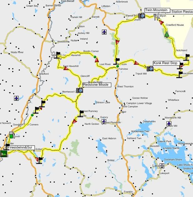
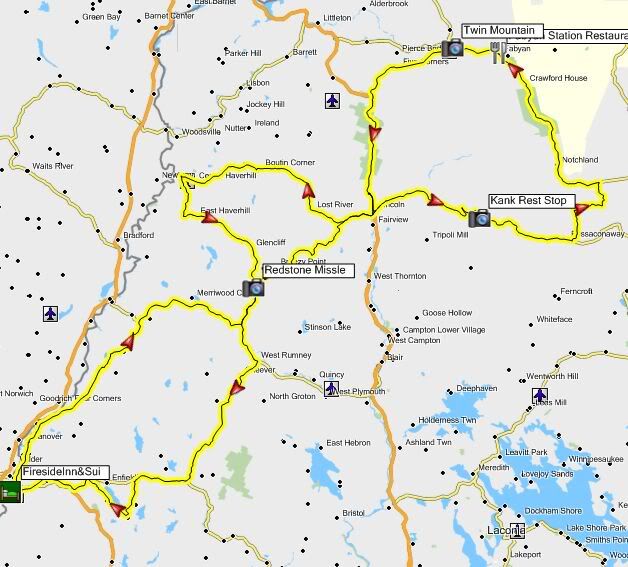
Comparison of mapping programs

Yamaha FJR Motorcycle Forum

Help Support Yamaha FJR Motorcycle Forum:

This site may earn a commission from merchant affiliate links, including eBay, Amazon, and others.
The recalculate in MSST causes the screen to change and forces you to re-zoom into the area you were making changes to. Mapsource just keeps your current view and shows you the new route. I do have a problem selecting waypoints on my route in mapsource to delete though. You need to be in selection tool mode and when you try to select the waypoint it will sometimes jump into a mode that connects the point before and the point after together. you then have to right mouse click and hit cancel, the retry. I've never really figured out what its trying to do, but i'm able to eventually work around it. If anyone has any suggestions about that one, let me know.
You've hit on the single biggest peeve I have with S&T. I HATE the screen changing to put the Directions window up. I don't want to see the Directions windows every time I calculate. As a matter of fact, I never want to see the Directions list! It's not just the zoom change I have to fix now to get where I was, I have to keep closing unwanted windows. Give me something when I ask for it, not when you think I should have it. (Then again, it is from Microsoft, and they know best, right?)

The other thing, in Mapsource when it connects to the previous and succeeding waypoint, is the ability to move the route. If you were to drop that vertex, your waypoint move and the route moves with it. Sometimes it's what you want to do, and other times when you're trying to move the route you can't get it to go into that mode. Goofy as hell.

 
Last edited by a moderator:
Absolutely correct...... adding waypoints in mapsource can be be a pain, but once your use to the process, its still a pain, but very doable. I like to go other way and add too many waypoint into MSST, then convert the .est to a .gpx, then open that in mapsource and start taking waypoint out untill i get the minimum i need to keep my route.
This is what I also like to do (just on longer, more complicated routes), but I just use GoogleMaps to rough out the route and then use the GmapToGPX utility to create the .gpx file to pull into Mapsource. GmapToGPX creates a whole buttload of viapoints with meaningless sequential names to define the route as it was on GoogleMaps.

After uploading the file into Mapsource I go through and either delete or move every single via point so that it gets a new (more meaningful) name and to ensure it is correctly placed.

I do have a problem selecting waypoints on my route in mapsource to delete though. You need to be in selection tool mode and when you try to select the waypoint it will sometimes jump into a mode that connects the point before and the point after together. you then have to right mouse click and hit cancel, the retry. I've never really figured out what its trying to do, but I'm able to eventually work around it. If anyone has any suggestions about that one, let me know.


Couple of Mapsource viapoint tips here:

If the route is already selected (the route line is highlighted yellow) when you left click on any viapoint it will jump to a mode to reposition that via point, and subsequently, the route. That is what you are referreing to above by "mode that connects the point before and the point after together". This is actually a very useful feature. This is what you do with all the nonsensically named viapoints to give them new names and make sure they are exactly in the right place. To get out of this mode just press the escape key on your keyboard.

If the route is not selected (the route line is magenta) when you left click a viapoint is will select just that viapoint (highlight just the viapoint in yellow). With the viapoint selected you can delete it by using right click menu / delete waypoint, or you can just press the "delete" key on your keyboard. So the trick to deleting viapoints is to be sure that you do not have the route selected before selecting the point.

If you are trying to select a viapoint for deletion and miss it, and mistakenly select the route, just left click anywhere else in the mapfield to deselect it.

Waypoints (also called Favorites on the GPS unit itself) are treated slightly differently, but some of the same things are true when manipulating them in Mapsource. Remember not all Waypoints are also viapoints. They only become viapoints when they have been added to the route.

If you want to do anything with a waypoint that is also a viapoint, you need to first be sure that the route is deselected, then left click on the Waypoint to select only it. Once it is selected you can move or delete it. If you move a Waypoint that is also a via point, any routes it is a part of will also be recalculated to the new location.
Thanx fred, one quick question: Are viapoints announced on the GPS (like waypoints)?

I'd rather not be reminded by GPS jill that i've arrived at my destination 14 times during my ride.

GreyGoose

 
Thanx fred, one quick question: Are viapoints announced on the GPS (like waypoints)?
I'd rather not be reminded by GPS jill that i've arrived at my destination 14 times during my ride.

GreyGoose
Actually, ONLY viapoints are announced by GPS Jill. Waypoints that are not also viapoints are not announced because they are not attached to the route. And of course waypoints that are viapoints are announced.

Unless...

There is a utility called PONI (Point Of No Interest) Killer. It is actually a utility called unflag.exe. You can download it from the Zumo Forum here (about 1/2 way down the page).

What this will do is to strip all the viapoints (but not any waypoints that are also viapoints) out of your route after the turn by turn directions have been calculated. That way Jill will only announce the Waypoints, which presumably are real Points of Interest.

In order to run a deflagged route you have to turn off the auto-recalculate feature on your Zumo. Otherwise if you stray from the route at all, or even if you don't but the Zumo thinks you have (like stopping for gas) it will recalculate your route and without all the stripped out viapoints the newly calculated route will be nothing like your intended one.

I've been running my Zumo with autorecalculate turned off for quite a while now anyway. I find it less bothersome if I veer off course, either intentionally or unintentionally, to just expand my view and figure my own way back to the intended route on my own.

 
Last edited by a moderator:
Thanx fred, one quick question: Are viapoints announced on the GPS (like waypoints)?
I'd rather not be reminded by GPS jill that i've arrived at my destination 14 times during my ride.

GreyGoose
Actually, ONLY viapoints are announced by GPS Jill. Waypoints that are not also viapoints are not announced because they are not attached to the route. And of course waypoints that are viapoints are announced.

Unless...

There is a utility called PONI (Point Of No Interest) Killer. It is actually a utility called unflag.exe. You can download it from the Zumo Forum here (about 1/2 way down the page).

What this will do is to strip all the viapoints (but not any waypoints that are also viapoints) out of your route after the turn by turn directions have been calculated. That way Jill will only announce the Waypoints, which presumably are real Points of Interest.

In order to run a deflagged route you have to turn off the auto-recalculate feature on your Zumo. Otherwise if you stray from the route at all, or even if you don't but the Zumo thinks you have (like stopping for gas) it will recalculate your route and without all the stripped out viapoints the newly calculated route will be nothing like your intended one.

I've been running my Zumo with autorecalculate turned off for quite a while now anyway. I find it less bothersome if I veer off course, either intentionally or unintentionally, to just expand my view and figure my own way back to the intended route on my own.
I've got the poni killer downloaded and i'm able to open it with a route and strip the waypoints, but i'm not sure how to take that file and import it into my garmin. Mapsource does not want to open the new POnI'ed file (It says its not a valid mapsource file) and the garmin cant find it if i drag and drop the unflagged .gpx file into the gpx folder on the device.

GreyGoose

 
Last edited by a moderator:
I've got the poni killer downloaded and i'm able to open it with a route and strip the waypoints, but i'm not sure how to take that file and import it into my garmin. Mapsource does not want to open the new POnI'ed file (It says its not a valid mapsource file) and the garmin cant find it if i drag and drop the unflagged .gpx file into the gpx folder on the device.
GreyGoose
You should be able to open the .gpx file in Mapsource after it has been unflagged, and even display the route.

You'll notice it doesn't have all the viapoint flags anymore. Just be sure not to do a recalculate.

Then just send it to your GPS using the Mapsource utility.

Make sure that you selected the correct version of Mapsource on the main screen of Unflag: Mapsource 6.14 and lower, or 6.15 and higher. I have the latter.
Thats what i'm doing. still tells me it not a valid mapsource program. i've got 6.15.11. Something fishy is going on here and i'm not sure what it is. This part of the process aint frigin rocket science. I'll try some things but i'm open for ideas.

thanx fred

GreyGoose
Hmmm... Works fine for me.

Just for grins, try clicking on the "keep original route in the file" check box. That should result in there now being two routes, the original one and the unflagged version.

Also, make sure the gpx file that you are unflagging is the output of your Mapsource and not some other mapping program.
I think i've got it. I needed to make sure and save the file from mapsource before runing it through the PONI. Once i got the file through poni and reload it into mapsource, how can i tell if the PONI did its job? Looks like my points are still in there and PONI even stated it did an 'unfiltering" during the process. I thought i had it, but those points are all still in there.

thanx

GreyGoose

 
Last edited by a moderator:
I think i've got it. I needed to make sure and save the file from mapsource before runing it through the PONI. Once i got the file through poni and reload it into mapsource, how can i tell if the PONI did its job? Looks like my points are still in there.
Remember, the PONI killer only removes viapoints. not waypoints. If you have created Waypoints and used them as viapoints to form the route it will not strip them, so they will still be announced.

Here's an example:

I created a route for the upcoming White Mountains ride this summer (certainly not the final version yet)

WhitesRoute.jpg


Now here is the unflagged version:

WhitesRouteUnflagged.jpg


One thing to note: If you have both the flagged and the unflagged version of the route in your .gpx file you will still see all the flags from the flagged version of the route even though they aren't included in the unflagged route. ;)
AAAhhh....Now thats the ticket.....I create my routes in street and trips. street and trips doesnt know didley about "via"points. Everything is a way point. when i create a route in street and trips, i have to convert it to a .gpx file before mapsource can read it. so my first problem was i had to load the converted street and trips file into mapsource, then save it while in mapsource (even if there were no changes to it) before the Poni would create a file that could be read back into mapsource (which was really odd). Once we got past that point, we now realize that the PONI is really only for use with routes that are created using mapsource viapoint functionality.

To make matters worse, my GPS does not allow me to turn off "recalculate". So if i'm using the PONI route and decide to get gas, i better turn the GPS off while still on the route, then work my way back to the route before turning it back on, otherwise i'll need to reload the PONI route each time (cause we know what a recalculation will do to you).

Thanx for all the help. Hopefully we've spelled this out pretty well for any other brave forum soles that want to try to master this connundrum.

GreyGoose

 
Regarding GPX files, three programs making the same route and saving as GPX will give you three very different files. Just because it's GPX doesn't make it Mapsource's GPX.

In my theoretical 1500 ride I used as the example in the beginning of the thread, The GPX from Streets & Trips through GPSUtility was 3K. The GPX from Street Atlas was 3K. The GPX from MapSource was 602K.

That doesn't mean that MapSource is horribly inefficient, it means that the others had no route information, only the sequence of via points. The Mapsource-generated GPX actually defines the exact route.

The route information is what PONI needs.

 
Last edited by a moderator:
Regarding GPX files, three programs making the same route and saving as GPX will give you three very different files. Just because it's GPX doesn't make it Mapsource's GPX.
In my theoretical 1500 ride I used as the example in the beginning of the thread, The GPX from Streets & Trips through GPSUtility was 3K. The GPX from Street Atlas was 3K. The GPX from MapSource was 602K.

That doesn't mean that MapSource is horribly inefficient, it means that the others had no route information, only the sequence of via points. The Mapsource-generated GPX actually defines the exact route.

The route information is what PONI needs.
Is there a technical limitation to why the converters won't create a Mapsource-gpx with the routing information?

 
Probably most GPSs don't use it, but calculate their own from the provided waypoints. Even those that do recognize the route in the GPX file will toss it if they have to recalc, and they only rely on the waypoints.

Just a guess, but a semi-edumacated one, since computers and their "logic" is what I do for what limited living i have.

 
Last edited by a moderator:
Probably most GPSs don't use it, but calculate their own from the provided waypoints. Even those that do recognize the route in the GPX file will toss it if they have to recalc, and they only rely on the waypoints.
Just a guess, but a semi-edumacated one, since computers and their "logic" is what I do for what limited living i have.

I'm a software nerd too ... which creates the basis for my question.

I think I can make the argument that "most GPSs" = Garmin.

If Garmin can read the route info, and Garmin appears to be the most popular GPS on the market with a crappy mapping program, you'd think the converter utilities would cater to that. I noticed ITN experts to *.gdp but that didn't create I wanted either. Wondering if Garmin uses some sort of obfuscation in their routing files.

 
Well, looking at the gpx files gives a big clue. The Street Atlas GPX file has a header that identifies the file, the program that made the file, and then several of these:

<extensions>

<delorme:routeType>points</delorme:routeType>

</extensions>

<rtept lat="30.686187744" lon="-88.053359985">

<name>Mobile</name>

<cmt>Mobile</cmt>

<desc>Mobile</desc>

<extensions>

<delorme:routePointType>start</delorme:routePointType>

</extensions>

</rtept>

That's a via point in the route. Notice it's called a route point, not a waypoint. All the file does is list those, one after the other. Basically, "Start here. Go here. Go here. Go here. Finish here." It has to be calculated, either in the device or in Mapsource. That's why it goes into Mapsource as straight lines, There is no route information other than these points along the route.

The Mapsource GPX lists the waypoints like this, one after the other,:

<wpt lat="30.4812072" lon="-90.4895107">

<time>2010-04-26T23:36:08Z</time>

<name>I12 to I55</name>

<cmt>38b</cmt>

<desc>38b</desc>

<sym>Waypoint</sym>

<extensions>

<gpxx:WaypointExtension xmlns:gpxx="https://www.garmin.com/xmlschemas/GpxExtensions/v3">

<gpxx:DisplayMode>SymbolAndName</gpxx:DisplayMode>

</gpxx:WaypointExtension>

</extensions>

</wpt>

But also lists Route points:

<rtept lat="30.2233640" lon="-85.6788559">

<time>2010-04-26T23:34:24Z</time>

<name>Start</name>

<cmt>Milano Rd</cmt>

<desc>Milano Rd</desc>

<sym>Waypoint</sym>

<extensions>

<gpxx:RoutePointExtension xmlns:gpxx="https://www.garmin.com/xmlschemas/GpxExtensions/v3">

<gpxx:Subclass>000000000000FFFFFFFFFFFFFFFFFFFFFFFF</gpxx:Subclass>

<gpxx:rpt lat="30.2233640" lon="-85.6788559">

<gpxx:Subclass>06009A304C0082170A002116000099007500</gpxx:Subclass>

</gpxx:rpt>

<gpxx:rpt lat="30.2208567" lon="-85.6788969">

<gpxx:Subclass>06009A304C007D570D011F060C005F063C02</gpxx:Subclass>

</gpxx:rpt>

<gpxx:rpt lat="30.2208996" lon="-85.6780815"/>

<gpxx:rpt lat="30.2208996" lon="-85.6772661"/>

<gpxx:rpt lat="30.2209425" lon="-85.6762362"/>

<gpxx:rpt lat="30.2209425" lon="-85.6751633"/>

<gpxx:rpt lat="30.2209425" lon="-85.6741333"/>

<gpxx:rpt lat="30.2209425" lon="-85.6730604"/>

<gpxx:rpt lat="30.2209425" lon="-85.6722450"/>

<gpxx:rpt lat="30.2209425" lon="-85.6722450"/>

<gpxx:rpt lat="30.2209425" lon="-85.6714296"/>

<gpxx:rpt lat="30.2209425" lon="-85.6706142"/>

<gpxx:rpt lat="30.2209425" lon="-85.6695843"/>

<gpxx:rpt lat="30.2209854" lon="-85.6683397"/>

<gpxx:rpt lat="30.2209425" lon="-85.6674814"/>

<gpxx:rpt lat="30.2207708" lon="-85.6668377"/>

<gpxx:rpt lat="30.2205992" lon="-85.6663227"/>

<gpxx:rpt lat="30.2203417" lon="-85.6658506"/>

.

.

.

.

.

<gpxx:rpt lat="30.4791212" lon="-90.4607821"/>

<gpxx:rpt lat="30.4791212" lon="-90.4638290"/>

<gpxx:rpt lat="30.4791212" lon="-90.4638290"/>

<gpxx:rpt lat="30.4791212" lon="-90.4821110"/>

<gpxx:rpt lat="30.4791212" lon="-90.4821110"/>

<gpxx:rpt lat="30.4791212" lon="-90.4842997"/>

<gpxx:rpt lat="30.4791212" lon="-90.4856730">

<gpxx:Subclass>0900A7304C00B0DC00001F8A13007914B700</gpxx:Subclass>

</gpxx:rpt>

<gpxx:rpt lat="30.4793787" lon="-90.4864454"/>

<gpxx:rpt lat="30.4795933" lon="-90.4868746"/>

<gpxx:rpt lat="30.4812072" lon="-90.4895106">

<gpxx:Subclass>0900A7304C00B0DC000021170000B7000000</gpxx:Subclass>

</gpxx:rpt>

</gpxx:RoutePointExtension>

</extensions>

</rtept>

The . . . lines are a snip of several pages of text. That goes on for about 220 printed pages for this particular route. (I have no clue what the Subclass clodes mean.) Mapsource lays out the exact route, by coordinates, not just go here, then here, then here. A Garmin GPS, some of them, anyway, can accept that route without having to calculate it. It's already calculated and mapped. However, those devices that only accept waypoints will ignore most of that GPX file and calculate from the waypoints found in it, basically taking the wpt sections and ignoring the rtept sections. Any device that has to recalculate the route for whatever reason will rely on the route points and ignore the paths, creating new ones in the recalc.

Now to the previous post's question about utilities building a route rather than a sequence of route points. The utility does not have access to the maps. It can't lay down the route. Simple as that. It converts this program's format of points to that program's format of points.

 
Last edited by a moderator:
Rumor has it that with Street and Trips 2010 new functionality (allowing you to export .gpx file), you can export your .gpx file, load it into Mapsource, and do a recalcuate. Mapsource will then show the start and stop points of the route but convert all the waypoints in between to viapoints. Can anyone confirm this? This would be a beautifull thing since many of us want to use the PONI program to get GPS Jill to shut her trap along the way. Since PONI can only work with Viapoints, this would be a perfect solution to the issue of trying to map within mapsource (which is just painfull) vs. street and trips (which is a breeze (not perfect, but loads better than designing in mapsource)). I use street and trips 2007, and have to convert my route with a converter. When i bring it into mapsource, every point along my route is waypont (vs. a viapoint), so PONI can strip out "along the way points". Street and trips really doesnt know anything about viapoints and makes everything a waypoint.

Can anyone out there with Street and Trips 2010 confirm this for me? I dont want to purchase it just to get the ability to export to .gpx. i can do that with a free converter. But if the export changes waypoints to viapoints during its export to .gpx, I'd be all over it.

Thanx

GreyGoose

 
FWIW - I'd say that if you can't turn off auto-recalculate on your GPS you will probably not be very happy with using unflagged routes. It is a serious PITA when it does a recalculate and changes your route all up on you, and that seems to get triggered at the most inopportune times.

 
FWIW - I'd say that if you can't turn off auto-recalculate on your GPS you will probably not be very happy with using unflagged routes. It is a serious PITA when it does a recalculate and changes your route all up on you, and that seems to get triggered at the most inopportune times.
My plan is to have 2 routes per route. 1 with the PONI and one without. If the PONI starts messing with me, i'll stop the route and load the non poni'd version. I thought i'd be ok as long as i stuck to the route. The plan is to turn the unit off before going off route, then turning it back on again when i'm back on it. I did a quick trial of this yesterday and it worked great. So the big question will be whether the GPS does something internally to think it needs to do a recalculate of the route (even though your on it).

Its pretty easy to reload or change a custom route while in transit. Even when switching to a different route, you get prompted to navigate to the beginning or just continue from where you are. I'll definitly have a back up plan during my upcoming ride (i.e a non poni'd route in the unit).

GreyGoose

 
Last edited by a moderator:
Can anyone out there with Street and Trips 2010 confirm this for me? I dont want to purchase it just to get the ability to export to .gpx. i can do that with a free converter. But if the export changes waypoints to viapoints during its export to .gpx, I'd be all over it.
Thanx

GreyGoose
Looks like there is a new function for downloading the S&T files to a GPS

S&T 2010

There's also a 60 day free trial, I may check it out

Trial Offer

 
Top