YFO 2017 - Yosemite and Beyond - June 1-3, 2017

Yamaha FJR Motorcycle Forum

Help Support Yamaha FJR Motorcycle Forum:

This site may earn a commission from merchant affiliate links, including eBay, Amazon, and others.
Sorry to hear about your pops, RFH. Hope he heals in time, that looked to be a nasty crash. It took me a year to get my mojo for riding back, so don't push too hard.

 
RFH, many options... trailer the bikes and ride Yosemite... fly and rent a vehicle - bike or car... or, of course, the big ride out... whatever way you come out, as long as you share it with your Pop, it's all good. :wub:

 
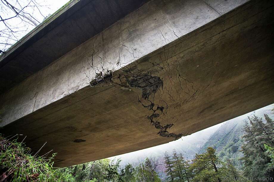
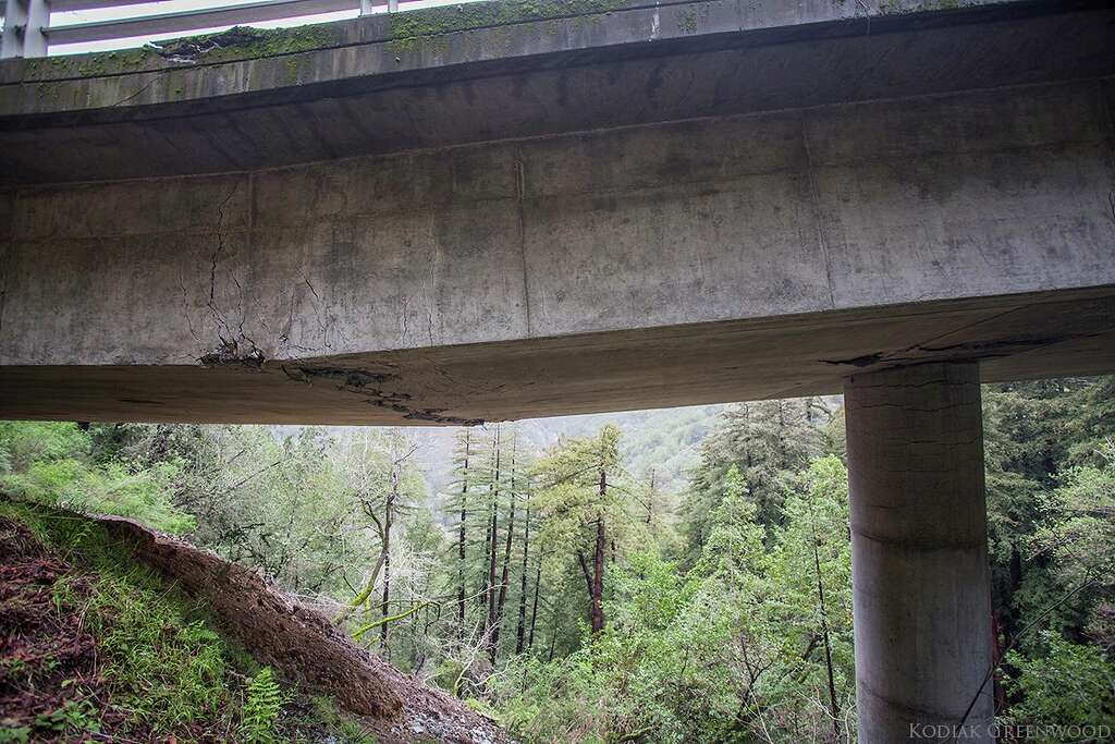
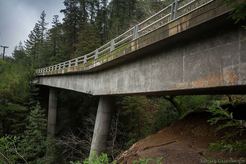
Looks like riding the entire stretch of Big Sur from Cambria to Carmel on Hwy 1 is not going to be possible for up to 6 months. Hopefully not any longer.

https://m.sfgate.com/news/article/See-the-Big-Sur-bridge-that-s-cracked-and-10951909.php?google_editors_picks=true

920x920.jpg


1024x1024.jpg


1024x1024.jpg


Last edited by a moderator:
I agree Cambria to Nacimiento is the most twisted fun anyway on Hwy 1 in the Big Sur area! However, it seems like they are turning around people at Ragged point from the South due to mud-slides. Which is no bueno. I think this will be relaxed this late Spring or Summer and perhaps we can travel to just South of Pfeiffer Beach.

So, it seems this Summer - Nacimiento is the way in, and then ride North as far as you can, and then exit out South.

From the north people are being turned around at Pfeiffer Beach area or a bit earlier. Which is also no bueno. This will probably be so for the rest of the year, till the bridge is replaced.

 
Last edited by a moderator:
One broken bridge has, however, closed the best part of "Big Sur".

The best part in my opinion, of "Big Sur", is currently closed, and it may not be possible to ride the entire length of "Big Sur" from Cambria to Carmel on Hwy 1.

Businesses in Big Sur - are shuttering due to Hwy 1 being closed in that area. Their employees are filing for unemployment etc..

 
Last edited by a moderator:
Sucks, I had one of my best riding days ever last September from San Rafael, just North of the Golden Gate Bridge to Oxnard. Between lane splitting through traffic at Santa Cruz and filtering to the front at several construction zones, and the efficacy of my Radar Detector just North of Hearst Castle, I had one he'll of a spirited and generally unimpeded assault on CA Route 1 Southbound :)

 
Damn! All around bad news for Big Sur. 1911 seems to have anticipated the Big Sur routing limitation in bolting north for Sunday evening on the coast.

I'm thinking about doing much the same now, but probably spending Sunday evening in Napa. Then molesting 1 and 101 (and Lost Coast?) on the way to Fortuna for Monday night. Then doing 36, 3, 299 and 96 to Yreka on Tuesday. Wednesday - probably 3, 36 (or 3, 299 & 44 if 89 is open through Lassen NP) and 89 south toward home.

 
Last edited by a moderator:
A road as long as Highway 1 has many different personalities, and lots of them are good, and certainly more than one can make a good argument for being "best." To me, it's the stretch from Jenner north, all the way to Leggett, where Hwy 1 joins up with 101, maybe an hour south of Eureka. But the two ends of the road are very different. The part I'm talking about hangs on the edge of very steep hillsides, with unlimited views of the ocean hundreds of feet below. Too tight to be described as high-speed sweepers, but you can have lots of fun going as fast as you're comfortable with. The last 40 to 50 miles climbs up very tight and heavily wooded redwood forests, the prettiest ride through those beautiful giants in California, in my opinion.

Add to that the extremely light traffic in the north, at least compared to Hwy 1 in Southern California, the fact that there are no closures, unlike farther south, and the always delightfully cool north coast weather, a real relief from the summer heat you'll find elsewhere. No need to argue about which is best. Everybody's welcome to their own opinion. Try both.

addendum: I thought it might be about 150 miles for that stretch of Hwy 1, but I wasn't sure. So I opened up Google maps, and no matter how I tried to enter the end points, they sent me inland and around instead of up the coast. Even entering midpoints along Highway 1, every time Google had the opportunity, it routed me inland. Stupid Google just doesn't know a good motorcycle road when it sees one.

Which accounts for the very light traffic, I guess.

 
The entire stretch of Hwy 1 is not called "Big Sur". That was the reason I put the name in quotation marks, when I repeated myself, so reading comprehension for the casual reader doesn't remain an issue, but perhaps it still is.
wink.png
rolleyes.gif


Last edited by a moderator:
I thought it might be about 150 miles for that stretch of Hwy 1, but I wasn't sure. So I opened up Google maps, and no matter how I tried to enter the end points, they sent me inland and around instead of up the coast. Even entering midpoints along Highway 1, every time Google had the opportunity, it routed me inland. Stupid Google just doesn't know a good motorcycle road when it sees one.
From Monterey to Cambria, it's approximately 100 (glorious) miles. Google maps has probably taken the road closure into account and that's why it won't route you straight through (have had that happen when trying to route over some of the Sierra passes in the winter time)

 
I'm talking about the much more northern stretch of 1, Tyler, where there are no closures. So I think Google just sends you by the fastest route, which probably isn't the most scenic. I don't know, but I suspect it would have sent you on that inland route around Big Sur even before the washout.

But here's something I wanted to pass along, since we were talking about the deep snow and the state of the Sierra passes come June.

In today's paper, Squaw Valley and Alpine Meadows, two resorts around Lake Tahoe, a couple hundred miles north of YNP, both announced that they plan to still be open for skiing . . . on the Fourth of July!
ohno-smiley02.gif


Squaw Valley and Alpine Meadows, two resorts around Lake Tahoe, a couple hundred miles north of YNP, both announced that they plan to still be open for skiing . . . on the Fourth of July! :eek:hno-smiley02:
Exactly what I was saying, Mike. I lived in Tahoe City for a number of years and have twice skied July 4 mornings, spent the afternoons playing golf at Tahoe City Golf Course and then watched the fireworks after dark from the third fairway behind Pete & Peters. This year's mountain snowfall has been a lot like those years, if not worse. Further, Sugar Bowl is reporting 631" of snowfall* at 8,383' elevation so far this year and even more snow has fallen in the Sierras south of these Tahoe area resorts this year.

FWIW, both Sonora (108) and Tioga (120) pass roads summit well above 9,000' elevation. I'm standing by the prediction that those passes will open sometime around June 30/July 1.

* the record is ~ 830" in '83/'84 IIRC (during a seven year stretch when I had moved away).

 
I like that Exskibum has predicted the passes will not be open until the end of June and I agree with him. It is good California will get some drought relief and hopefully no more people have to suffer from excessive rain and the problems it causes.

As the high passes will be closed maybe Tyler could fix the title of this post: Mariposa and Yosemite and Beyond - June 1-3, 2017.
smile.png


The waterfalls will be grand.

 
Last edited by a moderator:
As the high passes will be closed maybe Tyler could fix the title of this post: Mariposa and Yosemite and Beyond - June 1-3, 2017.
smile.png


The waterfalls will be grand.
We'll still be going beyond... lots of choices even without the high passes.
cool.png


And honestly, for the many folks who haven't been to Yosemite, there is so much to see and do, I think they'll want to take some time to enjoy the splendor of the place. ;)

 
Last edited by a moderator:
For those still making plans - check the room share thread.

Doesn't look like many are checking, and I have a room to share.

-Glen

 
Hopefully the roads closed list will be much shorter than the roads open list. Any other roads likely to be closed during yfo beside hwy 120?


Latest posts

Top