Blind guys GPS; Samsung Galaxy Tab 2

Yamaha FJR Motorcycle Forum

Help Support Yamaha FJR Motorcycle Forum:

This site may earn a commission from merchant affiliate links, including eBay, Amazon, and others.
If you are running Co-Pilot Live on your Nexus 7 you don't need Wi-Fi to update your maps as you drive. You install the maps in the memory of your Nexus 7 after installing the app and you have them there anytime you need them.

 
If you are running Co-Pilot Live on your Nexus 7 you don't need Wi-Fi to update your maps as you drive. You install the maps in the memory of your Nexus 7 after installing the app and you have them there anytime you need them.
That's true, but my understanding is if you attempt to find a destination after your leave wi-fi access, it won't work. I watched a video on youtube last night where they showed this issue.

 
I only turn the Nexus Wi-Fi on at home when surfing which is rare and I never turn it on in the car. I have no problems with finding destinations while driving but I do occasionally get some bizarre routing.

 
ETA: I should have disclosed that I'm running the native GPS navigation software and not the CoPilot, which is likely where my discrepancy is.

I tested it this morning in the car. Downloaded the map I needed while offline, and started navigation at home.

Navigation worked fine, but the map had some weird stuff going on. Turned on Foxfi on my Galaxy S3, my Nexus 7 connected to it, and BAM...map updated and it worked like a charm.

This is definitely the route I'm going to go. No point in dumping the money on a GPS for where I live/ride. I get good mobile coverage pretty much everywhere, and I'll download the map ahead of time, just in case.

To the OP, thank you for steering me in this direction. I was about to dump a boatload into a GPS I probably won't need.

Plus having a 7" screen is gonna be sweet!

 
Last edited by a moderator:
ETA: I should have disclosed that I'm running the native GPS navigation software and not the CoPilot, which is likely where my discrepancy is.

I tested it this morning in the car. Downloaded the map I needed while offline, and started navigation at home.

Navigation worked fine, but the map had some weird stuff going on. Turned on Foxfi on my Galaxy S3, my Nexus 7 connected to it, and BAM...map updated and it worked like a charm.

This is definitely the route I'm going to go. No point in dumping the money on a GPS for where I live/ride. I get good mobile coverage pretty much everywhere, and I'll download the map ahead of time, just in case.

To the OP, thank you for steering me in this direction. I was about to dump a boatload into a GPS I probably won't need.

Plus having a 7" screen is gonna be sweet!
UR welcome.

I downloaded both the US and Canada maps into the Tab2. So far it has never asked me for a wi-fi connection even when plotting a route, rerouting, draggin a new route etc. Still need more seat time tho.

Yes the 7" screen is sweet! I need to add a anti-glare matte screen protector yet. I ordered in the visor that was previously mentioned.
I downloaded the free version of CoPilot yesterday and used it on the way home in my car. My only question is, why doesn't the GPS show you as an arrow in the direction you're traveling (IE heading south, the arrow is pointed down towards the bottom of the screen)? Instead I'd like it as I'd be viewing the road. Right hand turn will be on my right, not the opposite.

Does that make sense? I couldn't find a setting anywhere to change it.

Ex: View I got (and hate) It showed me as an arrow and moving down (heading south) on the map

copilot-gps-app-works-offline-2.jpg


View I want:

copilot_truck_laptop_restrictions.jpg


Is this is a limitation of the free version or am I missing something easy?

Thanks again!

 
Last edited by a moderator:
Most GPSs give a display choice for "North up" or "Heads up".

In Co-Pilot Live go to Settings/Map Display/2D Display Settings/ and choose "Heading Up" under "2D Map Rotation".

In the second picture you displayed the view is 3D mode which is always showing Heads Up view and the free version doesn't have 3D mode. But you should be able to have 2D Heads Up with the free version.

 
Last edited by a moderator:
ETA: I should have disclosed that I'm running the native GPS navigation software and not the CoPilot, which is likely where my discrepancy is.

I tested it this morning in the car. Downloaded the map I needed while offline, and started navigation at home.

Navigation worked fine, but the map had some weird stuff going on. Turned on Foxfi on my Galaxy S3, my Nexus 7 connected to it, and BAM...map updated and it worked like a charm.

This is definitely the route I'm going to go. No point in dumping the money on a GPS for where I live/ride. I get good mobile coverage pretty much everywhere, and I'll download the map ahead of time, just in case.

To the OP, thank you for steering me in this direction. I was about to dump a boatload into a GPS I probably won't need.

Plus having a 7" screen is gonna be sweet!
UR welcome.

I downloaded both the US and Canada maps into the Tab2. So far it has never asked me for a wi-fi connection even when plotting a route, rerouting, draggin a new route etc. Still need more seat time tho.

Yes the 7" screen is sweet! I need to add a anti-glare matte screen protector yet. I ordered in the visor that was previously mentioned.
I downloaded the free version of CoPilot yesterday and used it on the way home in my car. My only question is, why doesn't the GPS show you as an arrow in the direction you're traveling (IE heading south, the arrow is pointed down towards the bottom of the screen)? Instead I'd like it as I'd be viewing the road. Right hand turn will be on my right, not the opposite.

Does that make sense? I couldn't find a setting anywhere to change it.

Ex: View I got (and hate) It showed me as an arrow and moving down (heading south) on the map

copilot-gps-app-works-offline-2.jpg


View I want:

copilot_truck_laptop_restrictions.jpg


Is this is a limitation of the free version or am I missing something easy?

Thanks again!
I get the cursor/arrow (triangle pointing in direction) on the Android Tab2 with the Pro (pay) edition, but on my iPad2 w the free edition I don't, So maybe it's something in the different apps or most likely the difference in the freebie vs. the pay app.

The map difference is easy. The top map (that you don't care for) is the free version, the bottom "3D" map is the Pro (pay) version. I agree, the 3D maps and enhancements you get with the $10 pay version are way nicer (and worth it). Guess this is how they get ya on the paid version
wink.png


Last edited by a moderator:
ETA: I should have disclosed that I'm running the native GPS navigation software and not the CoPilot, which is likely where my discrepancy is.

I tested it this morning in the car. Downloaded the map I needed while offline, and started navigation at home.

Navigation worked fine, but the map had some weird stuff going on. Turned on Foxfi on my Galaxy S3, my Nexus 7 connected to it, and BAM...map updated and it worked like a charm.

This is definitely the route I'm going to go. No point in dumping the money on a GPS for where I live/ride. I get good mobile coverage pretty much everywhere, and I'll download the map ahead of time, just in case.

To the OP, thank you for steering me in this direction. I was about to dump a boatload into a GPS I probably won't need.

Plus having a 7" screen is gonna be sweet!
UR welcome.

I downloaded both the US and Canada maps into the Tab2. So far it has never asked me for a wi-fi connection even when plotting a route, rerouting, draggin a new route etc. Still need more seat time tho.

Yes the 7" screen is sweet! I need to add a anti-glare matte screen protector yet. I ordered in the visor that was previously mentioned.
I downloaded the free version of CoPilot yesterday and used it on the way home in my car. My only question is, why doesn't the GPS show you as an arrow in the direction you're traveling (IE heading south, the arrow is pointed down towards the bottom of the screen)? Instead I'd like it as I'd be viewing the road. Right hand turn will be on my right, not the opposite.

Does that make sense? I couldn't find a setting anywhere to change it.

Ex: View I got (and hate) It showed me as an arrow and moving down (heading south) on the map

copilot-gps-app-works-offline-2.jpg


View I want:

copilot_truck_laptop_restrictions.jpg


Is this is a limitation of the free version or am I missing something easy?

Thanks again!
I get the cursor/arrow (triangle pointing in direction) on the Android Tab2 with the Pro (pay) edition, but on my iPad2 w the free edition I don't, So maybe it's something in the different apps or most likely the difference in the freebie vs. the pay app.

The map difference is easy. The top map that you don't care for is the free version, the bottom "3D" map is the Pro (pay) version. I agree, the 3D maps and enhancements you get with the $10 pay version are way nicer (and worth it). Guess this i show they get ya on the paid version
wink.png


**UPDATE**

Tested this more thoroughly, both on the Tab2 and iPad2.

Either version I get the arrow/cursor when under motion. It is a round (red dot-ball) when stopped. AND- when you don't have a GPS signal you get the dot only (no arrow in the direction of travel). Also remember on iPad devices, there is no GPS radio in the wi-fi only devices (only the 3G/4G models have the GPS radios built-in). So iPad wi-fi model owners--- You will need to add a receiver like the Bad Elf to make your GPS work.

 
Last edited by a moderator:
I have a pretty slow internet connection at home so it is going to take a while for this to download. My main question is will I be able to import POI's and routes?

 
... so I shopped and purchased the Galxay Tab 2 (7" screen) running the latest android 4.2 (jelly bean). Cost me $222.00 shipped for the upgraded model; 16gb internal. Far less than any other GPS that I have purchased so far ...
Top_Speed1, you have piqued my interest. On my trip last week my aging Garmin sent me on a couple of wild goose chases, so I started shopping . . . any chance you have a link for this great price? Thanks for doing all the research!
punk.gif


**UPDATE**

I now have found an easy way to import .gpx file (or any mapping file extension actually) converted to a .trp file which the Co-Pilot uses. It's actually quite easy after you do it once.

1. Download: RouteConverter to your computer. <the computer that you wanna use as the Quarterback in this process>.

2. Within this ^ program, -> Click File/Open and browse to your .gpx (.gpd or whatever) file on your computer and load it up.

3. File/Save(as) to <your location> as a .trp file (you will see Co-Pilot labeled with op system revision, 9x is latest at this publish)

4. Email (or fetch/send via wifi) this .trp file to your Android GPS device. (I use a separate email account for my Tab2, so emailed, no confusion = easy transfer)

5. On your Android GPS device-> Locate your (or download a) file Mgr./browser to copy and paste the .trp (I use Astro File Manager, it's in the app store, free as usual)

6. With the File Mgr/browser, find your .trp stored locations, either browse w Astro } or an easy way is to make a distinguished (fake) trip within Co-Pilot, save it as a unique simple name:1234.trp then go find w the Astro or File Mgr (or search it is another method). This will tell you [the directory] where you have to paste your new .trp file(s).

7. Paste the file in this directory, open Co-Pilot and it will now be in your stored trips upon firing up the Co-Pilot.

<done>

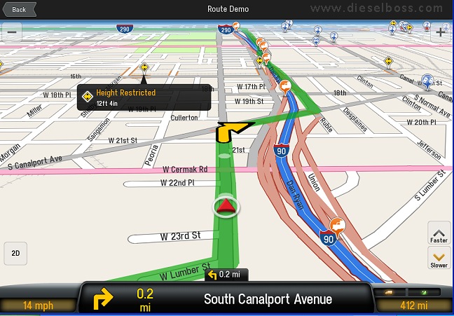
It acts just as Garmin. (i.e.) follow the lines on the road stuff. No voice guidance to these 'layers'... (yet!).


One more thing.

I have a buddy running my suggested android GPS w Co-Pilot, he was pulling his hair out all frustrated. I kept asking him what's the problem?, finally at a stop he tells me the screen is flipping all over the place and shutting off the unit. (me laughing) and him pissed, I went into his Co-Pilot Config/Screen Settings and locked the screen on Landscape mode (his was set on "use device settings"). Apparently every-time he leaned into a turn it blipped to portrait mode and then would shut off after several back and fourth's of this. He's very happy now BUT don't be like him ...(thinking that I will think you're a dingdong for saying sumtin' simple
smile.png
)


@Wolf_in_sheep... Waypoints/POI stored within your file will be inserted as such
smile.png


@no1passme Locally? Best Buy 8GB model $179 and you can cheaply add microSD memory, 32GB for under $20 online, scandisk brand, a few more bucks. I added 32gb, 10rate. More space than I can ever use plus my on-board built-in memory is 16gb (but these 8gb mentioned will do perfect for our use). Having this additional space allows for multiple GPS programs to be loaded/ready. The one HUGE advantage we have over the 'GPS only' units
smile.png
Also remember, this (Tab2 7") is not the only Android that will work... maybe experiment with your favorite one?!

 
Last edited by a moderator:
Hey TS1!
How about an update on this? Is the tablet still functioning well in spite of the vibration and weather exposure?
I used this setup all season with no problems. I wrapped it in a zip-lock bag on a couple of rainout days that I knew ahead of time. I eventually got caught naked a few times (un-wrapped). Maybe it's my taller windshield (or the surround protector on the unit itself) but it went thru some rain outs and kept on running fine. The onscreen touches were screwed up due to the moisture on the screen, that was the only hiccup. Do I trust it in the rain? No, I would wrap it if I knew I was riding that day in rain. Performance has been flawless. It never did the ole lockup ever. I downloaded updated maps maybe 3 times during the season... all at no charge.

My new Bike coming this spring features a built in GPS. I still want to incorporate this GPS setup however (between the handlebar?) for a general overview map of my position, then use the Garmin Nav5 for turn by turn. I like the bigger screen, my glance downs are quicker.

Any other q's, fire away.

-KJ

 
Where are you getting the digital speedo on your phone...? What app is that or is it part of the gheydar detector ?

I kinda like that..... I have a Nexus 7 as well, and may try to implement this, I have the ram ball mount for my Galaxy S4, and its a bit on the small side for me also...

I'd love to see a thread made up by all the guys that implemented their own version as well...

thanks for the info sir, great Job....

 
Thanks for reviving this thread. Nice app and Copilot does indeed work with multi-waypoint GPX routes by following TopSpeed's update instructions (post # 51). I figured out drag-and-drop *.trp file transfer to the android GPS which might be easier for some...

  • Plug in the android device to your computer with USB
  • Bring up Windows file manager and find the android device folders. There can be both internal and external storage
  • Locate the main Copilot folder. The name can vary depending on version but "copilot" will be part of it.
  • Go to the NA/Save folder within the Copilot folder
  • Drag and drop your *.trp from where ever you saved it to the Save folder
  • That's it. Your Trip will appear in the saved trips list.
 
My new Bike coming this spring features a built in GPS. I still want to incorporate this GPS setup however (between the handlebar?) for a general overview map of my position, then use the Garmin Nav5 for turn by turn. I like the bigger screen, my glance downs are quicker.
When I get around to it I plan on using copilot for my primary GPS. You're going to use garmin for turn by turn, but the premium version of copilot has that feature, no?
Only using the new Garmin Nav-V cuz it's built into the dash on the K16. The V (5) features a bit larger screen than the prior fitted NavIV, so I'm going to give it a whirl. As said, the 7" Tab2 hopefully will be still put to use as a "Zoomed out 2D map view" of my position. The turn by turn leaves out this geographical view (ie) I might see a lake 50 miles from my route and decide to side-bar over to it. I do ad-lib a lot, well at least when I can... lost is fun with the right GPS(s)... yep, plural now!
smile.png


Last edited by a moderator:
Top