Name That Place Game

Yamaha FJR Motorcycle Forum

Help Support Yamaha FJR Motorcycle Forum:

This site may earn a commission from merchant affiliate links, including eBay, Amazon, and others.
Ross, I had no clue until that last hint. I have ridden very near that location but was not aware there was such a functional ravine here. I've done several pics lately so let's give Pants or someone else a day to guess it. If not, I'll officially guess tomorrow evening...

 
On 1/9/2021 at 11:56 AM, Goodman4 said:

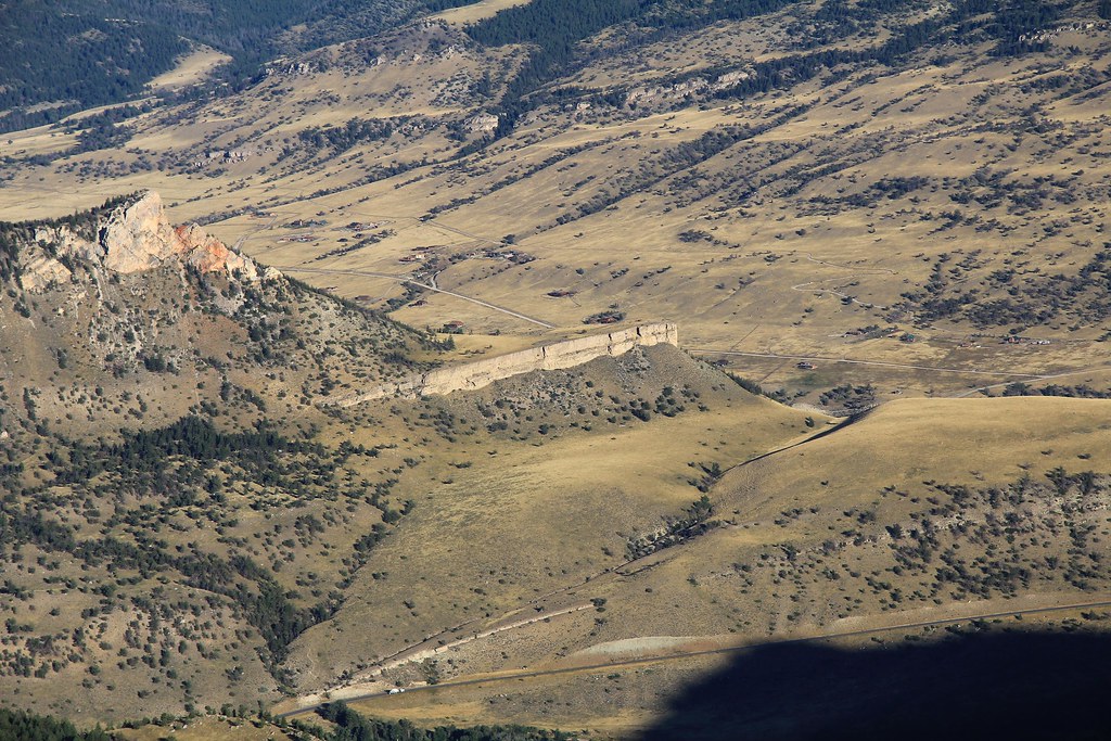
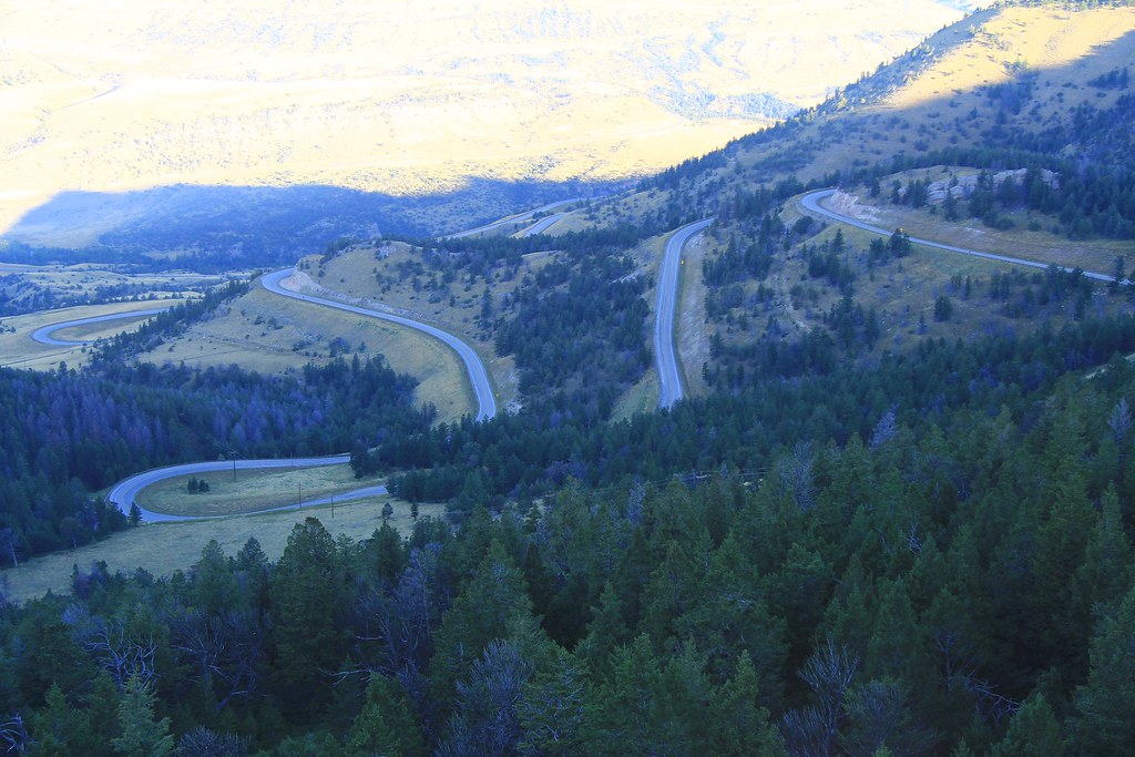
The road at the bottom is Utah 142 / Shafer Road. It also looks like an amazing dirt road. Fast forward to 2:00 in this video I found:


My complements to your photographic acumen!!  I've been to many of the venues you have posted but never captured them as well as you have. Utah and Arizona sure do offer some of the best photo ops. in the west!!!

 
While I appreciate the deference, I'm trying to play fair (no googling).  If I haven't been there, then I hold off.  As to the current place, I do not think I have been there.

 
OK, if we're not Googling this is gonna go slower, but let's try it on this one... I'll also defer for now, hoping someone recognizes it. 

Per the guidelines defined in page 3 of this thread, I said we'd give it a week past the last hint before giving up and reverting back to the person who posted the pic. If Pants or someone else doesn't want to guess after finding it by Googling by next Tuesday, I will guess it and take it. 

But per current rules you are not required to have been to the location to guess. Researching locations is part of LD riding for me, so I feel Internet searching is fair game. But I'd like this to be a group decision.

 
I would use a Google assist to confirm an exact location but not to identify it from scratch unless guesses are going nowhere.  Even if I haven't been there, I feel a bit more justified if I have at least been close!  

Similarly, I try to pick something fairly iconic where there is a very good chance that someone recognizes it (that is why I replaced the generic mountain in Jasper with the Diablo Lake location).  Also nice to post up places that people might be interested in seeing in person.

I don't think I can provide any further hints on the current one - hope someone gets it.

 
I enjoy the challenge of looking for clues in the pictures, and sleuthing out the locations.

So,,, this picture is in the Lake Champlain area; I'll bet that building is an old power-generation plant - like those I've seen on other rides in the Eastern mountains.

From what I see as I zoom in and out on Google, it's a beautiful area, I'd like to ride in someday.

I agree, finding it on Google isn't as much fun as actually having been there. Hence my deference at shouting, "Eureka", before some one who's had a visual sighting can claim it. But until I can get there, Google's the best I can do.

 
From what I see as I zoom in and out on Google, it's a beautiful area, I'd like to ride in someday.
Both sides of Lake Champlain offer some great riding.  On the west are the Adirondacks and on the east side, there are the Green and White mountains of Vermont and New Hampshire. 

A series of rides centering on Stowe VT were developed for a NERDS meet a number of years ago (2011) and they were great. These are more VT and upstate NY than NH but I have a bunch in NH as well.  I have the NERDS rides in a Basecamp format if anyone wants them.  This is a Dropbox link for the rides (updated in 2013) which I will leave up for a week or so.  After that, send me a PM with your email address and I can send the file.  10 or 11 different rides - each will be a decent day ride.

https://www.dropbox.com/s/t40hnve8kwapuru/NERDS'13.gpx?dl=0

Have a look at New England Riders for lots of good rides in the northeast.

Edit to add descriptions for the NERDs rides (I have done most of these)

Art's 'Dacks Twisty Butt
365 Miles / 7:55
The Long Way Around... this is a longer route for those looking to put in some bigger mileage on some fantastic Adirondack roads. Enjoy some fast sweepers and real river road twisties in the Adirondacks. A good route to get your “ya-yas” out.

A'dacks Twisty
315 Miles / 6:48
A "Lite" version of the Twisty Butt (just cuts out the scenic loop down to Great Scanandaga Lake).

Covered Bridges of VT
163 Miles / 4:03
This route is designed for the Covered Bridge "aficionado". Visit seventeen different covered bridges in Vermont (including one that's reported to be "Haunted"), and ride across most of them. Be warned, this route includes a fair amount of dirt and gravel roads. Some of the Bridges are a little out of the way and you'll need to drive over some real back-roads to get to them.

Grand Isles and Northern 'Dacks
312 Miles / 6:44
Mountains, Lakes, Rivers, real twisties... this one has it all. Start out with a ride up through Smugglers Notch and through the Grand Isles of Lake Champlain, then across into NY State near the Canadian border. Down through the Adirondacks with a special twistie treat on Tracy Road, before heading back to Stowe via the App Gap. A full day's ride that’s hard to beat.

Islands and Northern VT Loop
187 Miles / 4:13
Starts out the same as above, but then turn east and ride along the northern border of Vermont and around Jay Peak. A slightly shorter ride for those who might get a late start, prefer an easy day, or just want to get back to Stowe earlier to allow time for touristing around.

Mt Washington loop
274 Miles / 6:16
For those with a need to "get high"… Ride over into New Hampshire and take the “auto road” up above the clouds, to the top of the most prominent peak east of the Mississippi River. Warning: The auto road is steep, unpaved for the upper half, and guaranteed to pucker your sphincter on the way down. Dress warmly, even in the summer. Average high temps in August are only 53F.

VT Six Gaps and a Notch
231 Miles / 5:41
They call them “passes” out west. On this route you’ll ride all 6 Vermont mountain gaps (2 are unpaved) plus ride down through Smuggler's Notch on the way back to the barn.

VT Four Gaps and a Notch
210 Miles / 5:11
Same flavor as the "Six Gaps" but with no gravel included, and in the opposite direction. You’ll start out with Smugglers Notch and then bag the 4 paved Gaps.

Villages and Sweepers
228 Miles / 5:15
Quaint little New England towns and Smooooooth fast turns. Get the essence of Vermont life in a nice day ride. There’s even a fun little roller coaster stretch of turns coming down through the Groton State Parks.

NEK (North-East Kingdom)
217 Miles / 4:54
A really nice loop through the "backwoods" of Vermont where the moose outnumber the people. This area where the “natives” retire to. It’s one ride I keep coming back for.

VT Tourist
167 Miles / 3:55
A route for those interested in actually stopping to sniff the flowers and see some of the unique things Vermont has to offer. We've combined a few different "touristy" stops with some nice sections of curvy road in-between to provide you with a shorter mileage route that's perfect for getting the true flavor of Northern New England.


My riding-partner and I were up your way in 2010, so I could finish up my list of states ridden in.

We tweaked our route so we could visit the Rhinebeck Aerodrome. Unique museum for an old aviation buff!

Beautiful country there, shame it gets cold and snow 😄😄. Thanks for the links!

(btw, The GPS guides from New England Riders are legendary)

Fred

 
For clarify, my "no google" decision is self-imposed.  I want others to have a chance to participate as well.  So whatever it takes to keep the game going, I'm all for it.

 
For clarify, my "no google" decision is self-imposed.  I want others to have a chance to participate as well.  So whatever it takes to keep the game going, I'm all for it.
Take the hints and spend a little time on Google Maps.  That's pretty fair - at least you did a bit of research and learned something about the region.   Googling the image itself is only OK if people have had a fair chance and some hints to find it without "cheating".

Goodman4's game so he sets the rules but that is how I see it.

 
I think we are all landing on the same basic guidelines for the most part. I found it from Ross's hint and Google Maps, so I'm going ahead. I would like to guess another of Pants' road pics, but that will happen, I'm sure.

It's not just "a functional ravine"... It's a usable chasm - or Ausable Chasm. Right? The online pics look much like another canyon somewhat nearby I hope to post from eventually.

 
Ross, I had no clue until that last hint. I have ridden very near that location but was not aware there was such a functional ravine here. I've done several pics lately so let's give Pants or someone else a day to guess it. If not, I'll officially guess tomorrow evening...
😃 Take it away!

 
It's not just "a functional ravine"... It's a usable chasm - or Ausable Chasm. Right?
Actually, it is from a French word for sand.  Some French influence in this area - not far from the Quebec border.

Au Sable, or Ausable (/ɒˈseɪbəl/ oss-AY-bəl), is a town in Clinton County, New York, United States. ... The name is from the Ausable River that flows through the town and means "at the sand". The town is in the southeast corner of the county, south of Plattsburgh.
Yes, I just can't pass up a bad play on words. 

 
Top