weekend rider
Well-known member
I am going to play it safe out there, I am going to bring a brown bag lunch just in case. :yahoo: :yahoo: :yahoo:
weekend rider
weekend rider


I agree, it would be too time consuming waiting for the other groups to show for a big group shot or group lunch. And besides, when ready to roll, we'd all be fired up and heading down the road enmasse. Disaster. If the goups do meet at some disignated rendezvous, great. But let's head out in separate groups again.My opinion: Enjoy the memories and shots taken by the various photogs, forget the "Group Shot". Emotionally a wonderful idea but logistically, the 1/2 hr.+ to set it up then add the stagger departure time is going to kill your end time/lunch time. Take some photos during the lunch stop and call it good.

What are you planning to bring? Seems like it might be hard to put something good together while not at home. But hey, I'm all for doin' the picnic thing. Just requires a bit more prep time.I am going to play it safe out there, I am going to bring a brown bag lunch just in case.
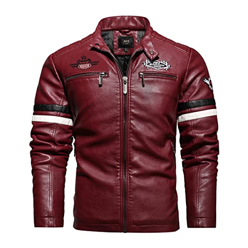
The leathers are called First Gear. Gotten at most cycle shops or online. There may not be a great need for them in Texass most of the riddin' season. But they are comfy. My First Gear Mesh Tech are my usual warm weather wear. Now I'm in SoCAL, where the leathers are rarely needed, like in Texass.Hey, scraper....nice leather pants....who makes em' and where'd ya get em?
Sorry guys, but a break with some air conditioning and decent bathrooms needs to be a priority to refresh everyone. A quick internet search of Sonora, CA yielded a couple of possibilities. And that would be besides any fast-food options that would be more than capable of handling our group. And if we have to split up, fine - that'll make it an even shorter break. A group photo at the Hilton is a great time-saving idea and I'm all for it. Now that we are leaving an hour earlier, that should give us plenty of time to stop for lunch.What are you planning to bring? Seems like it might be hard to put something good together while not at home. But hey, I'm all for doin' the picnic thing. Just requires a bit more prep time.I am going to play it safe out there, I am going to bring a brown bag lunch just in case.


We're having fun! :lol: The NorCal bunch don't do no pick-a-nick lunches, nosirree. We like them sit-down and cool-off places. Trust that there are enough riders with pillions that the breaks will be taken every hour or so (Leaders please take note!). Skyway is off playing at a rally this weekend...he lives in Sonora so he will be able to suggest good lunch stops there.Sorry guys, but a break with some air conditioning and decent bathrooms needs to be a priority to refresh everyone. A quick internet search of Sonora, CA yielded a couple of possibilities. .
You mean that top secret rally that no one is supposed to know about?Skyway is off playing at a rally this weekend...he lives in Sonora so he will be able to suggest good lunch stops there.
Any chance for starting a 4th group or adding another solo rider to either group?
Just sneak in no. 3. I won't tell
Mine are first racing...same company maybe? Used to have some older first gear pants. Got my first racing in minneapolis...bought two of the last pair they had because they said they were not selling them anymore. Figured I could get about six years out of two pair. Always on the look out for new pants.The leathers are called First Gear. Gotten at most cycle shops or online. There may not be a great need for them in Texass most of the riddin' season. But they are comfy. My First Gear Mesh Tech are my usual warm weather wear. Now I'm in SoCAL, where the leathers are rarely needed, like in Texass.Hey, scraper....nice leather pants....who makes em' and where'd ya get em?
Its on the first page, about the 3rd post or so.I don't remember (and don't want to look through 10 pages). Did anyone map this with a Garmin program? And if so, could i get a copy? Thanks.
Is that Garmin, or Street and Trips? I've got it mapped in Mapsource if anyone wants it... just send me a PM and an email addy. (note, if I screwed it up and you get lost, don't blame me... :lol: )Its on the first page, about the 3rd post or so.I don't remember (and don't want to look through 10 pages). Did anyone map this with a Garmin program? And if so, could i get a copy? Thanks.
PM sent.I've got it mapped in Mapsource if anyone wants it... just send me a PM and an email addy.
Thats Streets & Trips, I want Mapsource (Garmin)Its on the first page, about the 3rd post or so.
PM sent.I've got it mapped in Mapsource if anyone wants it... just send me a PM and an email addy. (note, if I screwed it up and you get lost, don't blame me... :lol: )
PM sent.
Files sent... let me know if you see any screwups.PM sent.
Dude, I already got that part.... sheesh...Ok Groo -- you're the wizard of little known roads on GPS. Here's the last part of the Big Dog ride then:
After coming back over Hwy 4 (Ebbetts Pass), we go north through Markleeville on 89 until we hit Hwy 88 at Woodfords and make a right on 88. About 0.25 miles after making that right, we make a right on Carson River Road, which generally parallels 88, but is MUCH more pleasant, fun and pretty in the way its sweepers follow the Carson River without any traffic. At its terminus, it tees into Diamond Valley Road about 100 feet south of its intersection with 88. We make a left and immediately stop for the stop sign at 88 before heading straight across 88 onto Fredericksburg Road. We follow this through ranchland until we hit a stop sign at Fairview Lane and make a left, where that road quickly turns into Foothill Road. We stay on that through Genoa (it turns into Jack's Valley Road) until it tees into Hwy 395 just south of Carson City. We go left (north) on 395 through Carson City, and after we get out of Carson City (about a mile or two past the obvious commercial and semi urban area, we get off on the right, and go under 395 to the left to get onto Old Highway 395 north. We ride that traffic free (and less windy) route until it tees back into 395 just south of Washoe City, where we get back on 395 north. We stay on that until we are in south Reno, where we have to remember to stay in the right lane to get on the Hwy 395 North on-ramp that will take us up to Wells Ave where the Hilton is.
:lol: Oops.. just noticed a small correction I need to make though.... :lol: some wizard I am... Carson River Road is designated as "Old Ca-88" in Mapsource...Wow, you are good. Maybe I didn't confer enough respect for your Route mapping abilities. How 'bout we call you the "Grand Wazoo" whe we get to WFO??? :lol: :lol: :yahoo:Dude, I already got that part.... sheesh...Ok Groo -- you're the wizard of little known roads on GPS. Here's the last part of the Big Dog ride then:
After coming back over Hwy 4 (Ebbetts Pass), we go north through Markleeville on 89 until we hit Hwy 88 at Woodfords and make a right on 88. About 0.25 miles after making that right, we make a right on Carson River Road, which generally parallels 88, but is MUCH more pleasant, fun and pretty in the way its sweepers follow the Carson River without any traffic. At its terminus, it tees into Diamond Valley Road about 100 feet south of its intersection with 88. We make a left and immediately stop for the stop sign at 88 before heading straight across 88 onto Fredericksburg Road. We follow this through ranchland until we hit a stop sign at Fairview Lane and make a left, where that road quickly turns into Foothill Road. We stay on that through Genoa (it turns into Jack's Valley Road) until it tees into Hwy 395 just south of Carson City. We go left (north) on 395 through Carson City, and after we get out of Carson City (about a mile or two past the obvious commercial and semi urban area, we get off on the right, and go under 395 to the left to get onto Old Highway 395 north. We ride that traffic free (and less windy) route until it tees back into 395 just south of Washoe City, where we get back on 395 north. We stay on that until we are in south Reno, where we have to remember to stay in the right lane to get on the Hwy 395 North on-ramp that will take us up to Wells Ave where the Hilton is.
Enter your email address to join: